

Datasets
-
CAMEX-3 AIRBORNE VERTICAL ATMOSPHERE PROFILING SYSTEM (AVAPS) V1
The CAMEX-3 DC-8 Airborne Vertical Atmospheric Profiling System (AVAPS) dataset consists of measurements from AVAPS, which uses dropsonde and Global Positioning System (GPS)... -
IBEX-Lo Release-3 Counts for flow latitude analysis
This product contains counts accumulated in \neach of 30 6-deg spin phase bins over some variable time span\nindicated in each record. The time spans are selected to... -
MAVEN SWEA Archive Rate 3D Electron Distributions Data Collection
MAVEN Solar Wind Electron Analyzer (SWEA) electron energy/angle (3D) distributions in units of differential energy flux (eV/cm^2 sec ster eV) at the MAVEN archive telemetry... -
Ulysses Heliosphere Instrument for Spectral, Composition, and Anisotropy at Low Energies (HISCALE) LEFS150 MFSA, Solar Wind Frame, Sectored Electron Fluxes, 17 min Averages
17-min-averaged sectored electron fluxes from the MF Spectrum Analyzer of the Ulysses/HISCALE LEFS150 instrument. All energies thresholds take into account the incident particle... -
Ulysses Heliosphere Instrument for Spectral, Composition, and Anisotropy at Low Energies (HISCALE) LEFS150 MFSA, Solar Wind Frame, Sectored Z>1 Ion Fluxes, 17 min Averages
17-min-averaged sectored Z>1 ion fluxes from the MF Spectrum Analyzer of the Ulysses/HISCALE LEFS150 instrument. All energies thresholds take into account the incident... -
STEREO-B In-Situ Measurements of Particles and CME Transients (IMPACT) Solar Wind Electron Analyzer (SWEA) Spectra
STEREO Behind In-situ Measurements of Particles and CME Transients, IMPACT, Solar Wind Electron Analyzer, SWEA, Level 1 Data -
ACE Solar Isotope Spectrometer (SIS) 256-sec Level 2 Data
ACE Solar Isotope Spectrometer (SIS) 256-sec intensities and count rates, for each of 14 elements (He,C,N,O,Ne,Na,Mg,Al,Si,S,Ar,Ca,Fe,Ni). in each of 8 energy bins. Overall... -
STEREO-B IMPACT HET Level 1 Data
STEREO-B In-Situ Measurements of Particles and CME Transients (IMPACT) High Energy Telescopes (HET) Level 1 1-minute data include electron fluxes in (cm^2 s sr MeV)^-1 measured... -
Continuing the Mission: SeaHawk-1 Ocean Color CubeSat Nanosatellite
Satellite validation work related to the SeaHawk Ocean Color CubeSat mission. This is a partnership between NASA, UNCW, UGA, ACC Clyde Space and Cloudland instruments. The... -
DISP Yearly Satellite Photographic Mosaics of Greenland 1962-1963, Version 1
The Declassified Intelligence Satellite Photographs (DISP) Yearly Satellite Photographic Mosaics of Greenland are composites of black-and-white photographs of Greenland taken... -
Data over the SSA in Raster Format and AEAC Projection
This data set consists of GIS layers that describe the soils of the BOREAS SSA. The original data were submitted as vector layers that were gridded by BOREAS staff to a 30-meter... -
GPM AMSUB on NOAA17 (GPROF) Climate-based Radiometer Precipitation Profiling L3 1 month 0.25 degree x 0.25 degree V07 (GPM_3GPROFNOAA17AMSUB_CLIM) at GES DISC
The "CLIM" products differ from their "regular" counterparts (without the "CLIM" in the name) by the ancillary data they use. They are Climate-Reference products, which requires... -
GPM ATMS on NOAA-20 (GPROF) Radiometer Precipitation Profiling L3 1 day 0.25 degree x 0.25 degree V07 (GPM_3GPROFNOAA20ATMS_DAY) at GES DISC
Version 07 is the current version of the data set. Older versions will no longer be available and have been superseded by Version 07. 3GPROF products provide global gridded... -
GPM ATMS on NOAA-20 (GPROF) Climate-based Radiometer Precipitation Profiling L3 1 day 0.25 degree x 0.25 degree V07 (GPM_3GPROFNOAA20ATMS_DAY_CLIM) at GES DISC
Version 07 is the current version of the data set. Older versions are no longer available and have been superseded by Version 07. The "CLIM" products differ from their "regular"... -
LBA-ECO LC-18 Hyperion 30-m Surface Reflectance, Mato Grosso, Brazil: July 2004
This image was collected by the Hyperion sensor on 10-July-2004 at 13:16:16 GMT. It was calibrated to apparent surface reflectance using the ACORN atmospheric model. The... -
International Satellite Cloud Climatology Project (ISCCP) Stage B3 Reduced Radiances in Native Format
The ISCCP_B3_NAT data is the International Satellite Cloud Climatology Project (ISCCP) Stage B3 Reduced Radiances in Native Format data product. This is the original radiance... -
MODIS/Aqua Aerosol 5-Min L2 Swath 3km
The new Collection 6.1 (C61) MODIS/Aqua Aerosol 5 Min L2 Swath 3km (MYD04_3K) product is an improved version based on algorithm changes in Dark Target (DT) Aerosol retrieval... -
MODIS/Aqua Aerosol Cloud Water Vapor Ozone Monthly L3 Global 1Deg CMG
The MODIS/Aqua Aerosol Cloud Water Vapor Ozone Monthly L3 Global 1Deg CMG product (MYD08_M3) contains monthly 1 x 1 degree grid average values of atmospheric parameters related... -
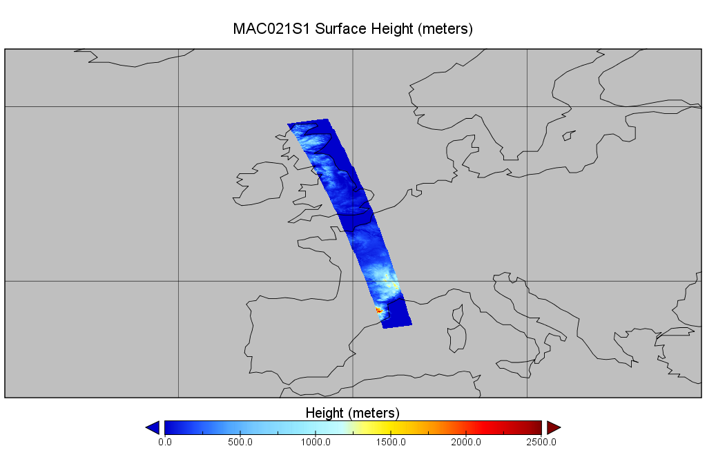
MODIS/Aqua Calibrated Radiances 1km 5-Min 1B Wide Swath Subset along CloudSat V002 (MAC021S1) at GES DISC
This is the wide-swath MODIS/Aqua subset along CloudSat field of view track. The goal of the wide-swath subset is to select and return MODIS data that are within +-100 km across...