-
52 COLOR ASTEROID SURVEY V2.0
52-color IR Spectra of Numbered Asteroids. -
GIBS Web Map Tile Service (WMTS)
The WMTS implementation standard provides a standards-based solution for serviing digital maps using predefined image tiles. Through the constructs of the specification, a WMTS... -
Catalog of Galactic OB Stars
An all-sky catalog of Galactic OB stars has been created by extending the Case-Hamburg Galactic Plane Luminous Stars surveys to include 5,500 additional objects drawn from the... -
In-Space Propulsion (346620) Technology Project
Technologies include, but are not limited to, electric and advanced chemical propulsion, propellantless propulsion such as aerocapture and solar sails, sample return ascent... -
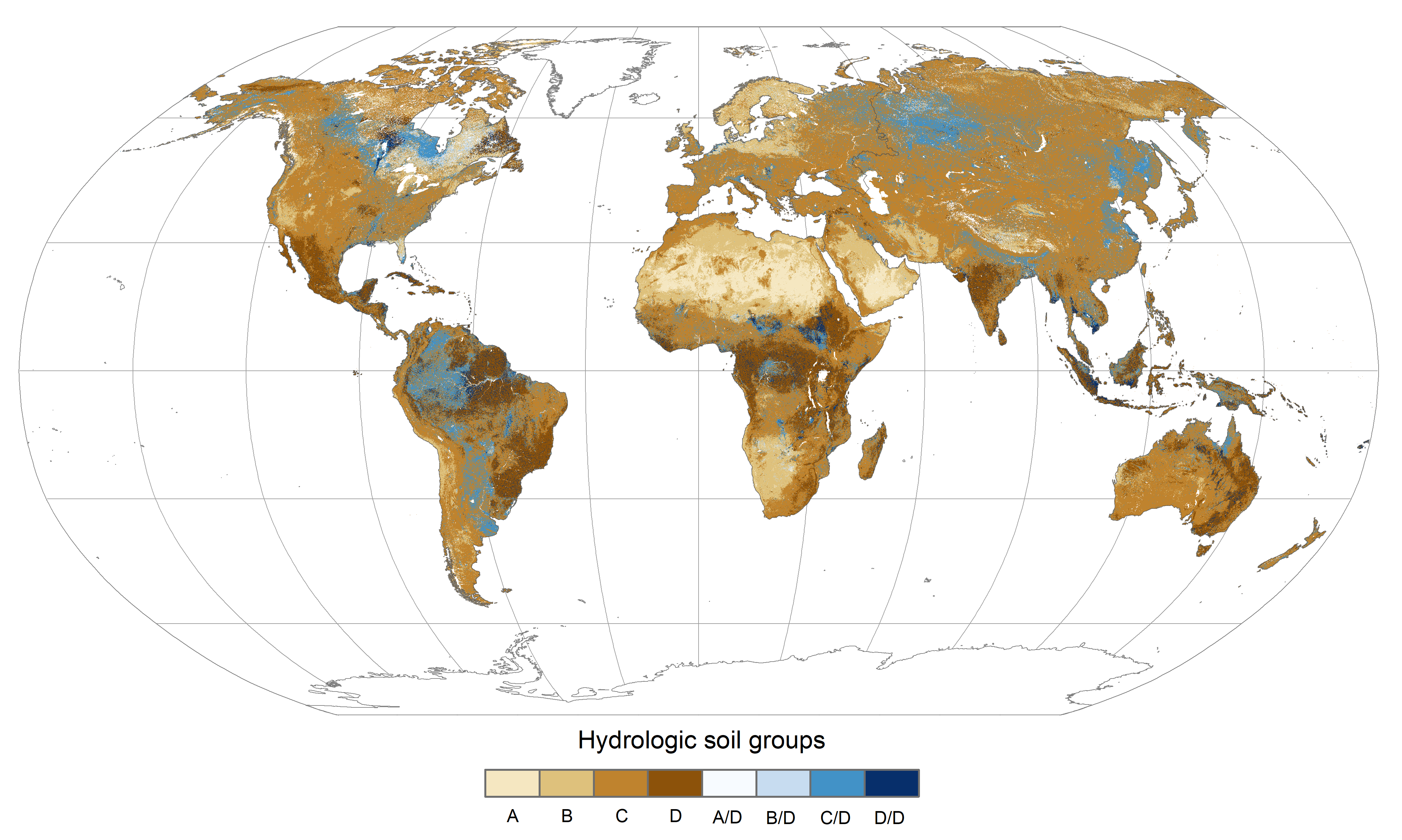
Global Hydrologic Soil Groups (HYSOGs250m) for Curve Number-Based Runoff Modeling
This dataset - HYSOGs250m - represents a globally consistent, gridded dataset of hydrologic soil groups (HSGs) with a geographical resolution of 1/480 decimal degrees,... -
Low Earth Orbit Land Surface Temperature Monthly Global Gridded V002
The NASA Making Earth System Data Records for Use in Research Environments (MEaSUREs) LEOLSTCMG30 version 2 Climate Modeling Grid (CMG) product provides Land Surface Temperature... -
ARTEMIS P2 field-plasma merged data, near moon
This data set contains 96s and 384s resolution magnetic field and plasma ion data from the THEMIS-C ESA and FGM instruments during the near moon (ARTEMIS) phase of the... -
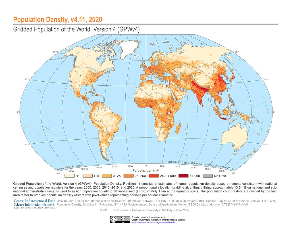
Gridded Population of the World, Version 4 (GPWv4): Population Density, Revision 11
The Gridded Population of the World, Version 4 (GPWv4): Population Density, Revision 11 consists of estimates of human population density (number of persons per square... -
First ISCCP Regional Experiment (FIRE) Cirrus 1 NASA ER-2 Cloud Lidar System Data
The First ISCCP Regional Experiments have been designed to improve data products and cloud/radiation parameterizations used in general circulation models (GCMs). Specifically,... -
SAWYER ASTEROID SPECTRA V1.1
Partial spectral data for the plots presented in S. Sawyer's PhD Thesis, 'A High Resolution Spectroscopic Survey of Low Albedo Main Belt Asteroids', 1991. -
USGS Digital Orthophoto Quadrangles
A Digital Orthophoto Quadrangle (DOQ) is a computer-generated image of an aerial photograph in which the image displacement caused by terrain relief and camera tilt has been... -
DSCOVR EPIC Level 3 PAR
DSCOVR_EPIC_L3_PAR_01 is the Deep Space Climate Observatory (DSCOVR) Earth Polychromatic Imaging Camera (EPIC) Level 3 photosynthetically available radiation (PAR) version 1... -
24-COLOR ASTEROID SURVEY
This dataset is comprised of asteroid flux data measured in 26 filters using the McCord dual beam photometer, and covering the range 0.32 - 1.08 microns for 285 numbered... -
MISR Level 2 Aerosol parameters subset for the UAE region V002
UAEMIAAE_002 is the Multi-angle Imaging spectro-radiometer (MISR). It contains aerosol optical depth, particle type, and associated atmospheric data. The MISR instrument... -
LRO MOON RADIO SCIENCE RAW TRACKING DATA V1.0
This data set contains archival raw, partially processed, and ancillary/supporting radio science data acquired during the Lunar Reconnaissance Orbiter (LRO) mission. The radio... -
IRTF NEAR-IR SPECTROSCOPY OF ASTEROIDS
This data set contains low-resolution, near-infrared (0.8 - 2.5 micron) spectra of asteroids obtained with SpeX at the NASA Infrared Telescope Facility (IRTF) on Mauna Kea.... -
Global Flood Hazard Frequency and Distribution
The Global Flood Hazard Frequency and Distribution is a 2.5 minute grid derived from a global listing of extreme flood events between 1985 and 2003 (poor or missing data in the... -
Historical Urban Population: 3700 BC - AD 2000
The Historical Urban Population, 3700 BC - AD 2000, originally developed by the Yale School of Forestry & Environmental Studies, is the first spatially explicit global data...

Official websites use .gov
A
.gov website belongs to an official government
organization in the United States.
Secure .gov websites use HTTPS
A
lock (
) or https:// means you’ve safely connected to
the .gov website. Share sensitive information only on official,
secure websites.