-
FIREX-AQ NOAA-CHEM Twin Otter Photolysis Rate (j value) Data
FIREXAQ_jValue_AircraftInSitu_N48_Data are in situ photolysis rate (j value) data collected onboard the NOAA-CHEM Twin Otter aircraft during FIREX-AQ. Data collection for this... -
EARTH ASTEROID DBP 24COLOR SURVEY V2.0
Photometric spectra covering the range 0.32 - 1.08 micrometers for 285 numbered asteroids, as published in Chapman & Gaffey (1979b) and McFadden, et al. (1984). -
GLDAS Noah Land Surface Model L4 3 hourly 0.25 x 0.25 degree V2.0 (GLDAS_NOAH025_3H) at GES DISC
NASA Global Land Data Assimilation System Version 2 (GLDAS-2) has three components: GLDAS-2.0, GLDAS-2.1, and GLDAS-2.2. GLDAS-2.0 is forced entirely with the Princeton... -
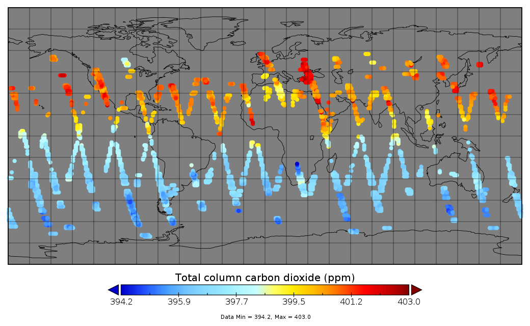
Multi-Instrument Fused bias-corrected XCO2 and other select fields aggregated as Level 4 daily files V3 (MultiInstrumentFusedXCO2)
Gridded carbon dioxide mole fraction (XCO2) and other select variables created by applying local kriging (also known as optimal interpolation) to daily aggregates of Orbiting... -
OPERA Land Surface Disturbance Alert from Harmonized Landsat Sentinel-2 product (Version 1)
The Observational Products for End-Users from Remote Sensing Analysis (OPERA) Land Surface Disturbance Alert from Harmonized... -
Aviation Safety Reporting System: Unmanned Aerial Vehicle (UAV) Reports
A sampling of reports involving Unmanned Aerial Vehicle (UAV) events. -
H-ATLAS All Potential Counterparts Catalog
The Herschel Astrophysical Terahertz Large Area Survey (H-ATLAS) is a survey of 600 deg^2 in five photometric bands - 100, 160, 250, 350 and 500 microns - with the... -
ECCO Ocean Three-Dimensional Volume Fluxes - Monthly Mean llc90 Grid (Version 4 Release 4)
This dataset provides monthly-averaged ocean three-dimensional volume fluxes on the native Lat-Lon-Cap 90 (LLC90) model grid from the ECCO Version 4 Release 4 (V4r4) ocean and... -
BARREL 1G X-ray Spectrometer (FSPC) Bremsstrahlung X-ray Spectrum Fast Time Resolution, Level 2, 0.05 s Data
FSPC: Four channels of fast time resolution, 50 ms, Bremsstrahlung X-ray spectra detected with a NaI Scintillator. Each channel is separated in its own variable: FSPC1, FSPC2,... -
Ground-Based Satellite Laser Ranging (SLR) Observation Data (normal points, hourly files) from NASA CDDIS
This dataset consists of ground-based Satellite Laser Ranging observation data (normal points, hourly files) from the NASA Crustal Dynamics Data Information System (CDDIS). SLR... -
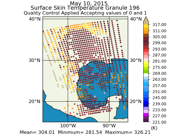
Aqua/AIRS L2 Support Retrieval (AIRS+AMSU) V7.0 at GES DISC
The Atmospheric Infrared Sounder (AIRS) is a grating spectrometer (R = 1200) aboard the second Earth Observing System (EOS) polar-orbiting platform, EOS Aqua. In combination... -
ABoVE: Soil Temperature Profiles, USArray Seismic Stations, 2016-2021
This dataset includes soil temperature profile measurements taken at 63 monitoring sites associated with the USArray program, located across the NASA ABoVE domain in interior... -
Accelerated Aging Experiments for Capacitor Health Monitoring and Prognostics
This paper discusses experimental setups for health monitoring and prognostics of electrolytic capacitors under nominal operation and accelerated aging conditions. Electrolytic... -
MODIS/Terra Vegetation Indices Monthly L3 Global 0.05Deg CMG V006
The MOD13C2 Version 6 data product was decommissioned on July 31, 2023. Users are encouraged to use the MOD13C2 Version... -
Map of Natural (Landscape) and Permafrost Zones and the Net of Soil Temperature Meteorological Stations in Russia and Middle Asian Mountains, Version 1
This data set is a vector coverage of the Map of Natural Landscape and Permafrost Zones and the Net of Soil Temperature Meteorological Stations in Russia and Middle Asian... -
Synoptic Charts of the Line-of-Sight Component of the Photospheric Magnetic Field
Synoptic charts are maps of the entire Sun produced in Carrington coordinates. Synoptic maps are constructed by merging together solar observations taken over many days.... -
Gateway to Astronaut Photography of Earth
Planetary nomenclature, like terrestrial nomenclature, is used to uniquely identify a feature on the surface of a planet or satellite so that the feature can be easily located,...

Official websites use .gov
A
.gov website belongs to an official government
organization in the United States.
Secure .gov websites use HTTPS
A
lock (
) or https:// means you’ve safely connected to
the .gov website. Share sensitive information only on official,
secure websites.