-
MISR Level 3 Cloud Top Height-Optical Depth Product covering a year V001
MIL3YCOD_1 is the Multi-angle Imaging SpectroRadiometer (MISR) Level 3 Cloud Top Height-Optical Depth Product covering a year version 1. MISR is designed to view Earth with... -
VILAS ASTEROID SPECTRA V1.1
This data set contains 81 published spectra of asteroids obtained by Faith Vilas during the years 1982 - 1992. -
Aquarius Official Release Level 3 Ancillary Reynolds Sea Surface Temperature Standard Mapped Image Descending 7-Day Data V5.0
Aquarius Level 3 ancillary sea surface temperature (SST) standard mapped image data are the ancillary SST data used in the Aquarius calibration for salinity retrieval. They are... -
Global Landslide Catalog Export
The Global Landslide Catalog (GLC) was developed with the goal of identifying rainfall-triggered landslide events around the world, regardless of size, impacts or location. The... -
Morphological Galaxy Catalog
The MCG database contains the "Morphological Catalogue of Galaxies," a compilation of information for approximately 34,000 galaxies found and examined on the Palomar Observatory... -
Aquarius Official Release Level 3 Rain-flagged Sea Surface Salinity Standard Mapped Image Descending 28-Day Running Mean Data V5.0
Aquarius Level 3 sea surface salinity (SSS) rain-flagged standard mapped image data contains gridded 1 degree spatial resolution SSS averaged over daily, 7 day, monthly, and... -
MODIS/Terra Land Surface Temperature/Emissivity Daily L3 Global 1km SIN Grid V006
The MOD11A1 Version 6 data product was decommissioned on July 31, 2023. Users are encouraged to use the MOD11A1 Version... -
IRTF NEAR-IR SPECTROSCOPY OF ASTEROIDS V2.0
This data set contains low-resolution, near-infrared (0.8 - 2.5 micron) spectra of asteroids obtained with SpeX at the NASA Infrared Telescope Facility (IRTF) on Mauna Kea.... -
EMIT L2A Estimated Surface Reflectance and Uncertainty and Masks 60 m V001
The Earth Surface Mineral Dust Source Investigation (EMIT) instrument measures surface mineralogy, targeting the Earth’s arid dust source regions. EMIT is installed on the... -
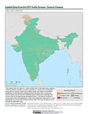
Spatial Data from the 2011 India Census
The Spatial Data from the 2011 India Census contains gridded estimates of India population at a resolution of 1 kilometer along with two spatial renderings of urban areas, one... -
MISR Level 3 Cloud Motion Vector yearly Product in netCDF format V002
MI3YCMVN_2 is the Multi-angle Imaging SpectroRadiometer (MISR) Level 3 Cloud Motion Vector yearly Product in netCDF format version 2. It contains retrievals of cloud motion... -
Aviation Safety Reporting System: Non-Tower Airport Incidents
A sampling of reports involving operations at non-tower airports. -
Consolidated Lunar Atlas
The Consolidated Lunar Atlas is a collection of the best photographic images of the moon, including low-oblique photography, full-moon photography, and tabular and positional... -
SAWYER ASTEROID SPECTRA
This data set contains 94 optical asteroid spectra obtained by Scott Sawyer as part of his Ph.D. dissertation at the University of Texas at Austin. Observational circumstances... -
Satellite Observations of Arctic Change, Version 1
The purpose of this site is to expose NASA satellite data and research on Arctic change in the form of maps that illustrate the changes taking place in the Arctic over time. A... -
24-COLOR ASTEROID SURVEY
This bundle is comprised of asteroid flux data measured in 26 filters using the McCord dual beam photometer, and covering the range 0.32 - 1.08 microns for 285 numbered...

Official websites use .gov
A
.gov website belongs to an official government
organization in the United States.
Secure .gov websites use HTTPS
A
lock (
) or https:// means you’ve safely connected to
the .gov website. Share sensitive information only on official,
secure websites.