-
BOREAS TE-01 SSA Soil Lab Data
This data set was collected by TE-01 to provide a set of soil properties for BOREAS investigators in the SSA. The soil samples were collected at sets of soil pits. Each set of... -
CMS: LiDAR Data for Mangrove Forests in the Zambezi River Delta, Mozambique, 2014
This data set provides high-resolution LiDAR point cloud data collected during surveys over mangrove forests in the Zambezi River Delta in Mozambique in May 2014. The data are... -
NMC Upper Air Derived Data (FIFE)
The Upper Air Derivative Data from NMC Data Set was derived from National Meteorological Center global upper air models. These models use a 6 hours intermittent assimilation... -
NWS Daily Climatology Data: 1990 (SNF)
Weather data were collected by the National Weather Service in International Falls, Minnesota. International Falls is about 80 miles from the SNF, but the weather data is... -
NWS Daily Climatology Data: 1978 (SNF)
Weather data were collected by the National Weather Service in International Falls, Minnesota. International Falls is about 80 miles from the SNF, but the weather data is... -
DXC'11 Framework and Oracle
The DXC Framework is a collection of programs and APIs for running and evaluating diagnostic algorithms (DAs) under identical experimental conditions. It is complementary to... -
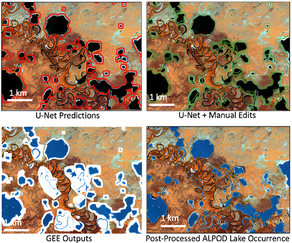
ABoVE: Alaska Lake and Pond Occurrence
The Alaska Lake and Pond Occurrence Dataset (ALPOD) is a spatially explicit map of lakes and ponds across Alaska and their seasonal fluctuations. The core product is an open... -
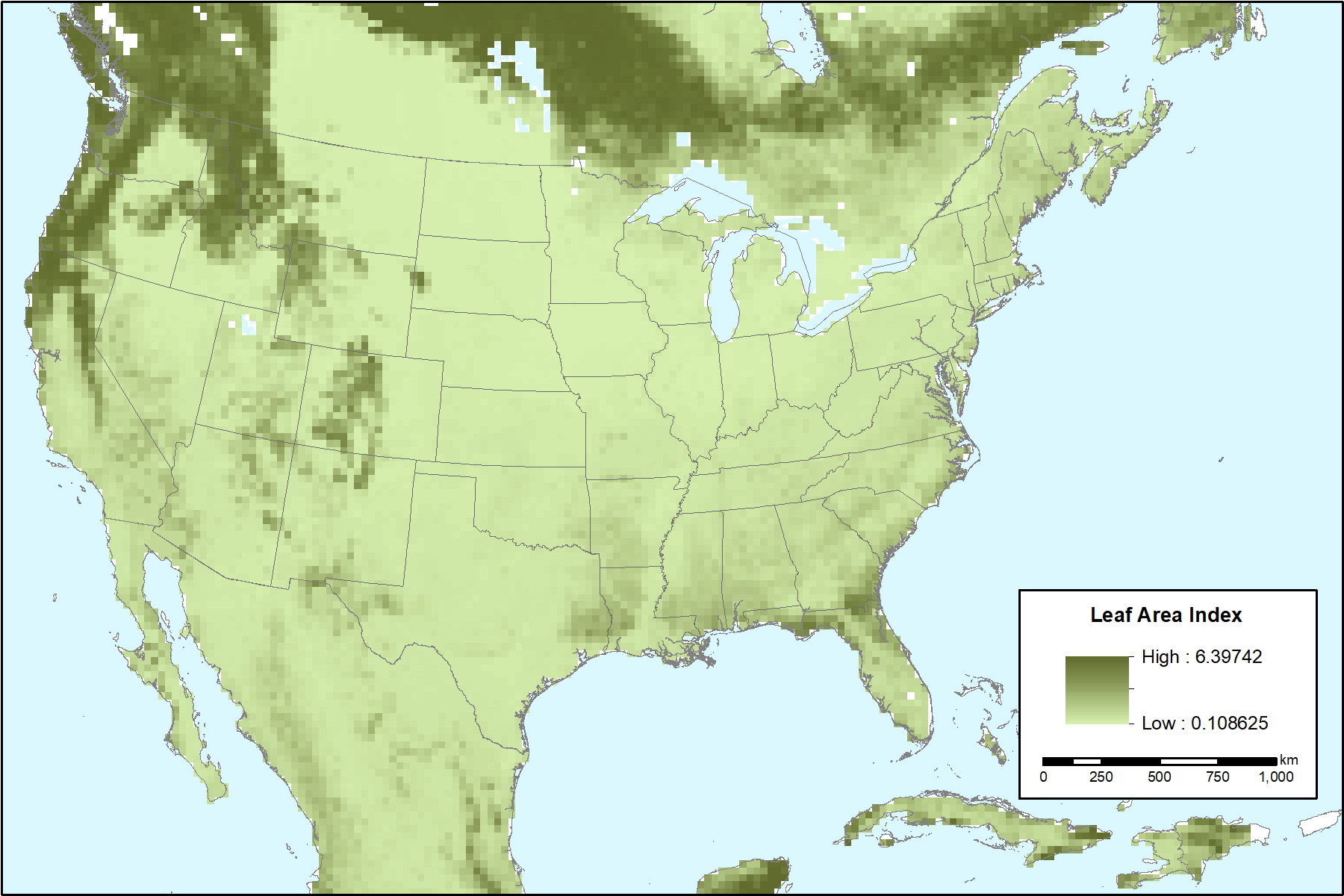
MODIS-derived Vegetation and Albedo Parameters for Agroecosystem-Climate Modeling
This dataset provides MODIS-derived leaf area index (LAI), stem area index (SAI), vegetation area fraction, dominant landcover category, and albedo parameters for the... -
Aquarius Official Release Level 3 Ancillary Reynolds Sea Surface Temperature Standard Mapped Image Descending Monthly Data V5.0
Aquarius Level 3 ancillary sea surface temperature (SST) standard mapped image data are the ancillary SST data used in the Aquarius calibration for salinity retrieval. They are... -
LBA-ECO LC-23 Characterization of Vegetation Fire Dynamics for Brazil: 2001-2003
Satellite fire detection was determined from two sensors—the Advanced Very High Resolution Radiometer (AVHRR) on NOAA-12 and the Moderate Resolution Imaging Spectroradiometer... -
BOREAS TE-20 NSA Soil Lab Data
This data set contains the major soil properties of soil samples collected at the tower flux sites in the NSA. The soil samples were collected by Hugo Veldhuis and his staff... -
Aquarius Official Release Level 3 Rain-flagged Sea Surface Salinity Standard Mapped Image Ascending 7-Day Data V5.0
Aquarius Level 3 sea surface salinity (SSS) rain-flagged standard mapped image data contains gridded 1 degree spatial resolution SSS averaged over daily, 7 day, monthly, and... -
BOREAS TGB-03 Plant Species Composition Data over the NSA Fen
The BOREAS TGB-03 team collected several data sets that contributed to understanding the measured trace gas fluxes over sites in the NSA. This data set contains information... -
CARVE: L2 Atmospheric CO2, CO and CH4 Concentrations, NOAA CRDS, Alaska, 2012-2015
This data set provides atmospheric carbon dioxide (CO2), methane (CH4), carbon monoxide (CO), and water vapor (H2O) concentrations from airborne campaigns over the Alaskan and... -
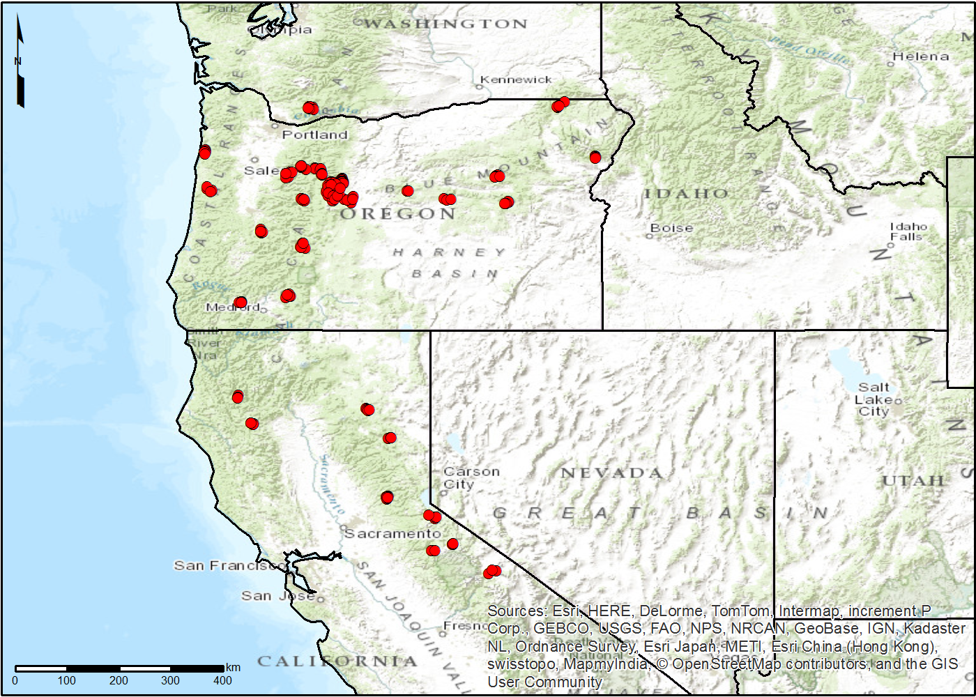
NACP TERRA-PNW: Forest Plant Traits, NPP, Biomass, and Soil Properties, 1999-2014
This data set contains measurements and estimates of leaf, tree, and soil data from six projects conducted by the Terrestrial Ecosystem Research and Regional Analysis- Pacific... -
BOREAS TE-12 Leaf Optical Data for SSA Species
The BOREAS TE-12 team collected several data sets in support of its efforts to characterize and interpret information on the reflectance, transmittance, and gas exchange of...

Official websites use .gov
A
.gov website belongs to an official government
organization in the United States.
Secure .gov websites use HTTPS
A
lock (
) or https:// means you’ve safely connected to
the .gov website. Share sensitive information only on official,
secure websites.