-
OMPS/NPP PCA SO2 Total Column 1-Orbit L2 Swath 50x50km NRT
The OMPS-NPP L2 NM Sulfur Dioxide (SO2) Total and Tropospheric Column swath orbital collection 2 version 2.0 product contains the retrieved sulfur dioxide (SO2) measured by the... -
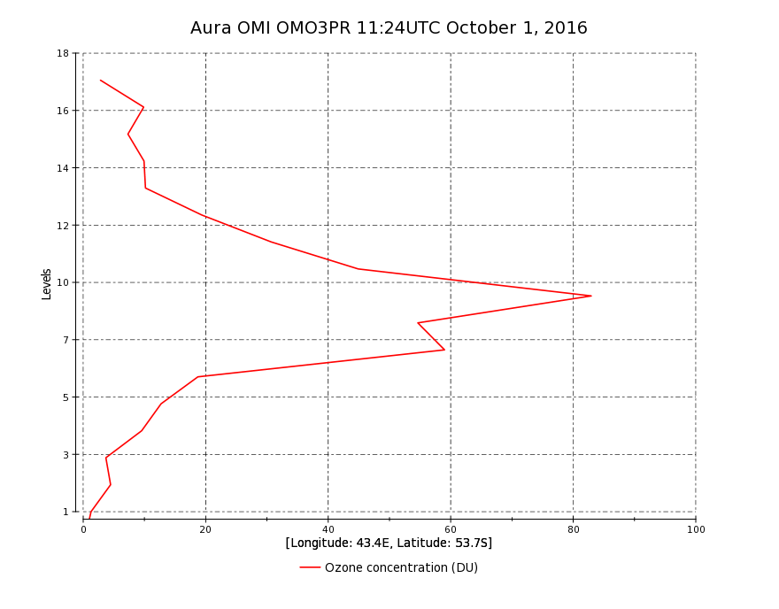
OMI/Aura Ozone (O3) Profile 1-Orbit L2 Swath 13x48km V003 (OMO3PR) at GES DISC
The Aura Ozone Monitoring Instrument Level-2 Ozone Profile data product OMO3PR (Version 003) is now available from the NASA Goddard Earth Sciences Data and Information Services... -
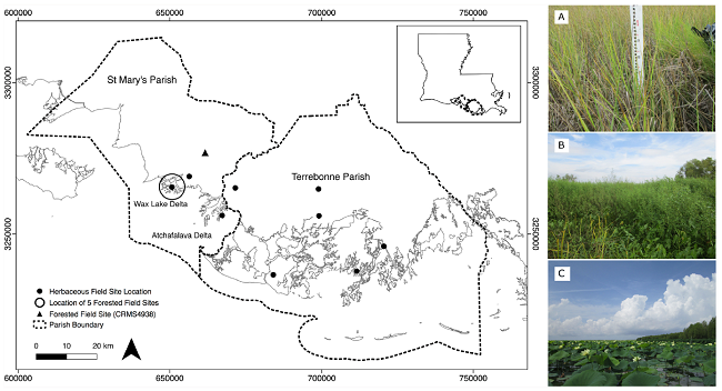
Pre-Delta-X: Vegetation Species, Structure, Aboveground Biomass, MRD, LA, USA, 2015
This dataset provides vegetation species, height, stem density and diameter, and species aboveground biomass (AGB) measurements collected at herbaceous and forested wetland... -
MLS/Aura Level 3 Daily Binned Ozone (O3) Mixing Ratio on Assorted Grids V005 (ML3DBO3) at GES DISC
ML3DBO3 is the EOS Aura Microwave Limb Sounder (MLS) daily binned on various vertical grids product for ozone (O3) derived from radiances measured by the 240 GHz radiometer. The... -
MLS/Aura Level 3 Daily Binned Chlorine Monoxide (ClO) Mixing Ratio on Assorted Grids V005 (ML3DBCLO) at GES DISC
ML3DBCLO is the EOS Aura Microwave Limb Sounder (MLS) daily binned on various vertical grids product for chlorine monoxide (ClO) derived from radiances measured primarily by the... -
MLS/Aura Level 2 Carbon Monoxide (CO) Mixing Ratio V004 (ML2CO) at GES DISC
ML2CO is the EOS Aura Microwave Limb Sounder (MLS) standard product for carbon monoxide derived from radiances measured by the 640 GHz radiometer. The data version is 4.2. Data... -
ECCO Ocean and Sea-Ice Surface Stress - Daily Mean 0.5 Degree (Version 4 Release 4)
This dataset contains daily-averaged ocean and sea-ice surface stress interpolated to a regular 0.5-degree grid from the ECCO Version 4 revision 4 (V4r4) ocean and sea-ice state... -
ECCO Ocean Bottom Pressure - Daily Mean 0.5 Degree (Version 4 Release 4)
This dataset contains daily-averaged ocean bottom pressure interpolated to a regular 0.5-degree grid from the ECCO Version 4 revision 4 (V4r4) ocean and sea-ice state estimate.... -
CPEX-CV DC-8 Aircraft In-situ Cloud Data
CPEXCV_Cloud_AircraftInSitu_DC8_Data is the in-situ cloud data collected during the Convective Processes Experiment - Cabo Verde (CPEX-CV) onboard the DC-8 aircraft. Data from... -
Wind SWE Weimer Propagated 60 s Resolution data in GSM Coordinates
Wind SWE propagated solar wind data and linearly interpolated to have the measurements on the minute at 60 s resolution data in GSM coordinates. This data set consists of... -
Wind SWE Weimer Propagated 60 s Resolution data in GSE Coordinates
Wind SWE propagated solar wind data and linearly interpolated to have the measurements on the minute at 60 s resolution data in GSE coordinates. This data set consists of... -
Wind SWE Linearly Interpolated 60 s Resolution data in GSM Coordinates
Wind linearly interpolated to have the measurements on the minute at 60 s resolution SWE data in GSM coordinates. This data set consists of processed solar wind data that has... -
DISCOVER-AQ California Deployment B-200 Aircraft In Situ Meteorological and Navigational Data
DISCOVERAQ_California_MetNav_AircraftInSitu_B200_Data contains in situ meteorological and navigational data collected onboard NASA's B-200 aircraft during the California (San... -
MODIS/Terra+Aqua BRDF/Albedo Parameter3 Band7 Daily L3 Global 30ArcSec CMG V061
The MCD43D21 Version 6.1 Bidirectional Reflectance Distribution Function and Albedo (BRDF/Albedo) Model Parameter dataset is produced daily using 16 days of Terra and Aqua... -
MODIS/Terra+Aqua BRDF/Albedo White Sky Albedo Band3 Daily L3 Global 30ArcSec CMG V061
The MCD43D54 Version 6.1 Bidirectional Reflectance Distribution Function and Albedo (BRDF/Albedo) White-Sky Albedo dataset is produced daily using 16 days of Terra and Aqua... -
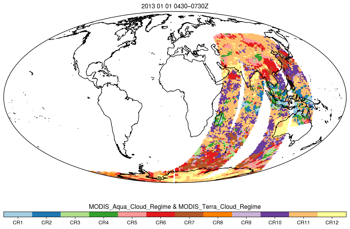
MODIS_CR_Equal_Area_3h
The MODIS Collection 6.1 Equal-Area Three-Hourly Cloud Regime product. This product is a discrete classification of cloud fields at the mesoscale as observed by the MODIS...

Official websites use .gov
A
.gov website belongs to an official government
organization in the United States.
Secure .gov websites use HTTPS
A
lock (
) or https:// means you’ve safely connected to
the .gov website. Share sensitive information only on official,
secure websites.