

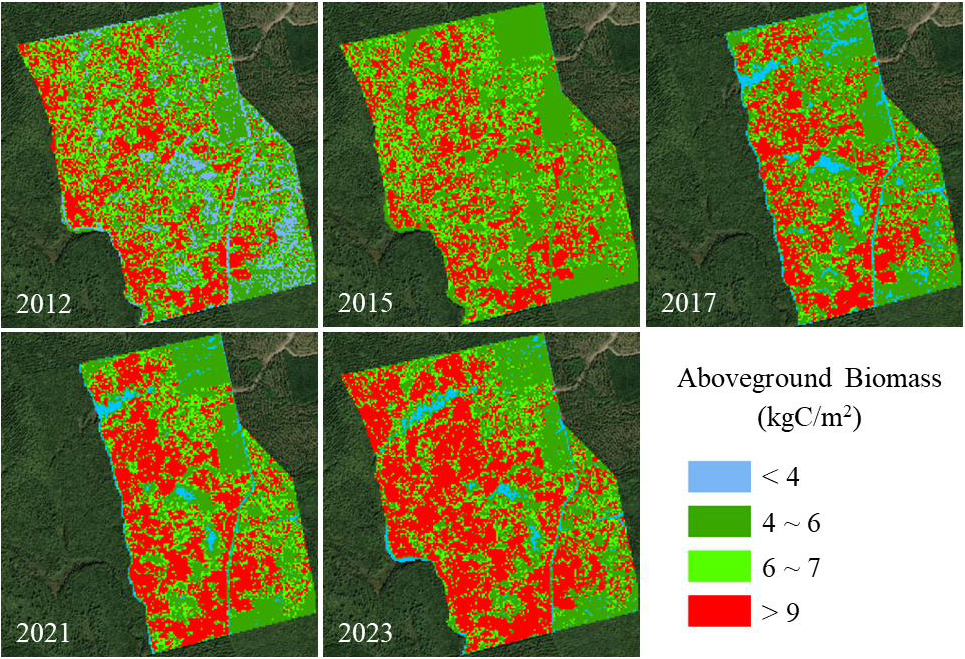
Aboveground Biomass for Howland Forest, Maine, 2012-2023
Access & Use Information
Public: This dataset is intended for public access and use.
License:
See this page for license information.
Downloads & Resources
-
Web ResourceBIN
-
Web PageHTML
-
Zip FileZIP
Howland_Forest_Biomass_Map_2434.zip
-
PNG Image FilePNG
Howland_Forest_Biomass_Map_Fig1.png
-
PDF FilePDF
Howland_Forest_Biomass_Map.pdf
-
Original MetadataISO
The metadata's original source.
Dates
| Metadata Created Date | June 20, 2025 |
|---|---|
| Metadata Updated Date | April 10, 2026 |
Metadata Source
- Data.json Data.json Metadata
Harvested from NASA Data.json
Additional Metadata
| Resource Type | Dataset |
|---|---|
| Metadata Created Date | June 20, 2025 |
| Metadata Updated Date | April 10, 2026 |
| Publisher | ORNL_DAAC |
| Maintainer | |
| Identifier | 10.3334/ORNLDAAC/2434 |
| Data Last Modified | 2026-04-06 |
| Category | Earth Science |
| Public Access Level | public |
| Bureau Code | 026:00 |
| Metadata Context | https://project-open-data.cio.gov/v1.1/schema/catalog.jsonld |
| Schema Version | https://project-open-data.cio.gov/v1.1/schema |
| Catalog Describedby | https://project-open-data.cio.gov/v1.1/schema/catalog.json |
| Harvest Object Id | 8779bb8a-b4ec-4372-b811-3bbaca1b35fd |
| Harvest Source Id | 58f92550-7a01-4f00-b1b2-8dc953bd598f |
| Harvest Source Title | NASA Data.json |
| License | https://www.usa.gov/government-works |
| Old Spatial | {"WestBoundingCoordinate":-68.7561,"NorthBoundingCoordinate":45.2144,"EastBoundingCoordinate":-68.7325,"SouthBoundingCoordinate":45.1961},"CARTESIAN" |
| Program Code | 026:000 |
| Source Datajson Identifier | True |
| Source Hash | bbc456571591083366e31bb5bec42e71771c224dce511768c365c9c71a287004 |
| Source Schema Version | 1.1 |
| Spatial | |
| Temporal | 2012-01-01/2023-12-31 |
Didn't find what you're looking for? Suggest a dataset here.