

21 datasets found
-
Federal
Salton Sea Geodatabase for Geothermal Exploration Artificial Intelligence
Department of Energy —
These files contain the geodatabases related to Salton Sea Geothermal Field. It includes all input and output files used with the Geothermal Exploration Artificial... -
Federal
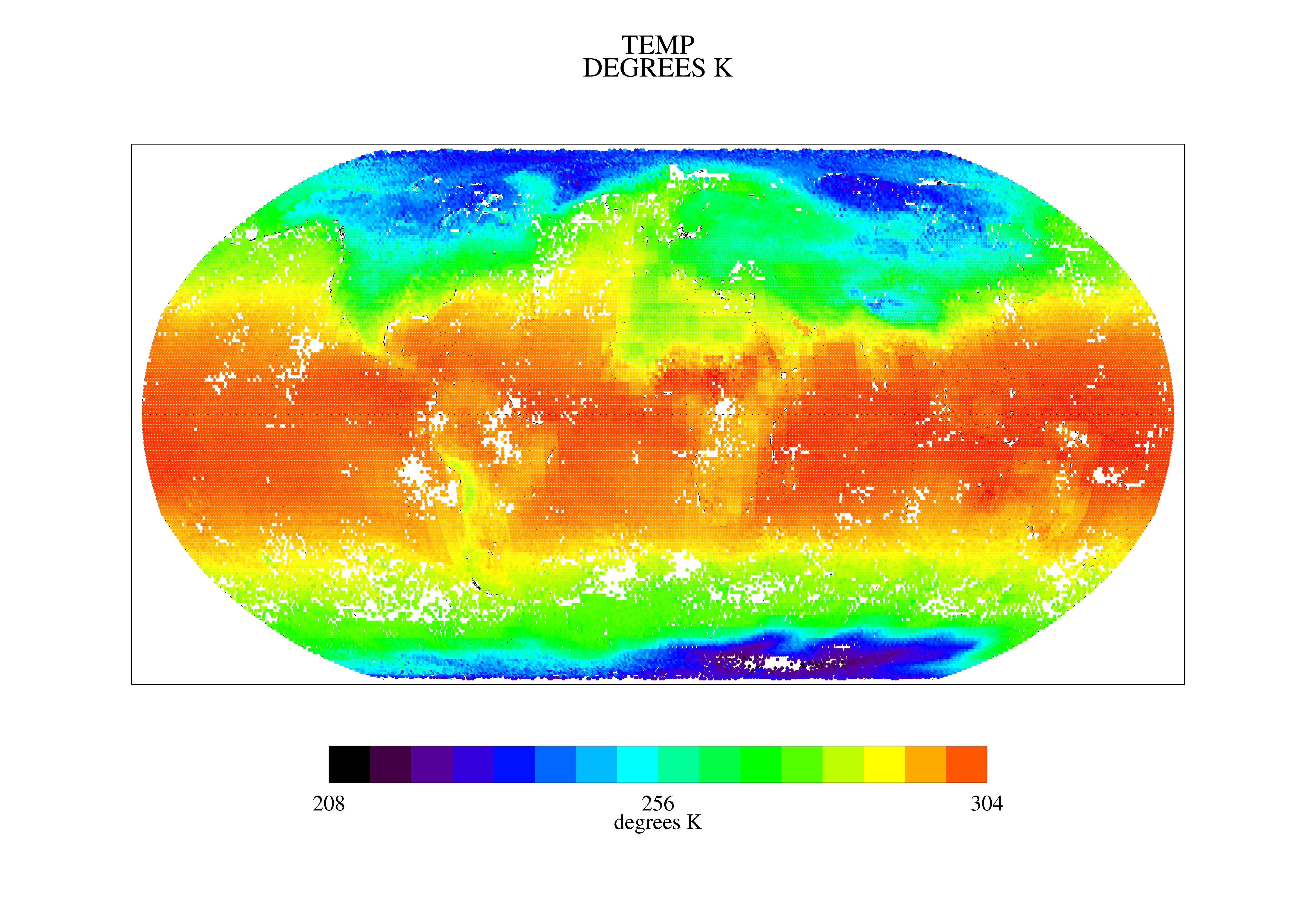
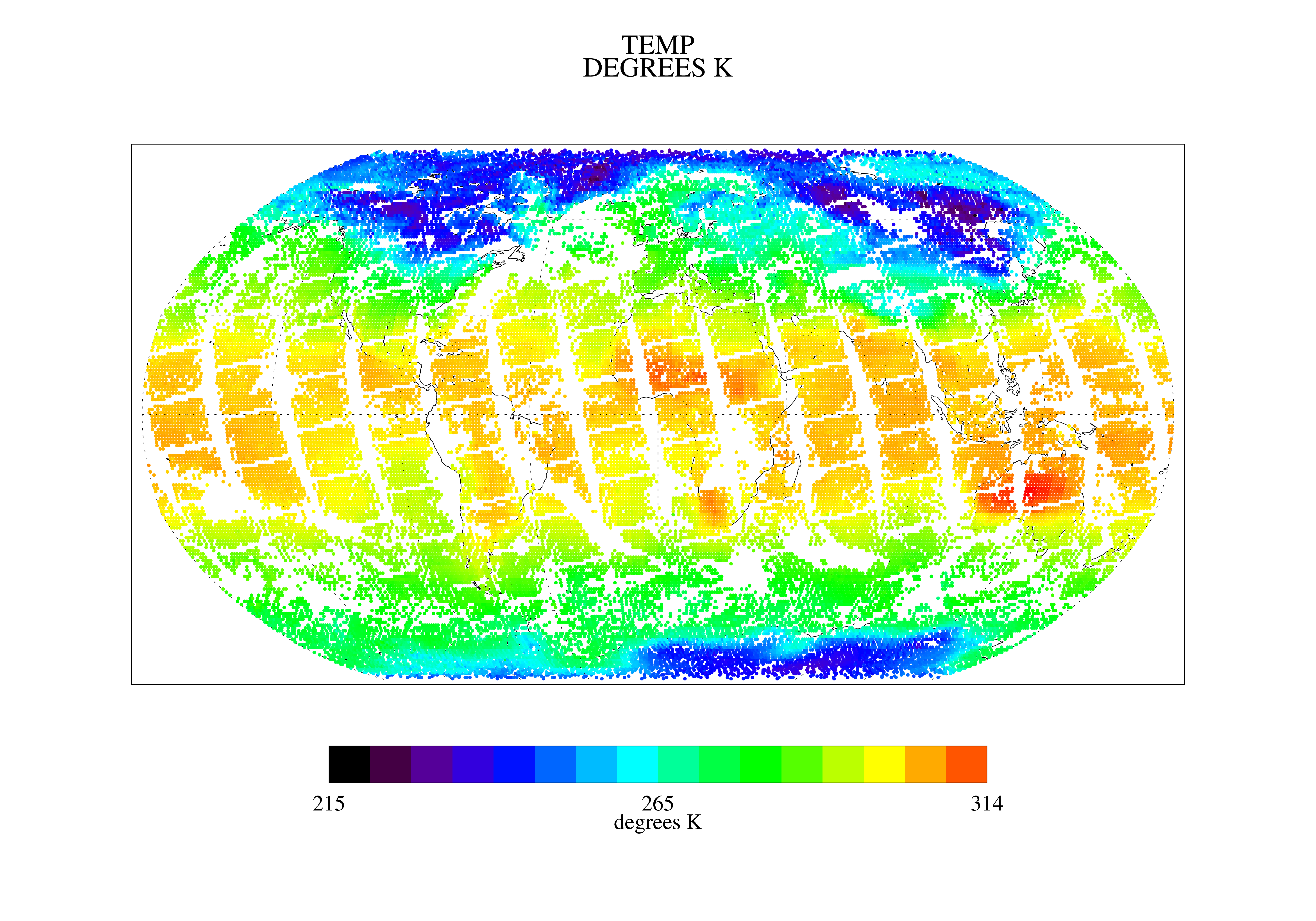
TOVS GLA 5 DAY GRIDS from NOAA-12 V01 (TOVSA5ND) at GES DISC
National Aeronautics and Space Administration —
This dataset (TOVSA5ND) contains the TIROS Operational Vertical Sounder (TOVS) level 3 geophysical parameters derived using data from NOAA-12 and the physical... -
Federal
Appendices for Geothermal Exploration Artificial Intelligence Report
Department of Energy —
The Geothermal Exploration Artificial Intelligence looks to use machine learning to spot geothermal identifiers from land maps. This is done to remotely detect... -
Federal
TOVS GLA 5 DAY GRIDS from NOAA-9 V01 (TOVSA5NF) at GES DISC
National Aeronautics and Space Administration —
This dataset (TOVSA5NF) contains the TIROS Operational Vertical Sounder (TOVS) level 3 geophysical parameters derived using data from NOAA-9 and the physical... -
Federal
Programs and Code for Geothermal Exploration Artificial Intelligence
Department of Energy —
The scripts below are used to run the Geothermal Exploration Artificial Intelligence developed within the "Detection of Potential Geothermal Exploration Sites from... -
Federal
Brady Geodatabase for Geothermal Exploration Artificial Intelligence
Department of Energy —
These files contain the geodatabases related to Brady's Geothermal Field. It includes all input and output files for the Geothermal Exploration Artificial... -
Federal
TOVS GLA 5 DAY GRIDS from NOAA-11 V01 (TOVSA5NH) at GES DISC
National Aeronautics and Space Administration —
This dataset (TOVSA5NH) contains the TIROS Operational Vertical Sounder (TOVS) level 3 geophysical parameters derived using data from NOAA-11 and the physical... -
Federal
TOVS GLA 5 DAY GRIDS from TIROSN V01 (TOVSA5TN ) at GES DISC
National Aeronautics and Space Administration —
This dataset (TOVSA5TN) contains the TIROS Operational Vertical Sounder (TOVS) level 3 geophysical parameters derived using data from TIROS-N and the physical... -
Federal
TOVS GLA DAILY GRIDS from NOAA-12 V01 (TOVSADND) at GES DISC
National Aeronautics and Space Administration —
This dataset (TOVSADND) contains the TIROS Operational Vertical Sounder (TOVS) level 3 geophysical parameters derived using data from NOAA-12 and the physical... -
Federal
Infrared Thermometer Data at the Weighing Lysimeters at Bushland, Texas
Department of Agriculture —
Directional brightness temperatures of fallow and cropped surfaces that were sensed by wireless infrared thermometers (IRTs) that were deployed at various positions... -
Federal
Desert Peak Geodatabase for Geothermal Exploration Artificial Intelligence
Department of Energy —
These files contain the geodatabases related to the Desert Peak Geothermal Field. It includes all input and output files used in the project. The files include data... -
Land Surface Temperature July 2015
District of Columbia —
Landsat 8 imagery (Level 1) for July 16, 2015 was processed to estimated land surface temperature. -
Federal
TOVS GLA DAILY GRIDS from TIROSN V01 (TOVSADTN) at GES DISC
National Aeronautics and Space Administration —
This dataset (TOVSADTN) contains the TIROS Operational Vertical Sounder (TOVS) level 3 geophysical parameters derived using data from TIROS-N and the physical... -
Federal
TOVS GLA 5 DAY GRIDS from NOAA-10 V01 (TOVSA5NG) at GES DISC
National Aeronautics and Space Administration —
This dataset (TOVSA5NG) contains the TIROS Operational Vertical Sounder (TOVS) level 3 geophysical parameters derived using data from NOAA-10 and the physical... -
Land Surface Temperature July 2014
District of Columbia —
Landsat 8 imagery (Level 1) for July 13, 2014 was processed to estimated land surface temperature. -
Federal
Training dataset and results for geothermal exploration artificial intelligence, applied to Brady Hot Springs and Desert Peak
Department of Energy —
The submission includes the labeled datasets, as ESRI Grid files (.gri, .grd) used for training and classification results for our machine leaning model: -... -
Land Surface Temperature July 2018
District of Columbia —
Landsat 8 imagery (Level 1) for July 8, 2018 was processed to estimated land surface temperature. -
Federal
TOVS GLA MONTHLY GRIDS from NOAA-11 V01 (TOVSAMNH) at GES DISC
National Aeronautics and Space Administration —
This dataset (TOVSAMNH) contains the TIROS Operational Vertical Sounder (TOVS) level 3 geophysical parameters derived using data from NOAA-11 and the physical... -
Land Surface Temperature August 2017
District of Columbia —
Landsat 8 imagery (Level 1) for August 22, 2017 was processed to estimated land surface temperature. -
Federal
TOVS GLA MONTHLY GRIDS from NOAA-10 V01 (TOVSAMNG) at GES DISC
National Aeronautics and Space Administration —
This dataset (TOVSAMNG) contains the TIROS Operational Vertical Sounder (TOVS) level 3 geophysical parameters derived using data from NOAA-10 and the physical...
21 datasets found