

6 datasets found
-
Federal
High Mountain Asia Daily 5km Landslide Hazard Indicator V001
National Aeronautics and Space Administration —
This data set projects the daily hazard of rainfall-triggered landslides in the High Mountain Asia region from 2015 through 2100, at 5 km resolution. Projections are... -
Federal
SMAPVEX16 Iowa Permanent Soil Moisture Network V001
National Aeronautics and Space Administration —
These data consist of soil moisture, soil temperature and precipitation measurements recorded in 2016 by the permanent soil moisture network; SMAPVEX16-Iowa. The... -
Federal
USGS JECAM Canada South Nation
National Aeronautics and Space Administration —
Joint Experiment for Crop Assessment and Monitoring The overarching goal of JECAM is to reach a convergence of approaches, develop monitoring and reporting protocols... -
Federal
GPM GROUND VALIDATION OKLAHOMA CLIMATOLOGICAL SURVEY MESONET MC3E V1
National Aeronautics and Space Administration —
The GPM Ground Validation Oklahoma Climatological Survey Mesonet MC3E data were collected during the Midlatitude Continental Convective Clouds Experiment (MC3E) in... -
Federal
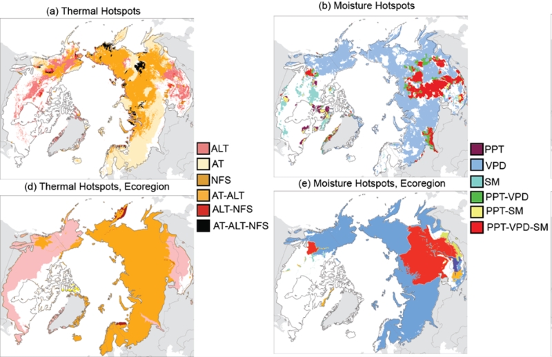
Trends of Thermal, Wetness, and Vegetative Change in the Circumpolar Arctic
National Aeronautics and Space Administration —
This dataset provides estimates of trends in temperature, moisture, and vegetation changes over the circumpolar Arctic. Time series trends were measured by the Theil-...
6 datasets found