-
Federal
Tropospheric Aerosol Radiative Forcing Observational eXperiment - University of Washington instrumented C-131A aircraft Data Set
National Aeronautics and Space Administration —
TARFOX_UWC131A is the Tropospheric Aerosol Radiative Forcing Observational eXperiment (TARFOX) - University of Washington instrumented C-131A aircraft data set. The... -
Federal
Moderate Resolution Imaging Spectroradiometer (MODIS) - Terra NGDA
National Aeronautics and Space Administration —
This dataset represents multiple products archived at the multiple archive centers for the MODIS (Moderate Resolution Imaging Spectroradiometer) instrument aboard the... -
Federal
NREL Solar Radiation Research Laboratory (SRRL): Baseline Measurement System (BMS), Golden, Colorado
Department of Energy —
The Solar Radiation Research Laboratory (SRRL) was established at the Solar Energy Research Institute (now NREL) in 1981 to provide continuous measurements of the... -
Federal
Moderate Resolution Imaging Spectroradiometer (MODIS)
National Oceanic and Atmospheric Administration, Department of Commerce —
Moderate Resolution Imaging Spectroradiometer (MODIS) is satellite data. It is archived as digital data set DSI-3614 at the National Climatic Data Center (NCDC). Data... -
Federal
CERES and GEO-Enhanced TOA, Within-Atmosphere and Surface Fluxes, Clouds and Aerosols 3-Hourly Terra-Aqua Edition4A NGDA
National Aeronautics and Space Administration —
CER_SYN1deg-3Hour_Terra-Aqua-MODIS_Edition4A is the Clouds and the Earth's Radiant Energy System (CERES) and geostationary (GEO)-Enhanced Top of Atmosphere (TOA),... -
Federal
Annual Mean PM2.5 Components Trace Elements (TEs) 50m Urban and 1km Non-Urban Area Grids for Contiguous U.S., 2000-2019, v1
National Aeronautics and Space Administration —
The Annual Mean PM2.5 Components Trace Elements (TEs) 50m Urban and 1km Non-Urban Area Grids for Contiguous U.S., 2000-2019, v1 data set contains annual predictions... -
Federal
Moderate Resolution Imaging Spectroradiometer (MODIS) - Aqua NGDA
National Aeronautics and Space Administration —
This dataset represents multiple products archived at the multiple archive centers for the MODIS (Moderate Resolution Imaging Spectroradiometer) instrument aboard the... -
Federal
Daily and Annual PM2.5 Concentrations for the Contiguous United States, 1-km Grids, v1 (2000 - 2016)
National Aeronautics and Space Administration —
The Daily and Annual PM2.5 Concentrations for the Contiguous United States, 1-km Grids, v1 (2000 - 2016) data set includes predictions of PM2.5 concentrations in grid... -
Federal
Moderate Resolution Imaging Spectroradiometer (MODIS) - Terra NGDA
National Aeronautics and Space Administration —
This dataset represents multiple products archived at the multiple archive centers for the MODIS (Moderate Resolution Imaging Spectroradiometer) instrument aboard the... -
Federal
Lidar In-Space Technology Experiment (LITE) L1
National Aeronautics and Space Administration —
LITE_L1 data are LIDAR Vertical profile data along the orbital flight path of STS-64.Lidar In-Space Technology Experiment (LITE) used a three-wavelength (355 nm, 532... -
Federal
Hurricane Satellite (HURSAT) from International Satellite Cloud Climatology Project (ISCCP) B1, Version 6
National Oceanic and Atmospheric Administration, Department of Commerce —
The Hurricane Satellite (HURSAT) from derived International Satellite Cloud Climatology Project (ISCCP) B1 observations of tropical cyclones worldwide. The B1 data... -
Federal
Aeronet AOD
National Aeronautics and Space Administration —
Sun photometer measurements of the direct (collimated) solar radiation provide information to calculate the columnar aerosol optical depth (AOD). AOD can be used to... -
Federal
Moderate Resolution Imaging Spectroradiometer (MODIS) - Aqua NGDA
National Aeronautics and Space Administration —
This dataset represents multiple products archived at the multiple archive centers for the MODIS (Moderate Resolution Imaging Spectroradiometer) instrument aboard the... -
Federal
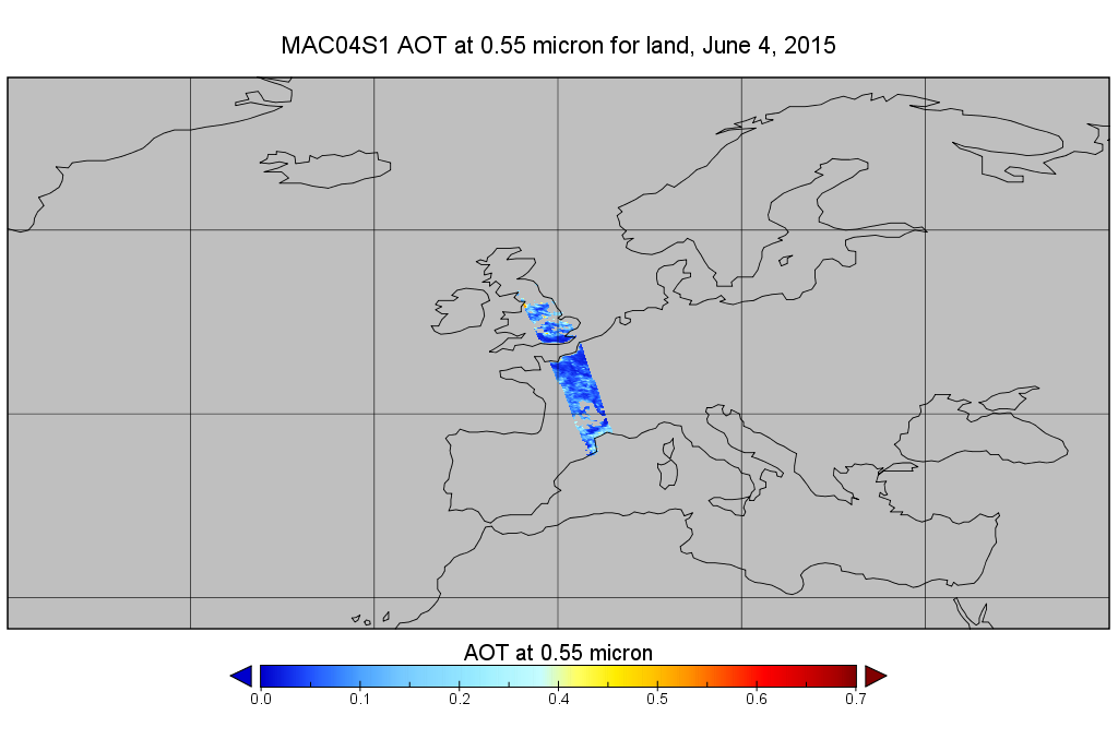
MODIS/Aqua Aerosol 10km 5-Min L2 Wide Swath Subset along CloudSat V002 (MAC04S1) at GES DISC NGDA
National Aeronautics and Space Administration —
This is the wide-swath MODIS/Aqua subset along CloudSat field of view track. The goal of the wide-swath subset is to select and return MODIS data that are within... -
Federal
Tropical Ozone Transport Experiment – Vortex Ozone Transport Experiment (TOTE-VOTE) DC-8 In Situ Aerosol Data
National Aeronautics and Space Administration —
TOTE-VOTE_Aerosol_AircraftInSitu_DC8_Data_1 is the in situ collected onboard the DC-8 aircraft during the Tropical Ozone Transport Experiment – Vortex Ozone Transport... -
Federal
TRACER-AQ JSC G-V Aircraft Remotely Sensed High Spectral Resolution Lidar-2 (HSRL-2) Data
National Aeronautics and Space Administration —
TRACERAQ_AircraftRemoteSensing_GV_HSRL2_Data is the remotely sensed High Spectral Resolution Lidar-2 (HSRL-2) data collected onboard the Johnson Space Center (JSC)... -
Federal
Polar Ozone and Aerosol Measurement III
National Aeronautics and Space Administration —
POAM3 data are Polar Ozone and Aerosol Measurement III Version 3.0. The Polar Ozone and Aerosol Measurement (POAM) III instrument measures the vertical distribution... -
Federal
Level 1.5 Almucantar Inversion Products (except phase functions)
National Aeronautics and Space Administration —
AERONET inversion code provides aerosoloptical properties in the total atmospheric column derived from the direct and diffuse radiation measured byAERONETCimel... -
Federal
CAPRICORN 2016 Field campaign: surface meteorological data and turbulent fluxes collected from the RV Investigator by the National Oceanic and Atmospheric Administration (NOAA) in the Indian and South Pacific Oceans from 2016-03-14 to 2016-04-15 (NCEI Accession 0170257)
National Oceanic and Atmospheric Administration, Department of Commerce —
The data contained within this file covers about 40 days of surface meteorological data and turbulent fluxes at sea south of Tasmania from 14 March to 16 April 2016....

Official websites use .gov
A
.gov website belongs to an official government
organization in the United States.
Secure .gov websites use HTTPS
A
lock (
) or https:// means you’ve safely connected to
the .gov website. Share sensitive information only on official,
secure websites.