
-
Federal
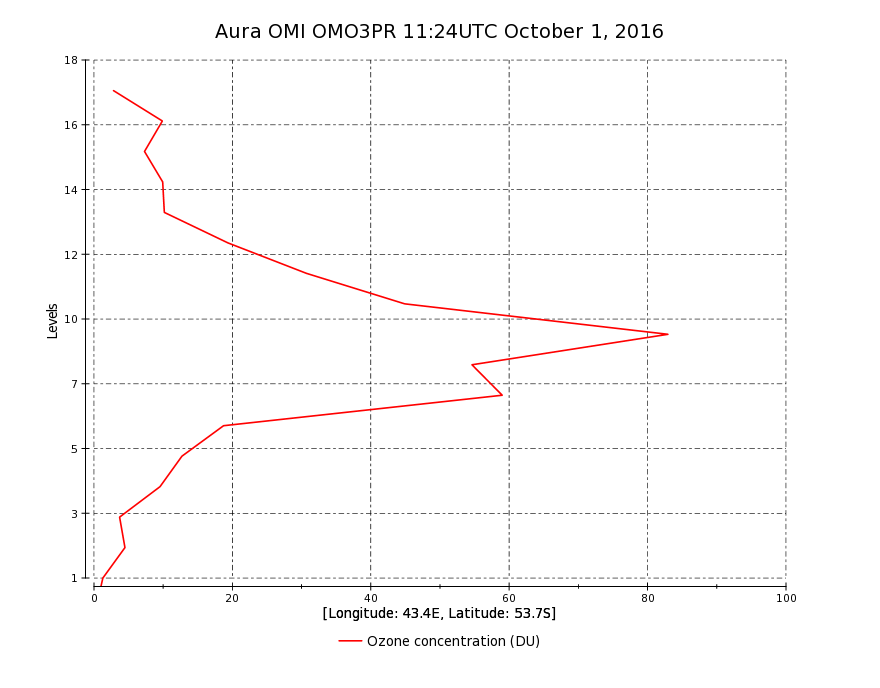
OMI/Aura Ozone (O3) Profile 1-Orbit L2 Swath 13x48km V003 (OMO3PR) at GES DISC
National Aeronautics and Space Administration —
The Aura Ozone Monitoring Instrument Level-2 Ozone Profile data product OMO3PR (Version 003) is now available from the NASA Goddard Earth Sciences Data and... -
Federal
SAFARI 2000 Cloud Absorption Radiometer BRDF, Dry Season 2000
National Aeronautics and Space Administration —
This record links to the web page for the Cloud Absorption Radiometer (CAR) data for the SAFARI 2000 project. Twenty-one flights were undertaken over Southern Africa... -
Federal
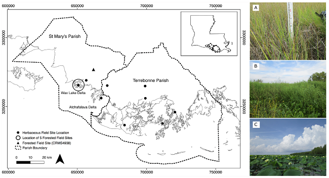
Pre-Delta-X: Vegetation Species, Structure, Aboveground Biomass, MRD, LA, USA, 2015
National Aeronautics and Space Administration —
This dataset provides vegetation species, height, stem density and diameter, and species aboveground biomass (AGB) measurements collected at herbaceous and forested... -
Federal
MLS/Aura Level 3 Daily Binned Ozone (O3) Mixing Ratio on Assorted Grids V005 (ML3DBO3) at GES DISC
National Aeronautics and Space Administration —
ML3DBO3 is the EOS Aura Microwave Limb Sounder (MLS) daily binned on various vertical grids product for ozone (O3) derived from radiances measured by the 240 GHz... -
Federal
MLS/Aura Level 3 Daily Binned Chlorine Monoxide (ClO) Mixing Ratio on Assorted Grids V005 (ML3DBCLO) at GES DISC
National Aeronautics and Space Administration —
ML3DBCLO is the EOS Aura Microwave Limb Sounder (MLS) daily binned on various vertical grids product for chlorine monoxide (ClO) derived from radiances measured... -
Federal
MLS/Aura Level 2 Carbon Monoxide (CO) Mixing Ratio V004 (ML2CO) at GES DISC
National Aeronautics and Space Administration —
ML2CO is the EOS Aura Microwave Limb Sounder (MLS) standard product for carbon monoxide derived from radiances measured by the 640 GHz radiometer. The data version is... -
Federal
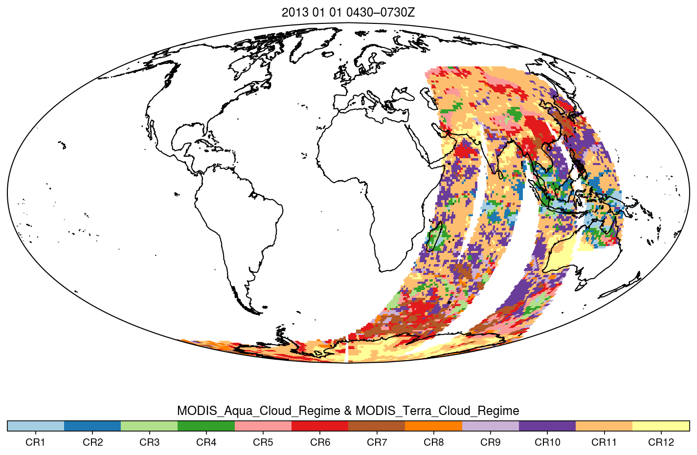
MODIS_CR_Equal_Area_3h
National Aeronautics and Space Administration —
The MODIS Collection 6.1 Equal-Area Three-Hourly Cloud Regime product. This product is a discrete classification of cloud fields at the mesoscale as observed by the... -
Federal
Ocean color calibration and validation measurements off the New Jersey and New York coasts
National Aeronautics and Space Administration —
Measurements made off the New Jersey and New York coasts between 2005 and 2009. -
Federal
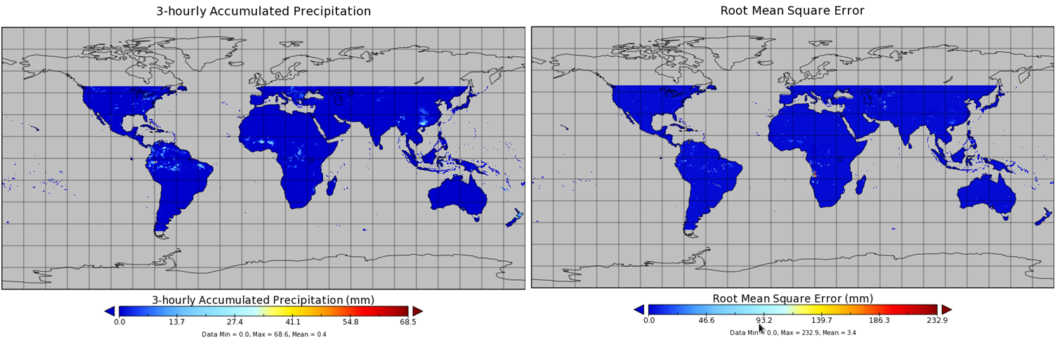
NASA MEASURES Precipitation Ensemble based on TMI TRMM NASA PPS L1C V05 Tbs 1-orbit L2 Swath 5x5km V1 (PRECIP_TMI_TRMM) at GES DISC
National Aeronautics and Space Administration —
The data presented in this level 2 orbital product are rain rate estimates expressed as mm/hour determined from brightness temperatures (Tbs) obtained from the... -
Federal
CERES ERBE-like Gridded Instantaneous TOA Fluxes Terra Crosstrack Edition4
National Aeronautics and Space Administration —
CER_ES9_Terra-Xtrk_Edition4 is the Clouds and the Earth's Radiant Energy System (CERES) Earth Radiation Budget Experiment (ERBE)-like Gridded Instantaneous Top-of-... -
Federal
CMS: LiDAR-derived Estimates of Aboveground Biomass at Four Forested Sites, USA
National Aeronautics and Space Administration —
These data consist of high-resolution maps of aboveground biomass at four forested sites in the US: Garcia River Tract in California, Anne Arundel and Howard Counties... -
Federal
BOREAS TF-11 Decomposition Data over the SSA-Fen
National Aeronautics and Space Administration —
The BOREAS TF-11 team collected several data sets in their efforts to fully describe the flux and site characteristics at the SSA-Fen site. This data set contains... -
Federal
CALIPSO IIR Lidar Level 3 Global Energy and Water Cycle Experiment (GEWEX) Cloud, Standard V1-00
National Aeronautics and Space Administration —
CAL_IIR_L3_GEWEX_Cloud-Standard-V1-00 is the Cloud-Aerosol Lidar and Infrared Pathfinder Satellite Observations (CALIPSO) IIR Level 3 Global Energy and Water Cycle... -
Federal
TROPESS Chemical Reanalysis CH2O Monthly 3-dimensional Product V1 (TRPSCRCH2OM3D) at GES DISC
National Aeronautics and Space Administration —
The TROPESS Chemical Reanalysis CH2O Monthly 3-dimensional Product contains vertical concentrations of formaldehyde. The data are part of the Tropospheric Chemical... -
Federal
TROPICS03 L2B Deep Multispectral INtensity (DMIN) of Tropical cyclones estimator Algorithm V1.0
National Aeronautics and Space Administration —
The "Time-Resolved Observations of Precipitation structure and storm Intensity with a Constellation of Smallsats" (TROPICS) mission has a goal of providing nearly... -
Federal
TROPESS Chemical Reanalysis SO2 Monthly 3-dimensional Product V1 (TRPSCRSO2M3D) at GES DISC
National Aeronautics and Space Administration —
The TROPESS Chemical Reanalysis SO2 Monthly 3-dimensional Product contains vertical concentrations of sulfur dioxide. The data are part of the Tropospheric Chemical... -
Federal
TMI/TRMM precipitation and uncertainty (TMPA) L3 3 hour 0.25 degree x 0.25 degree V001 (WC_MULTISEN_PREC_025) at GES DISC
National Aeronautics and Space Administration —
TMI/TRMM precipitation and uncertainty (TMPA) L3 3 hour 0.25 degree x 0.25 degree V001 provides estimates of accumulated precipitation from the Tropical Rainfall... -
Federal
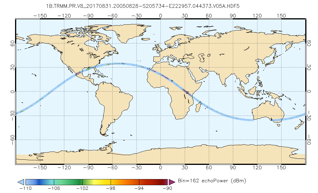
GPM PR on TRMM Echo Power L1B 1.5 hours 5 km V07 (GPM_1BPR) at GES DISC
National Aeronautics and Space Administration —
This is the new (GPM-formated) TRMM product. It replaces the old TRMM_1B21,1C21 Version 07 is the current version of the data set. Previous versions have been... -
Federal
ECOSTRESS Gridded Top of Atmosphere Calibrated Radiance Instantaneous L1C Global 70 m V002
National Aeronautics and Space Administration —
The ECOsystem Spaceborne Thermal Radiometer Experiment on Space Station (ECOSTRESS) mission measures the temperature of plants to better understand how much water...

Official websites use .gov
A
.gov website belongs to an official government
organization in the United States.
Secure .gov websites use HTTPS
A
lock (
) or https:// means you’ve safely connected to
the .gov website. Share sensitive information only on official,
secure websites.