
-
Federal
VEMAP 1: Georeferencing
National Aeronautics and Space Administration —
The Vegetation/Ecosystem Modeling and Analysis Project (VEMAP) is an ongoing multiinstitutional, international effort addressing the response of biogeography and... -
Federal
TROPICS01 Pathfinder L2B Instantaneous Surface Rain Rate (ISRR) V1.0
National Aeronautics and Space Administration —
The "Time-Resolved Observations of Precipitation structure and storm Intensity with a Constellation of Smallsats" (TROPICS) mission has a goal of providing nearly... -
Federal
PARABOLA Data (FIFE)
National Aeronautics and Space Administration —
The Surface Reflectances Measured by the PARABOLA Data Set contains measurements from the Portable Apparatus or Rapid Acquisitions of Bi-directional Observations of... -
Federal
SBUV2/NOAA-9 Ozone (O3) Nadir Profile and Total Column 1 Day L2 V1 (SBUV2N09L2) at GES DISC
National Aeronautics and Space Administration —
The Solar Backscattered Ultraviolet (SBUV) from NOAA-9 Level-2 daily product (SBUV2N09L2) contains ozone nadir profile and total column data from retrievals generated... -
Federal
Pre-ABoVE: Particle Trajectories for WRF-STILT Model, Barrow, AK, 1982-2011
National Aeronautics and Space Administration —
This dataset provides Stochastic Time-Inverted Lagrangian Transport model outputs for receptors located at the NOAA Barrow Alaska Observatory for 12 selected years... -
Federal
RSS SSM/I OCEAN PRODUCT GRIDS MONTHLY AVERAGE FROM DMSP F10 NETCDF V7
National Aeronautics and Space Administration —
The RSS SSM/I Ocean Product Grids Monthly Average from DMSP F10 netCDF dataset is part of the collection of Special Sensor Microwave/Imager (SSM/I) and Special Sensor... -
Federal
TEMPO cloud pressure and fraction (O2-O2 dimer) V03 (PROVISIONAL)
National Aeronautics and Space Administration —
O2-O2 cloud Level 2 files provide cloud information at TEMPO’s native spatial resolution, ~10 km^2 at the center of the Field of Regard (FOR), for individual... -
Federal
TEMPO formaldehyde total column V03 (PROVISIONAL)
National Aeronautics and Space Administration —
Formaldehyde Level 2 files provide trace gas information at TEMPO’s native spatial resolution, ~10 km^2 at the center of the Field of Regard (FOR), for individual... -
Federal
Sounder SIPS: JPSS-1 CrIMSS Level 2 CLIMCAPS: retrieved atmospheric state V2.1 (SNDRJ1IML2CPS) at GES DISC
National Aeronautics and Space Administration —
The CLIMCAPS (Community Long-term Infrared Microwave Coupled Product System) algorithm is used to analyze data from the Cross-track Infrared Sounder/Advanced... -
Federal
RLC Forest Cover Map of the Former Soviet Union, 1990
National Aeronautics and Space Administration —
This data set is a 1:2.5 million scale forest cover map for the land area of the Former Soviet Union that was completed in 1990 (Garsia 1990). There are forty-five... -
Federal
POLDER/Parasol L2 Radiation Budget subset along CloudSat track V001 (PARASOLRB_CPR) at GES DISC
National Aeronautics and Space Administration —
This is the POLDER/Parasol Level-2 Radiation Budget Subset, collocated with the CloudSat track. The subset is processed at the A-Train Data Depot of the GES DISC,... -
Federal
PREFIRE Auxiliary Meteorology Data for PREFIRE Satellite 2 R01
National Aeronautics and Space Administration —
Polar Radiant Energy in the Far InfraRed Experiment (PREFIRE) Auxiliary Meteorology Data for PREFIRE Satellite 2 (PREFIRE_SAT2_AUX-MET) contains GEOS-IT analyses and... -
Federal
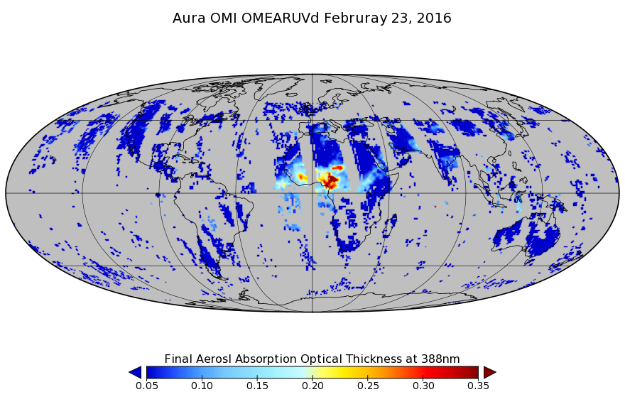
OMI/Aura Near UV Aerosol Optical Depth and Single Scattering Albedo L3 1 day 1.0 degree x 1.0 degree V3 (OMAERUVd) at GES DISC
National Aeronautics and Space Administration —
The OMI science team produces this Level-3 daily global gridded product OMAERUVd (1 deg Lat/Lon grids). The OMAERUVd product is produced with all data pixels that... -
Federal
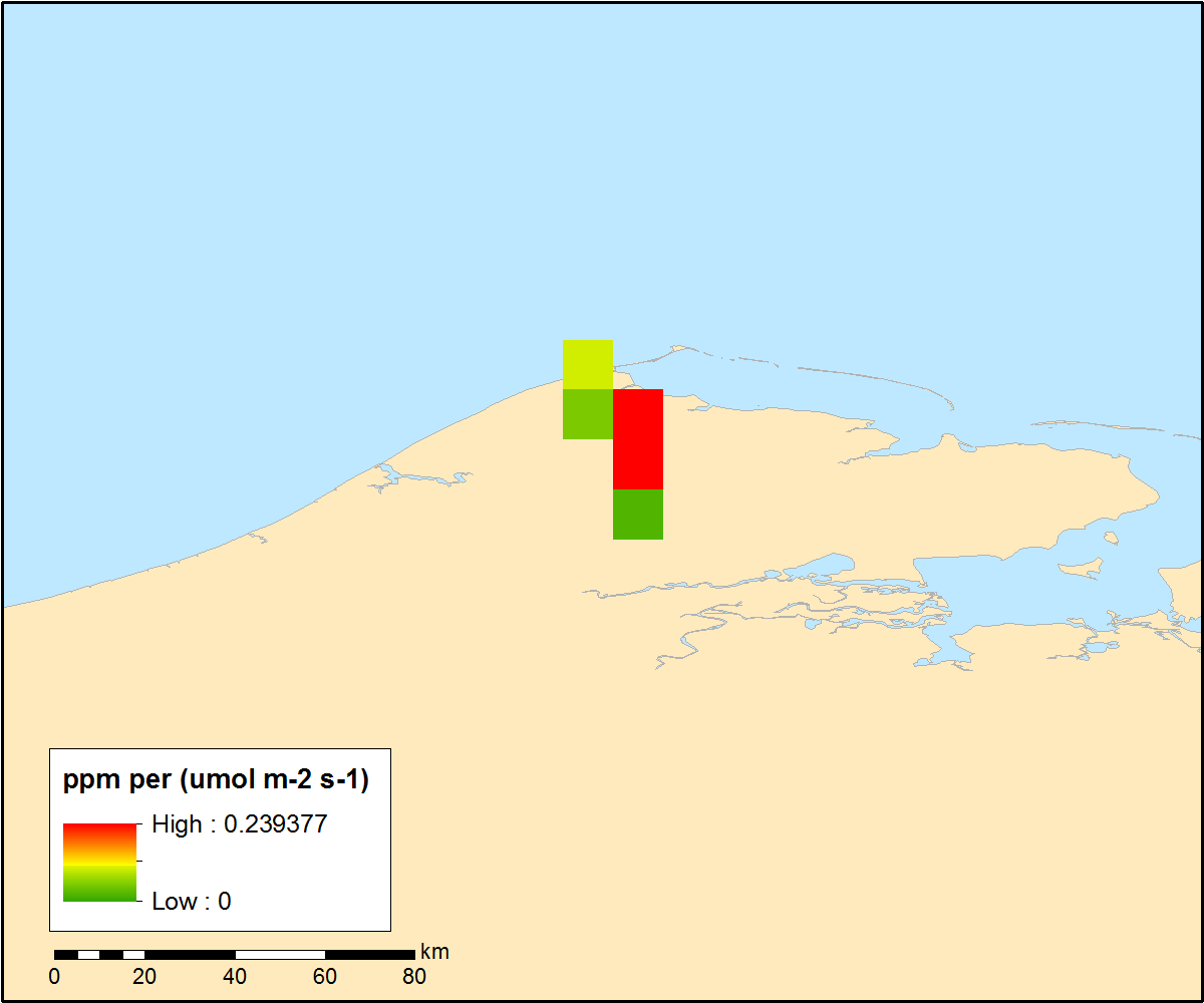
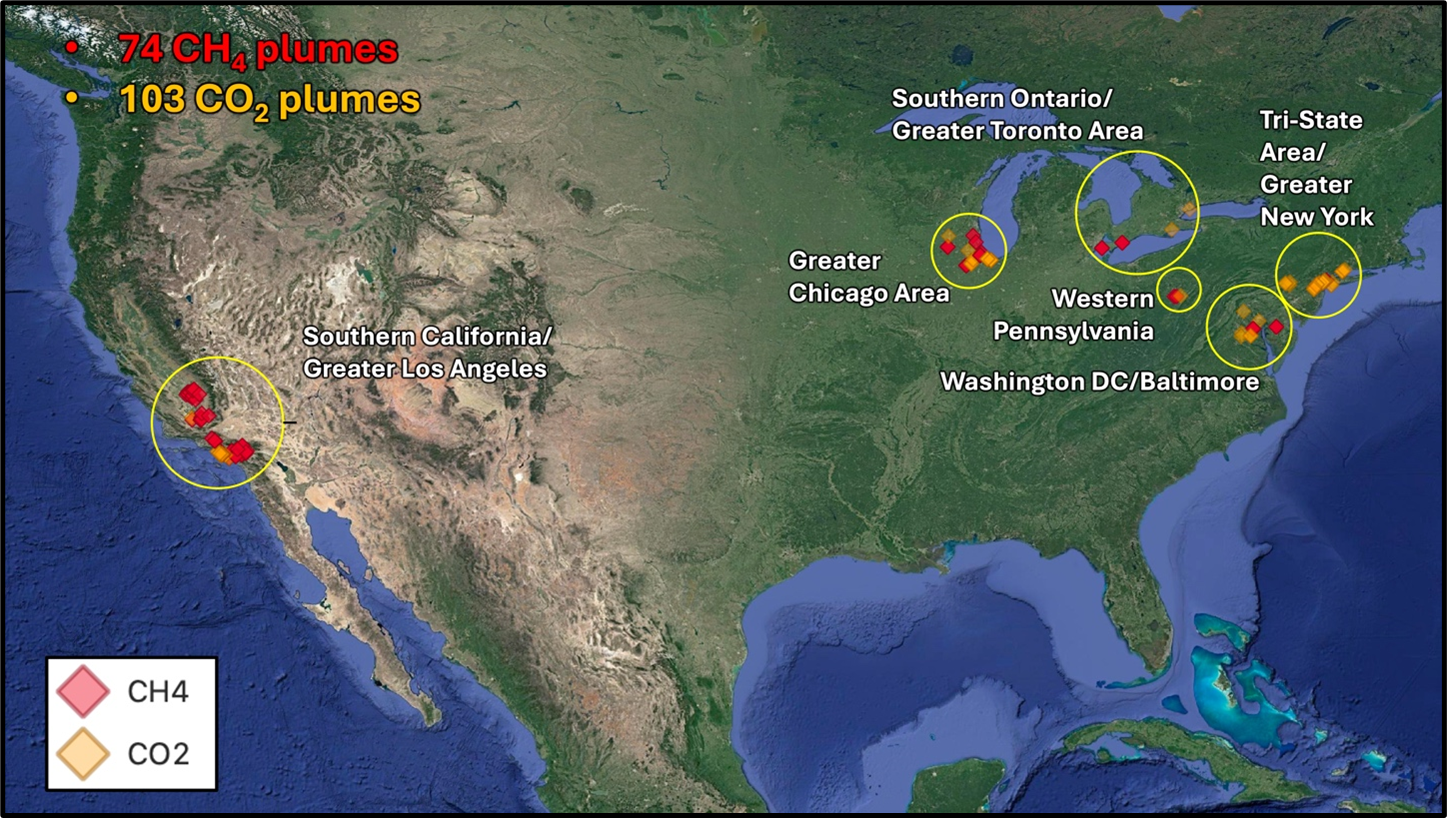
STAQS AVIRIS-NG-derived Methane and Carbon Dioxide Plumes, 2023
National Aeronautics and Space Administration —
This dataset contains enhanced column-integrated methane (CH4) and carbon dioxide (CO2) (concentration lengths) acquired from 211 flight lines across North America... -
Federal
S-NPP CrIS IMG_COL: Array indices for collocated VIIRS observations V2 (SNDRSNCrISL1BIMGC) at GES DISC
National Aeronautics and Space Administration —
The Cross-track Infrared Sounder (CrIS) Level 1B Normal Spectral Resolution (NSR) data files contain radiance measurements along with ancillary spacecraft,... -
Federal
RLC Forest Stand Carbon Map of Russia
National Aeronautics and Space Administration —
This dataset is a 1:15 million scale map of forest stand carbon for the land area of Russia (Stone et al., 2000). The objective was to create a first approximation of... -
Federal
Pre-Delta-X: AVIRIS-derived Total Suspended Solids Maps for MRD, LA, USA, 2015-2016
National Aeronautics and Space Administration —
This dataset includes total suspended solids (TSS) at the water surface across the Atchafalaya and Terrebonne Basins in Southern Louisiana, USA, within the... -
Federal
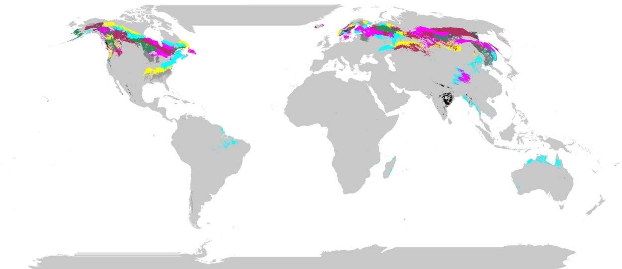
Phenoregions For Monitoring Vegetation Responses to Climate Change
National Aeronautics and Space Administration —
The overall purpose in this research was to identify the regions of the world best suited for long-term monitoring of biospheric responses to climate change, i.e.... -
Federal
SAFARI 2000 Plant and Soil C and N Isotopes, Southern Africa, 1995-2000
National Aeronautics and Space Administration —
This data set contains measurements of the concentration and stable carbon (13C / 12C) and nitrogen (15N / 14N) isotope ratios of plant (leaves, roots and fungi) and... -
Federal
SAFARI 2000 AERONET Ground-based Aerosol Data, Dry Season 2000
National Aeronautics and Space Administration —
AERONET (AErosol RObotic NETwork) is an optical ground-based aerosol monitoring network and data archive system. AERONET measurements of the column-integrated aerosol...

Official websites use .gov
A
.gov website belongs to an official government
organization in the United States.
Secure .gov websites use HTTPS
A
lock (
) or https:// means you’ve safely connected to
the .gov website. Share sensitive information only on official,
secure websites.