-
SDO/EVE Level 3 Version 8 Mission-Long Data
EVE level 3 data files were created at the Laboratory for Atmospheric and Space Physics in Boulder, Colorado for the NASA Solar Dynamics Observatory (SDO) Extreme Ultraviolet... -
VIIRS/JPSS1 BRDF/Albedo Parameter 1 Band M8 Daily L3 Global 30 ArcSec CMG V002
The NOAA-20 Visible Infrared Imaging Radiometer Suite (VIIRS) Bidirectional Reflectance Distribution Function (BRDF) and Albedo Model Parameter 1 Band M8 product (VJ143D19) is... -
GPM GROUND VALIDATION METEOROLOGICAL TOWER ENVIRONMENT CANADA GCPEX V1
The GPM Ground Validation Meteorological Tower Environment Canada GCPEx dataset provides temperature, relative humidity, 10 m winds, pressure and solar radiation data collected... -
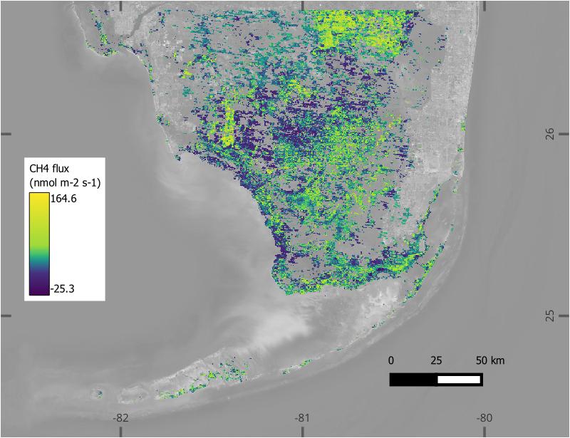
BlueFlux: Modeled Daily CO2 and CH4 Wetland Fluxes, Southern Florida, 2000-2024
This dataset contains gridded estimates of carbon dioxide (CO2) and methane (CH4) fluxes at daily resolution covering the Southern Florida region from 2000 to 2024. Gridded CO2... -
GPM GROUND VALIDATION PRECIPITATION VIDEO IMAGER (PVI) GCPEX V1
The GPM Ground Validation Precipitation Video Imager (PVI) GCPEx dataset collected precipitation particle images and drop size distribution data from November 2011 through March... -
OMPS-NPP L2 NM Aerosol Index swath orbital NRT
The OMPS-NPP L2 NM Aerosol Index swath orbital V2 for Near Real Time. For the standard product see the OMPS_NPP_NMMIEAI_L2 product in CMR .The aerosol index is derived from... -
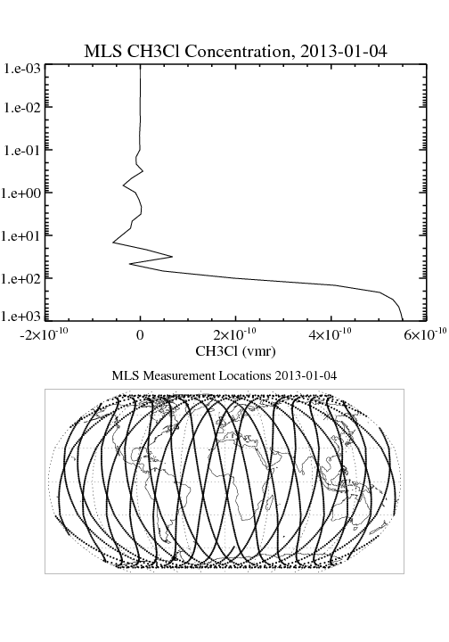
MLS/Aura Level 2 Methyl Chloride (CH3CL) Mixing Ratio V004 (ML2CH3CL) at GES DISC
ML2CH3CL is the EOS Aura Microwave Limb Sounder (MLS) standard product for methyl chloride derived from radiances measured by the 640 GHz radiometer. The data version is 4.2.... -
Burn Scar - Corrected Reflectance (VIIRS / Suomi-NPP)
This visualization represents a "false color" band combination (M11-I2-I1 | Red-Green-Blue) of data collected by the VIIRS instrument on the Suomi-NPP satellite and is useful... -
SOHO LASCO C2 Level 0.5 FITS Data
The LASCO C2 Raw FITS Data. \n\nLASCO (Large Angle Spectroscopic Coronagraph) is comprised of three nested coronagraphs (C1, C2, and C3) that image the solar corona from 1.1--30... -
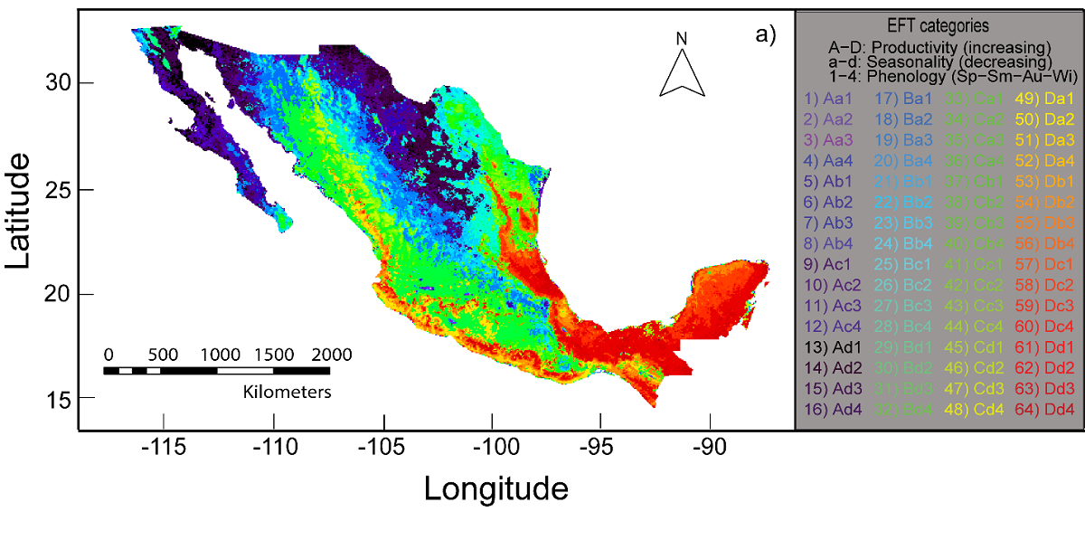
Arctic Alaska Vegetation, Geobotanical, Physiographic Maps, 1993-2005
This data set provides the spatial distributions of vegetation types, geobotanical characteristics, and physiographic features for the Arctic tundra region of Alaska for the... -
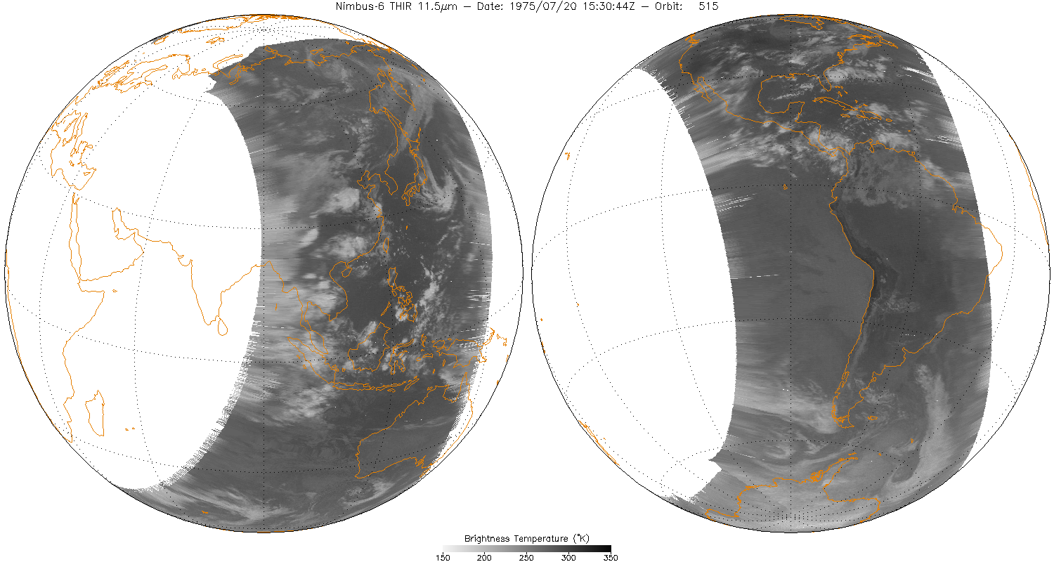
THIR/Nimbus-6 Level 1 Meteorological Radiation Data at 11.5 microns V001 (THIRN6L1CH115) at GES DISC
THIRN6L1CH115 is the Nimbus-6 Temperature-Humidity Infrared Radiometer (THIR) Level 1 Meteorological Radiation Data at 11.5 microns product and contains radiances expressed in... -
NLDAS Secondary Forcing Data L4 Hourly 0.125 x 0.125 degree V2.0 (NLDAS_FORB0125_H) at GES DISC
This data set contains the secondary forcing hourly data "File B" for Phase 2 of the North American Land Data Assimilation System (NLDAS-2). The data are in 1/8th degree grid... -
IPCC Special Report on Emissions Scenarios (SRES) Fluor-Gases Emissions Dataset
The Intergovernmental Panel on Climate Change (IPCC) Special Report Emissions Scenarios (SRES) Fluor-Gases Emissions Dataset consists of global and regional emissions of... -
VIIRS/NPP BRDF/Albedo Parameter 2 Band M4 Daily L3 Global 30 ArcSec CMG V002
The NASA/NOAA Suomi National Polar-orbiting Partnership (Suomi NPP) Visible Infrared Imaging Radiometer Suite (VIIRS) Bidirectional Reflectance Distribution Function (BRDF) and... -
MODIS/Aqua Aerosol 5-Min L2 Swath Subset 10km along MLS V002 (MAM04S0) at GES DISC
This is the MODIS/Aqua subset along MLS field of view track. The goal of the subset is to select and return MODIS data that are within +-100 km across the MLS track. I.e. the... -
SARP 2017 Data
SARP_2017_Data is the data collected onboard the Wallops C-23 aircraft during the 2017 deployment of the Student Airborne Research Program (SARP) mission. Data collection for...

Official websites use .gov
A
.gov website belongs to an official government
organization in the United States.
Secure .gov websites use HTTPS
A
lock (
) or https:// means you’ve safely connected to
the .gov website. Share sensitive information only on official,
secure websites.