-
GEDI L2A Elevation and Height Metrics Data Global Footprint Level V001
GEDI Version 1 data products were decommissioned on February 15, 2022. Users are advised to use the improved GEDI02_A Version... -
Global Navigation Satellite System (GNSS) Satellite Data from NASA CDDIS
Global Navigation Satellite System (GNSS) data consists of the U.S. Global Positioning System (GPS) and the Russian GLObal NAvigation Satellite System (GLONASS) (plus other... -
Updated Nearby Galaxy Catalog
This table contains an all-sky catalog of 869 nearby galaxies having individual distance estimates within 11 Mpc or corrected radial velocities relative to the Local Group... -
CERES Regionally Averaged TOA Fluxes, Clouds and Aerosols Hourly Terra Edition4A
CER_SSF1deg-Hour_Terra-MODIS_Edition4A is the Clouds and the Earth's Radiant Energy System (CERES) Regionally Averaged Top of Atmosphere (TOA) Fluxes, Clouds and Aerosols Hourly... -
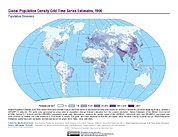
Global Population Density Grid Time Series Estimates
The Global Population Density Grid Time Series Estimates provide a back-cast time series of population density grids based on the year 2000 population grid from SEDAC's Global... -
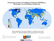
HANPP Collection: Human Appropriation of Net Primary Productivity as a Percentage of Net Primary Productivity
The HANPP Collection: Human Appropriation of Net Primary Productivity as a Percentage of Net Primary Productivity represents a map identifying regions in which human consumption... -
Gaia Source Catalogue DR2
The Gaia DR2 Source Catalogue contains positions and brightnesses for 1.693 billion stars, including distances and proper motions for more than 1.3 billion stars. For more... -
Mars Ephemeris, Heliocentric Trajectories, Heliographic, Heliographic Inertial, and Solar Ecliptic Coordinates, HelioWeb, Daily Data
Heliocentric trajectories for Planet Mars in Heliographic, HG, Heliographic Inertial, HGI, and Solar Ecliptic, SE, Coordinates\n\nThe original trajectory data are taken from... -
Global Land Cover Characterization Program
The Global Land Cover Characterization Project was established to meet science data requirements identified by the International Geosphere and Biosphere Programme (IGBP), and... -
Lunar Meteorite Compendium
Image database of meteorites of lunar origin collected by the Antarctic Search for Meteorites Program. -
MISR Level 3 Cloud Top Height-Optical Depth Product covering a year V001
MIL3YCOD_1 is the Multi-angle Imaging SpectroRadiometer (MISR) Level 3 Cloud Top Height-Optical Depth Product covering a year version 1. MISR is designed to view Earth with... -
Morphological Galaxy Catalog
The MCG database contains the "Morphological Catalogue of Galaxies," a compilation of information for approximately 34,000 galaxies found and examined on the Palomar Observatory... -
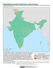
Spatial Data from the 2011 India Census
The Spatial Data from the 2011 India Census contains gridded estimates of India population at a resolution of 1 kilometer along with two spatial renderings of urban areas, one... -
MISR Level 3 Cloud Motion Vector yearly Product in netCDF format V002
MI3YCMVN_2 is the Multi-angle Imaging SpectroRadiometer (MISR) Level 3 Cloud Motion Vector yearly Product in netCDF format version 2. It contains retrievals of cloud motion... -
Consolidated Lunar Atlas
The Consolidated Lunar Atlas is a collection of the best photographic images of the moon, including low-oblique photography, full-moon photography, and tabular and positional... -
Satellite Observations of Arctic Change, Version 1
The purpose of this site is to expose NASA satellite data and research on Arctic change in the form of maps that illustrate the changes taking place in the Arctic over time. A... -
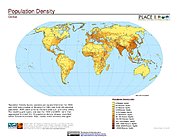
National Aggregates of Geospatial Data Collection: Population, Landscape, And Climate Estimates, Version 2 (PLACE II)
The National Aggregates of Geospatial Data Collection: Population, Landscape, And Climate Estimates, Version 2 (PLACE II) data set contains estimates of national-level...

Official websites use .gov
A
.gov website belongs to an official government
organization in the United States.
Secure .gov websites use HTTPS
A
lock (
) or https:// means you’ve safely connected to
the .gov website. Share sensitive information only on official,
secure websites.