-
SMEX03 QuikSCAT/SeaWinds Backscatter Data, Oklahoma, Version 1
This data set includes data collected over the Soil Moisture Experiment 2003 (SMEX03) areas of Alabama, Georgia, and Oklahoma, USA. -
CATS-ISS Level 1B Day Mode 7.2 Version 3-00
CATS-ISS_L1B_D-M7.2-V3-00 is the Cloud-Aerosol Transport System (CATS) International Space Station (ISS) Level 1B Day Mode 7.2 Version 3-00 data product. This collection spans... -
BOREAS TF-11 Decomposition Data over the SSA-Fen
The BOREAS TF-11 team collected several data sets in their efforts to fully describe the flux and site characteristics at the SSA-Fen site. This data set contains decomposition... -
CALIPSO IIR Lidar Level 3 Global Energy and Water Cycle Experiment (GEWEX) Cloud, Standard V1-00
CAL_IIR_L3_GEWEX_Cloud-Standard-V1-00 is the Cloud-Aerosol Lidar and Infrared Pathfinder Satellite Observations (CALIPSO) IIR Level 3 Global Energy and Water Cycle Experiment... -
CAMEX-4 AMPR BRIGHTNESS TEMPERATURE (TB) V1
The CAMEX-4 AMPR Brightness Temperature (TB) dataset was collected by the Advanced Microwave Precipitation Radiometer (AMPR), which was deployed during the Fourth Convection and... -
TROPESS Chemical Reanalysis CH2O Monthly 3-dimensional Product V1 (TRPSCRCH2OM3D) at GES DISC
The TROPESS Chemical Reanalysis CH2O Monthly 3-dimensional Product contains vertical concentrations of formaldehyde. The data are part of the Tropospheric Chemical Reanalysis v2... -
Terra MODIS Level-3 Global Mapped 4µm Nighttime Sea Surface Temperature (SST4) Data, version R2019.0
MODIS (or Moderate-Resolution Imaging Spectroradiometer) is a key instrument aboard the Terra (EOS AM) and Aqua (EOS PM) satellites. Terra's orbit around the Earth is timed so... -
Suomi-NPP VIIRS Level-3 Global Mapped Triple-window Sea Surface Temperature (SST3) Data, version R2016.2
The Visible and Infrared Imager/Radiometer Suite (VIIRS) is a multi-disciplinary instrument that is being flown on the Joint Polar Satellite System (JPSS) series of spacecraft,... -
Global Navigation Satellite Systems (GNSS) Real-Time Orbit Products from NASA CDDIS
Precise satellite orbits derived from analysis of Global Navigation Satellite System (GNSS) data. Analysis Centers (ACs) of the International GNSS Service (IGS) retrieve GNSS... -
Ground-Based Global Navigation Satellite System (GNSS) GLONASS real-time POD Clock Corrections (1-second sampling, 60-second files) from NASA CDDIS
This product contains a high-rate time series of clock biases for healthy satellites in the GLONASS constellation that are accumulated every minute throughout the day. In... -
Ground-Based Global Navigation Satellite System (GNSS) GPS real-time POD Orbits (60-second sampling, 60-second files) from NASA CDDIS
This product contains a time series of position and velocity components for healthy satellites in the GPS constellation that are accumulated every minute throughout the day. In... -
TROPICS03 L2B Deep Multispectral INtensity (DMIN) of Tropical cyclones estimator Algorithm V1.0
The "Time-Resolved Observations of Precipitation structure and storm Intensity with a Constellation of Smallsats" (TROPICS) mission has a goal of providing nearly all-weather... -
TROPESS Chemical Reanalysis SO2 Monthly 3-dimensional Product V1 (TRPSCRSO2M3D) at GES DISC
The TROPESS Chemical Reanalysis SO2 Monthly 3-dimensional Product contains vertical concentrations of sulfur dioxide. The data are part of the Tropospheric Chemical Reanalysis... -
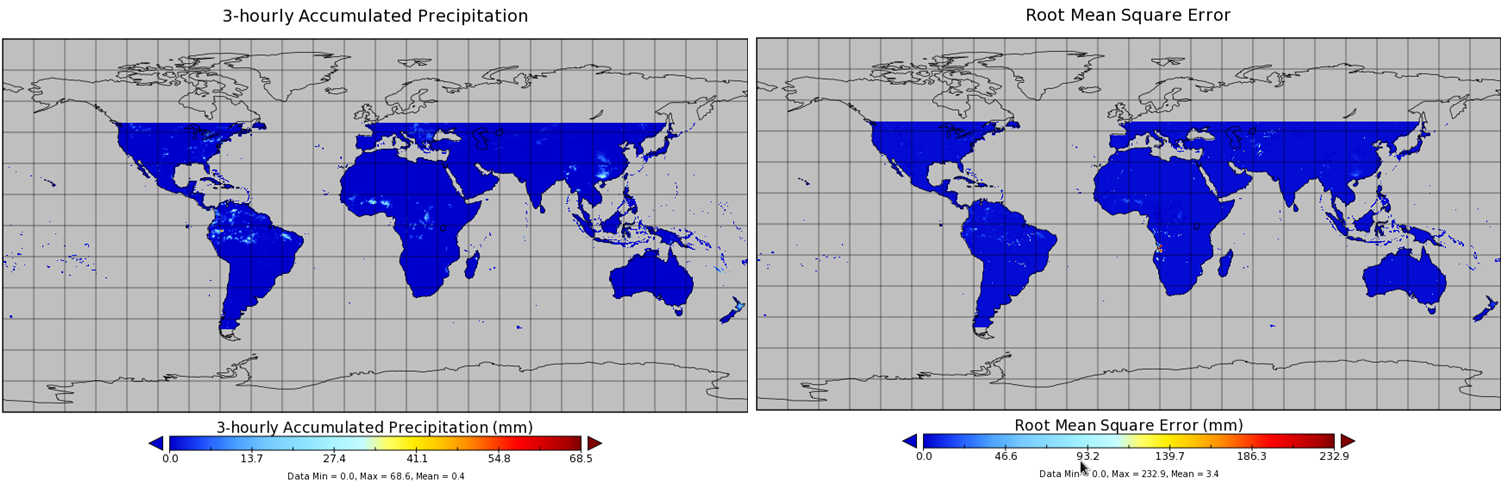
TMI/TRMM precipitation and uncertainty (TMPA) L3 3 hour 0.25 degree x 0.25 degree V001 (WC_MULTISEN_PREC_025) at GES DISC
TMI/TRMM precipitation and uncertainty (TMPA) L3 3 hour 0.25 degree x 0.25 degree V001 provides estimates of accumulated precipitation from the Tropical Rainfall Measuring... -
Global Navigation Satellite System (GNSS) Rapid Clocks Products from NASA CDDIS
Satellite and receiver clock products derived from analysis of Global Navigation Satellite System (GNSS) data. These products are the generated by analysis centers in support of... -
Global Navigation Satellite System (GNSS) Earth Rotation Parameters (ERP) products from NASA CDDIS
Earth Rotation Parameters (ERPs) derived from analysis of Global Navigation Satellite System (GNSS) data. These products are the generated by analysis centers in support of the... -
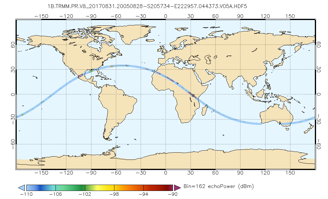
GPM PR on TRMM Echo Power L1B 1.5 hours 5 km V07 (GPM_1BPR) at GES DISC
This is the new (GPM-formated) TRMM product. It replaces the old TRMM_1B21,1C21 Version 07 is the current version of the data set. Previous versions have been superseded by...

Official websites use .gov
A
.gov website belongs to an official government
organization in the United States.
Secure .gov websites use HTTPS
A
lock (
) or https:// means you’ve safely connected to
the .gov website. Share sensitive information only on official,
secure websites.