-
GLIMPSE 360 Catalog
GLIMPSE360 is a Warm Mission Spitzer Cycle 6 Exploration Science Program (PIDs 60020, 61070, 61071, 61072, 61073, 70072) that mapped 187 degrees of longitude of the Galactic... -
Global Land Survey 1975
Global Land Survey 1975 images were acquired from 1972 to 1987 by Landsat 1-5 MSS. Landsat 4-5 data were used to fill gaps in the Landsat 1-3 data. The U.S. Geological Survey... -
Multisensor Analyzed Sea Ice Extent - Northern Hemisphere (MASIE-NH), Version 1
The Multisensor Analyzed Sea Ice Extent - Northern Hemisphere (MASIE-NH) products provide measurements of daily sea ice extent and sea ice edge boundary for the Northern... -
Voyager 1 Ephemeris, Heliocentric Trajectories, Heliographic, Heliographic Inertial, and Solar Ecliptic Coordinates, HelioWeb, Daily Data
Heliocentric trajectories for Voyager 1 in Heliographic, HG, Heliographic Inertial, HGI, and Solar Ecliptic, SE, Coordinates The original trajectory data are taken from... -
CERES MODIS and GEO Cloud Retrievals in ISCCP-D2like Format Daytime Edition3A
CER_ISCCP-D2like-Mrg_GEO-MODIS-DAY_Edition3A is the Clouds and the Earth's Radiant Energy System (CERES) Moderate Resolution Imaging Spectroradiometer (MODIS) and Geostationary... -
SOHO LASCO C2 Polarized Brightness FITS Data
The Polarized Brightness data from the LASCO C2 coronagraph.\n\nLASCO (Large Angle Spectroscopic Coronagraph) is comprised of three nested coronagraphs (C1, C2, and C3) that... -
VIIRS/NPP Lunar BRDF-Adjusted Nighttime Lights Yearly L3 Global 15 arc-second Linear Lat Lon Grid
VIIRS/NPP Lunar BRDF-Adjusted Nighttime Lights Yearly L3 Global 15 arc-second Linear Lat Lon Grid, with short-name VNP46A4, is the third nighttime lights (NTL) product in the... -
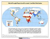
Global Drought Proportional Economic Loss Risk Deciles
The Global Drought Proportional Economic Loss Risk Deciles is a 2.5 minute grid of drought hazard economic loss as proportions of Gross Domestic Product (GDP) per analytical... -
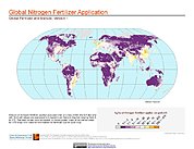
Global Fertilizer and Manure, Version 1: Nitrogen Fertilizer Application
The Nitrogen Fertilizer Application data set of the Global Fertilizer and Manure, Version 1 Data Collection represents the amount of nitrogen fertilizer nutrients applied to... -
ROSETTA-ORBITER EARTH OSIWAC 3 EAR1 RDR V2.0
This CODMAC level 3 data set contains radiometric calibrated image data in W/m^2/sr/nm, acquired by the OSIRIS Wide Angle Camera on the Rosetta spacecraft during the EARTH... -
Navigation and Ancillary Information Facility's SPICE
The Navigation and Ancillary Information Facility (NAIF), acting under the directions of NASA's Planetary Science Division, has built an information system named 'SPICE' to... -
NOAA-20 VIIRS Global Mapped Chlorophyll (CHL) - NRT Data, version R2022.0
The Ocean Biology DAAC produces near real-time (quicklook) products using the best-available combination of ancillary data from meteorological and ozone data. As such, the... -
NAAMES R/V Atlantis Miscellaneous Data, Version 1
NAAMES_Misc_Ship_Data are miscellaneous ship measurements collected onboard the R/V Atlantis vessel during the North Atlantic Aerosols and Marine Ecosystems Study (NAAMES).... -
GPM Ground Validation Doppler on Wheels (DOW) OLYMPEX V2
The GPM Ground Validation Doppler on Wheels (DOW) OLYMPEX V2 dataset was obtained by a dual-polarization and dual-frequency X-band mobile radar operated by the Center for Severe... -
Hawkeye Electric and Magnetic Field Radio Frequency Spectrum Analyzer High Time Resolution
The CDF file contains approximately 22 second time resolution Electric and Magnetic field data, average magnetic field magnitude, and orbital position data from Hawkeye 1. The... -
Forest Inventory and Biophysical Measurements, Brazilian Amazon, 2009-2018
This dataset provides the complete catalog of forest inventory and biophysical measurements collected over selected forest research sites across the Amazon rainforest in Brazil... -
Global Soil Profile Data (ISRIC-WISE)
The International Soil Reference and Information Centre-World Inventory of Soil Emission Potentials (ISRIC-WISE) international soil profile data set consists of a homogenized,...

Official websites use .gov
A
.gov website belongs to an official government
organization in the United States.
Secure .gov websites use HTTPS
A
lock (
) or https:// means you’ve safely connected to
the .gov website. Share sensitive information only on official,
secure websites.