-
XBOOTES:NDWFSBootesFieldOptical&NearIRCounterparts
The XBootes Survey is a 5 ks Chandra survey of the Bootes Field of the NOAO Deep Wide-Field Survey (NDWFS). This survey is unique in that it is the largest (9.3 square degrees)... -
Monthly Summaries of Soil Temperature and Soil Moisture in China, Version 1
This data set contains soil temperature and soil moisture data from nine sites in China. Temporal coverage varies by station; the earliest record is from June 1998, and the... -
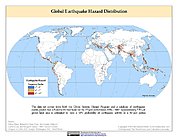
Global Earthquake Hazard Frequency and Distribution
The Global Earthquake Hazard Frequency and Distribution is a 2.5 minute grid utilizing Advanced National Seismic System (ANSS) Earthquake Catalog data of actual earthquake... -
Parker Solar Probe Ephemeris, Heliocentric Trajectories, Heliographic, Heliographic Inertial, and Solar Ecliptic Coordinates, HelioWeb, Daily Data
Heliocentric trajectories for Parker Solar Probe in Heliographic, HG, Heliographic Inertial, HGI, and Solar Ecliptic, SE, Coordinates\n\nThe original trajectory data are taken... -
VIIRS/JPSS1 Actual and Potential Evapotranspiration 8-Day L4 Global 500m SIN Grid V002
The NOAA-20 Visible Infrared Imaging Radiometer Suite (VIIRS) Actual and Potential Evapotranspiration product is an 8-day composite dataset produced at 500 meter (m) pixel... -
1:100,000-scale Digital Line Graphs (DLG) from the U.S. Geological Survey
Digital line graph (DLG) data are digital representations of cartographic information. DLG's of map features are converted to digital form from maps and related sources.... -
CALIPSO Lidar Level 3 Stratospheric Aerosol Profiles Standard V1-01
CAL_LID_L3_Stratospheric_APro-Standard-V1-01 is the Cloud-Aerosol Lidar and Infrared Pathfinder Satellite Observation (CALIPSO) Lidar Level 3 Stratospheric Aerosol Profiles... -
Brightest M Dwarfs in the Northern Sky Spectroscopic Catalog
This table contains a spectroscopic catalog of the 1564 brightest (J < 9m) M-dwarf candidates in the northern sky, as selected from the SUPERBLINK proper-motion catalog... -
Mars orbital image (HiRISE) labeled data set version 3
This data set contains a total of 73,031 landmarks. 10,433 landmarks were detected and extracted from 180 HiRISE browse images, and 62,598 landmarks were augmented from 10,433... -
VIIRS/NOAA-20 Deep Blue Aerosol L2 6-Min Swath 6 km (v2.0)
The NOAA-20 Visible Infrared Imaging Radiometer Suite (VIIRS) NASA standard Level-2 (L2) deep blue aerosol product provides satellite-derived measurements of Aerosol Optical... -
Million Quasars Catalog (MILLIQUAS), Version 8 (2 August 2023)
This table contains the Million Quasars (MILLIQUAS) Catalog, Version 8 (2 August 2023). It is a compendium of 907,144 type-I QSOs and AGN, largely complete from the literature... -
Aqua MODIS Level-3 Global Mapped 11µm Daytime Sea Surface Temperature (SST) Data, version R2019.0 NGDA
MODIS (or Moderate-Resolution Imaging Spectroradiometer) is a key instrument aboard the Terra (EOS AM) and Aqua (EOS PM) satellites. Terra's orbit around the Earth is timed so... -
TSIS TIM Level 3 Total Solar Irradiance 24-Hour Means V04 (TSIS_TSI_L3_24HR) at GES DISC
Version 04 is the current release of this data product, and supercedes all previous versions. The TSIS TIM Level 3 Total Solar Irradiance (TSI) 24-Hour Means data product... -
Daily and Annual PM2.5 Concentrations for the Contiguous United States, 1-km Grids, v1 (2000 - 2016)
The Daily and Annual PM2.5 Concentrations for the Contiguous United States, 1-km Grids, v1 (2000 - 2016) data set includes predictions of PM2.5 concentrations in grid cells at a... -
GEDI L4A Footprint Level Aboveground Biomass Density, Version 2.1
This dataset contains Global Ecosystem Dynamics Investigation (GEDI) Level 4A (L4A) Version 2 predictions of the aboveground biomass density (AGBD; in Mg/ha) and estimates of... -
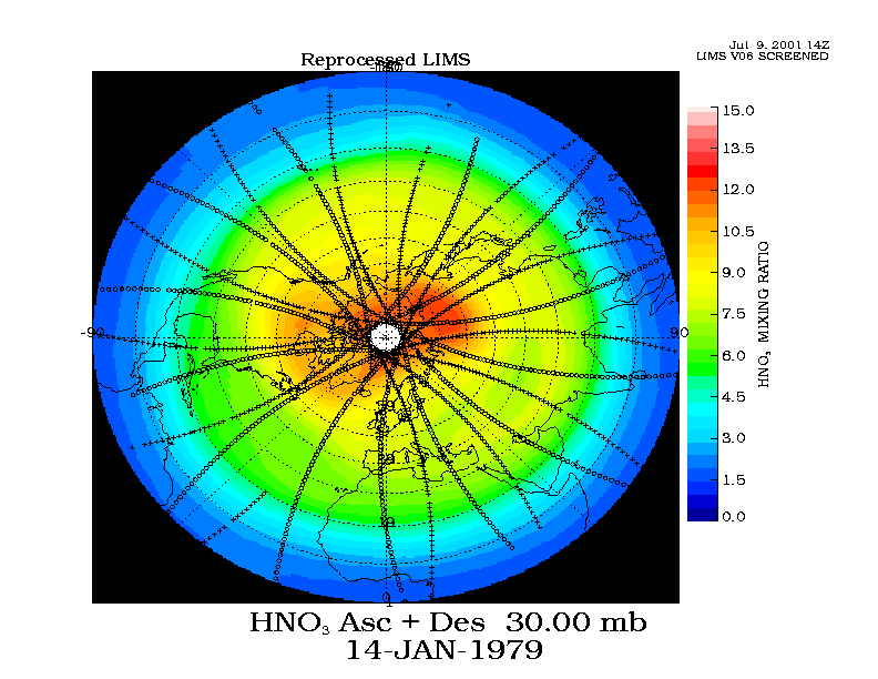
LIMS/Nimbus-7 Level 2 Vertical Profiles of O3, NO2, H2O, HNO3, Geopotential Height, and Temperature V006 (LIMSN7L2) at GES DISC
The Limb Infrared Monitor of the Stratosphere (LIMS) version 6 Level-2 data product consists of daily, geolocated, vertical profiles of temperature, geopotential height, and... -
GLAS/ICESat L2 Sea Ice Altimetry Data (HDF5) V034
GLAH06 is used in conjunction with GLAH05 to create the Level-2 altimetry products. Level-2 altimetry data provide surface elevations for ice sheets (GLAH12), sea ice (GLAH13),... -
Ground-Based Satellite Laser Ranging (SLR) Observation Data (normal points, monthly files) from NASA CDDIS
This dataset consists of ground-based Satellite Laser Ranging observation data (normal points, monthly files) from the NASA Crustal Dynamics Data Information System (CDDIS). SLR...

Official websites use .gov
A
.gov website belongs to an official government
organization in the United States.
Secure .gov websites use HTTPS
A
lock (
) or https:// means you’ve safely connected to
the .gov website. Share sensitive information only on official,
secure websites.