-
OMNIWeb at the Space Physics Data Facility (SPDF)
Hourly-averaged near-Earth solar wind magnetic field and plasma, etc. The web services consists of OMNI data (spacecraft-interspersed, near-Earth solar wind data); spacecraft-... -
Satellite Laser Ranging (SLR) Data Handling File for the International Laser Ranging Service (ILRS) extension of the International Terrestrial Reference Frame 2020 (ITRF2020) TRF Model with additional SLR sites
Corrections to SLR tracking data collected from various tables on CDDIS, resolutions from the ILRS/ASC (AWG) meetings, the T2L2 @ Jason-2 project (July 2008 to December 2017),... -
Hickson Compact Groups of Galaxies (HCG) Catalog
The HCG database table is based on the Hickson Catalog, which is a list of 100 compact groups of galaxies that were identified by a systematic search of the Palomar Observatory... -
VIIRS/NPP Surface Reflectance 8-Day L3 Global 500m SIN Grid V001
The VNP09H1 VIIRS Version 1 data product was decommissioned on April 8th, 2025. Users are encouraged to use Version 2 data products, which provideGIBS API for Developers
API using Global Imagery Browse Services (GIBS) designed to deliver global, full-resolution satellite imagery to users in a highly responsive manner, enabling interactive...First ISCCP Regional Experiment (FIRE) Atlantic Stratocumulus Transition Experiment (ASTEX) Colorado State University (CSU) PRT-6 Data
The First ISCCP Regional Experiments have been designed to improve data products and cloud/radiation parameterizations used in general circulation models (GCMs). Specifically,...Global Organic Soil Carbon and Nitrogen (Zinke et al.)
This package contains worldwide soil carbon and nitrogen data for more than 3,500 soil profiles. The database was begun about 40 years ago with the collection and analyses by...Global Forest Cover Change Forest Cover Change Multi-Year Global 30m V001
The Land Processes Distributed Active Archive Center (LP DAAC) archives and distributes Global Forest Cover Change (GFCC) data products through the NASA Making Earth System Data...Global Soil Data Products CD-ROM Contents (IGBP-DIS)
This dataset contains global data on soil properties, global maps of soil distributions, and the SoilData System developed by the International Geosphere-Biosphere Programme...NASA Life Sciences Portal (NLSP)
The NASA Life Sciences Portal (NLSP) is the data platform for accessing NASA's Life Sciences Data Archive (LSDA). The LSDA is an active archive that provides information and...Comet Halley Ephemeris, Heliocentric Trajectories, Heliographic, Heliographic Inertial, and Solar Ecliptic Coordinates, HelioWeb, Daily Data
Heliocentric trajectories for Comet Halley in Heliographic, HG, Heliographic Inertial, HGI, and Solar Ecliptic, SE, Coordinates\n\nThe original trajectory data are taken from...National High Altitude Photography
The National High Altitude Photography (NHAP) program, which was operated from 1980 - 1989, was coordinated by the U.S. Geological Survey as an interagency project to eliminate...Principal Galaxy Catalog (PGC) 2003
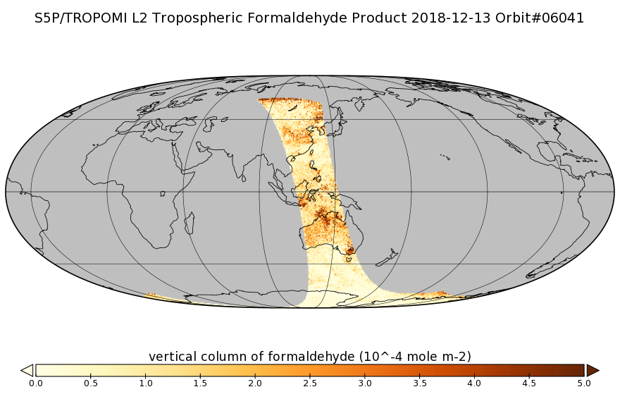
The Principal Galaxy Catalog, 2003 Version (PGC2003) is a new catalog of principal galaxies. It constitutes the framework of the HYPERLEDA database that supersedes the LEDA one,...Sentinel-5P TROPOMI Tropospheric Formaldehyde HCHO 1-Orbit L2 7km x 3.5km V1 (S5P_L2__HCHO__) at GES DISC
Starting from August 6th in 2019, Sentinel-5P TROPOMI along-track high spatial resolution (~5.5km at nadir) has been implemented. Starting from July 13th in 2020, five...Global Multi-resolution Terrain Elevation Data 2010 (GMTED2010)
The USGS and the NGA have collaborated on the development of a notably enhanced global elevation model named the GMTED2010 that replaces GTOPO30 as the elevation dataset of...Uranus Ephemeris, Heliocentric Trajectories, Heliographic, Heliographic Inertial, and Solar Ecliptic Coordinates, HelioWeb, Daily Data
Heliocentric trajectories for Planet Uranus in Heliographic, HG, Heliographic Inertial, HGI, and Solar Ecliptic, SE, Coordinates\n\nThe original trajectory data are taken from...

Official websites use .gov
A
.gov website belongs to an official government
organization in the United States.
Secure .gov websites use HTTPS
A
lock (
) or https:// means you’ve safely connected to
the .gov website. Share sensitive information only on official,
secure websites.