-
Georeferenced U.S. County-Level Population Projections, Total and by Sex, Race and Age, Based on the SSPs, 2020-2100
The Georeferenced U.S. County-Level Population Projections, Total and by Sex, Race and Age, Based on the SSPs, 2020-2100 consists of county-level population projection scenarios... -
Lunar Orbiter Laser Altimeter (LOLA) one-way Laser Ranging Full Rate Data (all ranges collected, ground stations, aggregate of normal points daily) from NASA CDDIS
Lunar Orbiter Laser Altimeter (LOLA) one-way laser ranging full rate data. These files contain the full rate data (all ranges collected) as delivered from the ground stations... -
Global Land Survey 1975
Global Land Survey 1975 images were acquired from 1972 to 1987 by Landsat 1-5 MSS. Landsat 4-5 data were used to fill gaps in the Landsat 1-3 data. The U.S. Geological Survey... -
Global Drought Proportional Economic Loss Risk Deciles
The Global Drought Proportional Economic Loss Risk Deciles is a 2.5 minute grid of drought hazard economic loss as proportions of Gross Domestic Product (GDP) per analytical... -
Global Fertilizer and Manure, Version 1: Nitrogen Fertilizer Application
The Nitrogen Fertilizer Application data set of the Global Fertilizer and Manure, Version 1 Data Collection represents the amount of nitrogen fertilizer nutrients applied to... -
NOAA-20 VIIRS Global Mapped Chlorophyll (CHL) - NRT Data, version R2022.0
The Ocean Biology DAAC produces near real-time (quicklook) products using the best-available combination of ancillary data from meteorological and ozone data. As such, the... -
GPM Ground Validation Doppler on Wheels (DOW) OLYMPEX V2
The GPM Ground Validation Doppler on Wheels (DOW) OLYMPEX V2 dataset was obtained by a dual-polarization and dual-frequency X-band mobile radar operated by the Center for Severe... -
MetOp-C ASCAT Level 2 25.0km Ocean Surface Wind Vectors in Full Orbit Swath
This dataset contains operational near-real-time Level 2 ocean surface wind vector retrievals from the Advanced Scatterometer (ASCAT) on MetOp-C at 25 km sampling resolution... -
Moderate Resolution Imaging Spectroradiometer (MODIS) - Aqua NGDA
This dataset represents multiple products archived at the multiple archive centers for the MODIS (Moderate Resolution Imaging Spectroradiometer) instrument aboard the Aqua... -
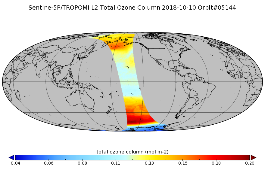
Sentinel-5P TROPOMI Total Ozone Column 1-Orbit L2 7km x 3.5km V1 (S5P_L2__O3_TOT) at GES DISC
Starting from August 6th in 2019, Sentinel-5P TROPOMI along-track high spatial resolution (~5.5km at nadir) has been implemented. Starting from July 13th in 2020, five... -
MLS/Aura Near-Real-Time L2 Sulfur Dioxide (SO2) Mixing Ratio V005 (ML2SO2_NRT) at GES DISC
ML2SO2_NRT is the EOS Aura Microwave Limb Sounder (MLS) Near-Real-Time (NRT) product for sulfur dioxide (SO2). This product contains SO2 profiles derived from the 190 and 240... -
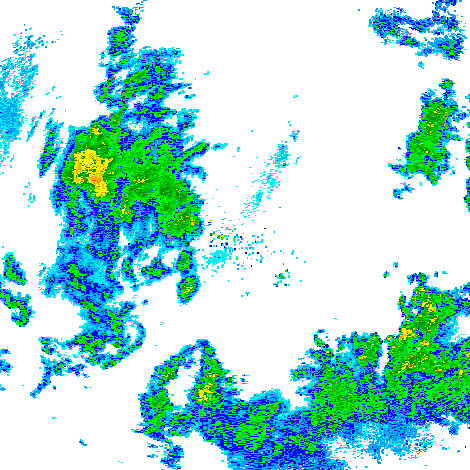
GPM GROUND VALIDATION NEXRAD LEVEL II KDVN IFLOODS V1
The GPM Ground Validation Next Generation Weather Radar (NEXRAD) Level II IFloodS datasets were collected from four sites (see Table 1) from March 29, 2013 to June 18, 2013 for... -
Natural Resource Protection and Child Health Indicators, 2022 Release
The Natural Resource Protection and Child Health Indicators, 2022 Release, is produced in support of the U.S. Millennium Challenge Corporation (MCC) as selection criteria for... -
LANDSAT SURFACE REFLECTANCE -L7 ETM+
Landsat satellite data have been produced, archived, and distributed by the U.S. Geological Survey (USGS) since 1972. Users rely on these data for historical study of land... -
TES/Aura L2 Ammonia Lite Nadir V006
Atmospheric vertical profile estimates and associated errors including the mapping matrix to relate the reduced-size retrieval vectors, covariances, and averaging kernels back... -
Daily 8-Hour Maximum and Annual O3 Concentrations for the Contiguous United States, 1-km Grids, v1 (2000 - 2016)
The Daily 8-Hour Maximum and Annual O3 Concentrations for the Contiguous United States, 1-km Grids, v1 (2000 - 2016) data set contains estimates of ozone concentrations at a... -
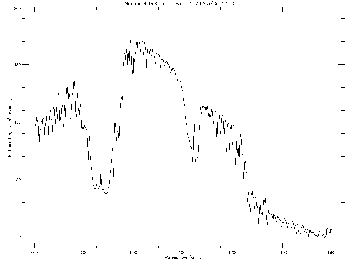
IRIS/Nimbus-4 Level 1 Radiance Data V001 (IRISN4RAD) at GES DISC
The Nimbus-4 Infrared Interferometer Spectrometer (IRIS) Level 1 Radiance Data contain thermal emissions of the Earth's atmosphere at wave numbers between 400 and 1600...

Official websites use .gov
A
.gov website belongs to an official government
organization in the United States.
Secure .gov websites use HTTPS
A
lock (
) or https:// means you’ve safely connected to
the .gov website. Share sensitive information only on official,
secure websites.