-
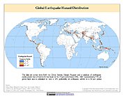
Global Earthquake Hazard Frequency and Distribution
The Global Earthquake Hazard Frequency and Distribution is a 2.5 minute grid utilizing Advanced National Seismic System (ANSS) Earthquake Catalog data of actual earthquake... -
Advanced Spaceborne Thermal Emission and Reflection Radiometer (ASTER) NGDA
This dataset represents multiple products archived at the Land Processes DAAC for ASTER (Advanced Spaceborne Thermal Emission and Reflection Radiometer) aboard the Terra... -
1:100,000-scale Digital Line Graphs (DLG) from the U.S. Geological Survey
Digital line graph (DLG) data are digital representations of cartographic information. DLG's of map features are converted to digital form from maps and related sources.... -
Aqua MODIS Level-3 Global Mapped 11µm Daytime Sea Surface Temperature (SST) Data, version R2019.0 NGDA
MODIS (or Moderate-Resolution Imaging Spectroradiometer) is a key instrument aboard the Terra (EOS AM) and Aqua (EOS PM) satellites. Terra's orbit around the Earth is timed so... -
Daily and Annual PM2.5 Concentrations for the Contiguous United States, 1-km Grids, v1 (2000 - 2016)
The Daily and Annual PM2.5 Concentrations for the Contiguous United States, 1-km Grids, v1 (2000 - 2016) data set includes predictions of PM2.5 concentrations in grid cells at a... -
GLAS/ICESat L2 Sea Ice Altimetry Data (HDF5) V034
GLAH06 is used in conjunction with GLAH05 to create the Level-2 altimetry products. Level-2 altimetry data provide surface elevations for ice sheets (GLAH12), sea ice (GLAH13),... -
VIIRS Plus DMSP Change in Lights (VIIRS+DMSP dLIGHT)
The VIIRS Plus DMSP Change in Lights (VIIRS+DMSP dLIGHT) data set fuses nighttime lights imagery from the U.S. Air Force Defense Meteorological Satellite Program (DMSP)... -
IceBridge BedMachine Greenland V005
This data set contains a bed topography/bathymetry map of Greenland based on mass conservation, multi-beam data, and other techniques. It also includes surface elevation and ice... -
MEaSUREs ITS_LIVE Regional Glacier and Ice Sheet Surface Velocities V001
This data set from the Inter-Mission Time Series of Land Ice Velocity and Elevation (ITS_LIVE) project, part of NASA's Making Earth System Data Records for Use in Research... -
USGS Global Fiducials
The Global Fiducials Library (GFL) is a long-term archive of images from U.S. National Imagery Systems which represents a long-term periodic record for selected scientifically... -
OMI/Aura Ozone (O3) Total Column Daily L3 Global 0.25deg Lat/Lon Grid NRT
The OMI science team produces this Level-3 Aura/OMI Global TOMS-Like Total Column Ozone gridded product OMTO3e (0.25deg Lat/Lon grids). The OMTO3e product selects the best pixel... -
Moderate Resolution Imaging Spectroradiometer (MODIS) - Terra NGDA
This dataset represents multiple products archived at the multiple archive centers for the MODIS (Moderate Resolution Imaging Spectroradiometer) instrument aboard the Terra... -
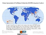
HANPP Collection: Global Patterns in Human Appropriation of Net Primary Productivity (HANPP)
The HANPP Collection: Global Patterns in Human Appropriation of Net Primary Productivity (HANPP) represents a digital map of human appropriation of net primary productivity... -
Lidar In-Space Technology Experiment (LITE) L1
LITE_L1 data are LIDAR Vertical profile data along the orbital flight path of STS-64.Lidar In-Space Technology Experiment (LITE) used a three-wavelength (355 nm, 532 nm and 1064... -
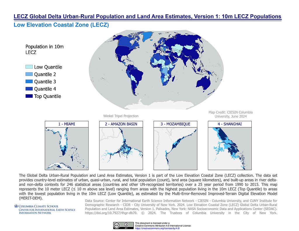
Low Elevation Coastal Zone (LECZ) Global Delta Urban-Rural Population and Land Area Estimates, Version 1
The Low Elevation Coastal Zone (LECZ) Global Delta Urban-Rural Population and Land Area Estimates, Version 1 data set provides country-level estimates of urban, quasi-urban,... -
SnowEx17 SnowSAR Raw FMCW Waveforms V001
This data set, part of the SnowEx 2017 campaign, contains raw data captured from the SnowSAR instrument. The processed SnowSAR data are also archived at NSIDC (DOI:...

Official websites use .gov
A
.gov website belongs to an official government
organization in the United States.
Secure .gov websites use HTTPS
A
lock (
) or https:// means you’ve safely connected to
the .gov website. Share sensitive information only on official,
secure websites.