-
Gridded Population of the World, Version 3 (GPWv3): Population Density Grid, Future Estimates
The Gridded Population of the World, Version 3 (GPWv3): Population Density Grid, Future EstimatesFuture Estimates consists of estimates of human population for the years 2005,... -
MSS 1-5 (1972-1987)
The USGS Earth Resources Observation and Science (EROS) Center archive holds data collected by the Landsat suite of satellites, beginning with Landsat 1 in 1972. All Landsat... -
NASA Landsat Data Collection
The NASA Landsat Data Collection (NLDC) is a compilation of Landsat multispectral scanner (MSS) scenes and Landsat thematic mapper (TM) scenes. This compilation of scenes... -
SWOT Level 2 River Single-Pass Vector Data Product, Version 2.0
The SWOT Level 2 River Single-Pass Vector Data Product from the Surface Water Ocean Topography (SWOT) mission provides water surface elevation, slope, width, and discharge... -
VIIRS/NPP Thermal Anomalies and Fire Daily L3 Global 1km SIN Grid V001
The daily NASA/NOAA Suomi National Polar-orbiting Partnership (Suomi NPP) Visible Infrared Imaging Radiometer Suite (VIIRS) Thermal Anomalies/Fire (VNP14A1) Version 1 data... -
Ground-Based Doppler Orbitography by Radiopositioning Integrated on Satellite (DORIS) Satellite Orbit Product from NASA CDDIS
Doppler Orbitography by Radiopositioning Integrated on Satellite (DORIS) Satellite Orbit Product from the NASA Crustal Dynamics Data Information System (CDDIS). DORIS is a dual-... -
Latin America and the Caribbean Population Time Series
The Latin America and the Caribbean Population Time Series data set provides total population estimates using spatially consistent and comparable Units for Latin American... -
MLS/Aura Near-Real-Time L2 Water Vapor (H2O) Mixing Ratio V005 (ML2H2O_NRT) at GES DISC
ML2H2O_NRT is the EOS Aura Microwave Limb Sounder (MLS) Near-Real-Time (NRT) product for water vapor (H2O). This product contains H2O profiles derived from the 190 GHz region.... -
Central American Vegetation/Land Cover Classification and Conservation Status
The Central American Vegetation/Land Cover Classification and Conservation Status consists of GIS coverages of vegetation classes (forests, woodlands, savannas, shrubs,... -
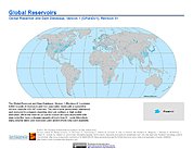
Global Reservoir and Dam Database, Version 1 (GRanDv1): Reservoirs, Revision 01
Global Reservoir and Dam Database, Version 1, Revision 01 (v1.01) contains 6,862 records of reservoirs and their associated dams with a cumulative storage capacity of 6,197... -
Global Fertilizer and Manure, Version 1: Nitrogen in Manure Production
The Nitrogen in Manure Production data set of the Global Fertilizer and Manure, Version 1 Data Collection represents the amount of nitrogen manure produced and present on the... -
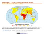
SDG Indicator 7.1.1: Access to Electricity, 2023 Release
The SDG Indicator 7.1.1: Access to Electricity, 2023 Release data set, part of the Sustainable Development Goal Indicators (SDGI) collection, measures the proportion of the... -
IPCC Fourth Assessment Report (AR4) Observed Climate Change Impacts Database
The Intergovernmental Panel on Climate Change (IPCC) Fourth Assessment Report (AR4) Observed Climate Change Impacts Database contains observed responses to climate change across... -
High Mountain Asia 8-meter DEM Mosaics Derived from Optical Imagery V001
This data set contains 8-meter Digital Elevation Model (DEM) mosaics of high mountain Asia glacier and snow regions generated from very-high-resolution (VHR) commercial... -
VIIRS/NPP Snow Cover 6-Min L2 Swath 375m V002
This data set reports snow cover using radiance data acquired by the Visible Infrared Imager Radiometer Suite (VIIRS) on board the Suomi National Polar-orbiting Partnership... -
Moderate Resolution Imaging Spectroradiometer (MODIS) - Aqua NGDA
This dataset represents multiple products archived at the multiple archive centers for the MODIS (Moderate Resolution Imaging Spectroradiometer) instrument aboard the Aqua...

Official websites use .gov
A
.gov website belongs to an official government
organization in the United States.
Secure .gov websites use HTTPS
A
lock (
) or https:// means you’ve safely connected to
the .gov website. Share sensitive information only on official,
secure websites.