-
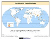
Global Landslide Hazard Distribution
The Global Landslide Hazard Distribution is a 2.5 minute grid of global landslide and snow avalanche hazards based upon work of the Norwegian Geotechnical Institute (NGI). The... -
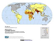
Poverty Mapping Project: Global Subnational Prevalence of Child Malnutrition
The Poverty Mapping Project: Global Subnational Prevalence of Child Malnutrition data set consists of estimates of the percentage of children with weight-for-age z-scores that... -
Global Reservoir and Dam Database, Version 1 (GRanDv1): Dams, Revision 01
The Global Reservoir and Dam Database, Version 1, Revision 01 (v1.01) contains 6,862 records of reservoirs and their associated dams with a cumulative storage capacity of 6,197... -
Shuttle Radar Topography Mission (SRTM) Images
Culminating more than four years of processing data, NASA and the National Geospatial-Intelligence Agency (NGA) have completed Earth's most extensive global topographic map. The... -
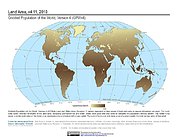
Gridded Population of the World, Version 4 (GPWv4): Land and Water Area, Revision 11
The Gridded Population of the World, Version 4 (GPWv4): Land and Water Area, Revision 11 consists of two rasters that measure surface areas of land and water in square... -
SWOT Level 2 KaRIn Low Rate Sea Surface Height Data Product - WindWave, Version 2.0
The SWOT Level 2 KaRIn Low Rate Sea Surface Height Windwave Data Product from the Surface Water Ocean Topography (SWOT) mission provides global sea surface height and... -
EO-1 Hyperion
The Earth-Observing One (EO-1) satellite was decommissioned March 2017. The EO-1 satellite was launched on November 21, 2000 with the NASA's New Millennium Program (NMP). The... -
TRMM Precipitation Radar Rain Characteristics L2 1.5 hours V7 (TRMM_2A23) at GES DISC
The new version of these data is in GPM-like format (consistent with the GPM Dual-frequency Radar data format), and can be found under the name GPM_2APR. The TRMM Precipitation... -
SWOT Level 2 Water Mask Raster Image Data Product, Version 2.0
The SWOT Level 2 Water Mask Raster Image Data Product from the Surface Water Ocean Topography (SWOT) mission provides global surface water elevation and inundation extent... -
General Archive Information from NASA CDDIS
The Crustal Dynamics Data Information System (CDDIS) supports the space geodesy and geodynamics community through NASA's Space Geodesy Project as well as NASA's Earth Science... -
MEaSUREs Global Record of Daily Landscape Freeze/Thaw Status V005
This data set, part of the NASA Making Earth System Data Records for Use in Research Environments (MEaSUREs) program, contains a global record of the daily freeze/thaw status of...

Official websites use .gov
A
.gov website belongs to an official government
organization in the United States.
Secure .gov websites use HTTPS
A
lock (
) or https:// means you’ve safely connected to
the .gov website. Share sensitive information only on official,
secure websites.