-
TES/Aura L2 Methanol Lite Nadir V006
Atmospheric vertical profile estimates and associated errors including the mapping matrix to relate the reduced-size retrieval vectors, covariances, and averaging kernels back... -
AMSR-E/Aqua Monthly L3 5x5 deg Rainfall Accumulations V002
This Level-3 rainfall accumulation product (AE_RnGd) consists of two grids of 28 rows by 72 columns of monthly averaged rainfall accumulation over ocean and land. Both grids are... -
SMAPVEX19-22 Millbrook UAVSAR Mosaics V001
This data set consists of mosaicked Uninhabited Aerial Vehicle Synthetic Aperture Radar (UAVSAR) images corrected for terrain-flattened gamma. Data image files at three... -
Nimbus-7 Narrow Field of View (NFOV) Maximum Likelihood Cloud Estimation (MLCE) Data in Native Format
NIMBUS7_NFOV_MLCE data are Nimbus 7 Narrow Field of View (NFOV) Maximum Likelihood Cloud Estimation (MLCE) Data in Native Format.The NIMBUS7_NFOV_MLCE data set uses the Nimbus-7... -
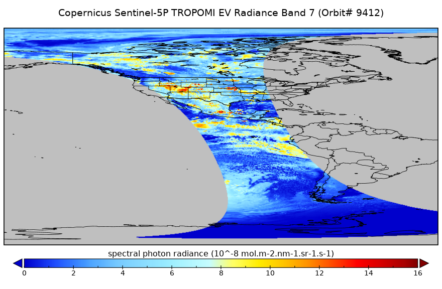
Sentinel-5P TROPOMI Radiance product band 7 (SWIR detector) L1B 5.5km x 7km V2 (S5P_L1B_RA_BD7_HiR) at GES DISC
Starting from August 6th in 2019, Sentinel-5P TROPOMI along-track high spatial resolution (~5.5km at nadir) has been implemented. For data before August 6th of 2019, please... -
SMAP_L1A_RADAR_RECEIVE_ONLY_QA_V001
SMAP Level 1A Radar Receive Only Data Quality Information Version 1 -
Sentinel-5P TROPOMI Aerosol Layer Height 1-Orbit L2 7km x 3.5km V1 (S5P_L2__AER_LH) at GES DISC
Starting from August 6th in 2019, Sentinel-5P TROPOMI along-track high spatial resolution (~5.5km at nadir) has been implemented. For data after August 6th of 2019, please check... -
Turbulent Air Motion Measurement System (TAMMS) IMPACTS V1
The Turbulent Air Motion Measurement System (TAMMS) IMPACTS dataset consists of wind speed, wind direction, and cross wind speed measurements from the TAMMS instrument onboard... -
SWOT Level 2 Lake Single-Pass Vector Data Product, Version 2.0
The SWOT Level 2 Lake Single-Pass Vector Data Product from the Surface Water Ocean Topography (SWOT) mission provides water surface elevation, area, storage change derived from... -
SWOT Level 2 Radiometer Brightness Temperatures and Troposphere Operational Data Product, Version 2.0
The SWOT Level 2 Radiometer Brightness Temperatures and Troposphere Operational Geophysical Data Record (OGDR) Version 1.0 dataset produced by the Surface Water and Ocean... -
NOAA-21 VIIRS Regional Ocean Color (OC) - Near Real Time (NRT) Data, version R2022.0
The Ocean Biology DAAC produces near real-time (quicklook) products using the best-available combination of ancillary data from meteorological and ozone data. As such, the... -
Gridded Population of the World, Version 4 (GPWv4): Administrative Unit Center Points with Population Estimates, Revision 11
The Gridded Population of the World, Version 4 (GPWv4): Administrative Unit Center Points with Population Estimates, Revision 11 consists of UN WPP-adjusted population estimates... -
SnowEx20 Cameron Pass Ground Penetrating Radar Raw V001
This data set contains the raw files from ground-penetrating radar surveys conducted at Cameron Pass, Colorado during the SnowEx20 campaign. Data were collected between 18... -
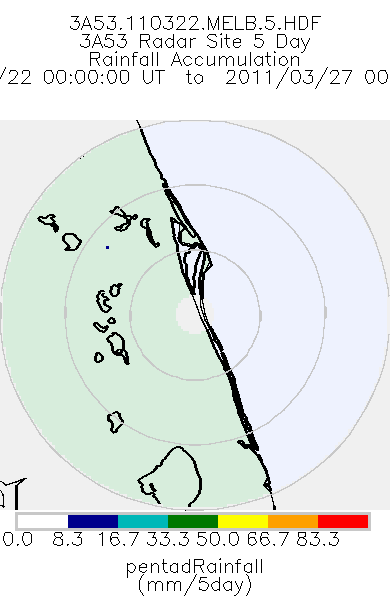
TRMM Ground Validation Radar Site Rain Totals Map L3 5 days 2 km V7 (TRMM_3A53) at GES DISC
This is the 5-day accumulation of the 2A53 product, 'Radar Site Rain Map', which originally is an instantaneous surface rain rate map in Cartesian coordinates with a 2 km... -
ACES Aircraft and Mechanical Data V1
The ACES Aircraft and Mechanical Data consist of aircraft (e.g. pitch, roll, yaw) and mechanical (e.g. aircraft engine speed, tail commands, fuel levels) data recorded by the... -
USGS Global Forest Observations Initiative (GFOI) Colombia
The Global Forest Observations Initiative (GFOI) is an initiative of the inter-governmental Group on Earth Observations (GEO) that aims to: foster the sustained availability of...

Official websites use .gov
A
.gov website belongs to an official government
organization in the United States.
Secure .gov websites use HTTPS
A
lock (
) or https:// means you’ve safely connected to
the .gov website. Share sensitive information only on official,
secure websites.