-
Nimbus Temperature-Humidity Infrared Radiometer 6.7 µm Water Vapor Remapped Digital Data Daily L3, GeoTIFF V001
This data set (NmTHIR67-3G) consists of daily, global composites of radiative temperatures obtained in the 6.7 µm water vapor window (6.5 µm - 7.0 µm) by the Temperature-... -
TES/Aura L2 Ozone Nadir V007
TL2O3N_7 is the Tropospheric Emission Spectrometer (TES)/Aura Level 2 Ozone Nadir Version 7 data product. It consists of information for one molecular species for an entire... -
SMAPVEX15 Probe-Based In Situ Soil Moisture Data V001
This data set contains in situ gravimetric and volumetric soil moisture, bulk density, and soil temperature measurements collected for the Soil Moisture Active Passive... -
Gridded Population of the World, Version 4 (GPWv4): National Identifier Grid, Revision 11
The Gridded Population of the World, Version 4 (GPWv4): National Identifier Grid, Revision 11 is a raster representation of nation-states in GPWv4 for use in aggregating... -
TROPICS06 L2B Neural-network Atmospheric Vertical Temperature & Moisture Profiles V1.0
The "Time-Resolved Observations of Precipitation structure and storm Intensity with a Constellation of Smallsats" (TROPICS) mission has a goal of providing nearly all-weather... -
Suomi-NPP VIIRS Global Mapped Particulate Inorganic Carbon (PIC) - Near Real Time (NRT) Data, version R2022.0
The Ocean Biology DAAC produces near real-time (quicklook) products using the best-available combination of ancillary data from meteorological and ozone data. As such, the... -
SMAPVEX12 PALS Backscatter Data V001
This data set contains backscatter data obtained by the Passive Active L-band System (PALS) microwave aircraft instrument as part of the Soil Moisture Active Passive Validation... -
VIIRS/JPSS1 Sea Ice Cover 6-Min L2 Swath 375m V002
This data set reports the location of sea ice cover derived from radiance data acquired by the Visible Infrared Imager Radiometer Suite (VIIRS) onboard the Joint Polar Satellite... -
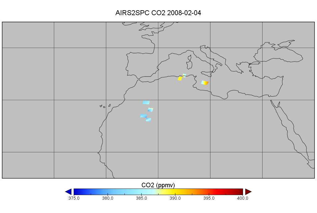
AIRS/Aqua L2 CO2 support retrieval (AIRS-only) V005 (AIRS2SPC) at GES DISC
The Atmospheric Infrared Sounder (AIRS) is a grating spectrometer (R = 1200) aboard the second Earth Observing System (EOS) polar-orbiting platform, EOS Aqua. In combination... -
Sentinel-3B OLCI Level-2 Earth-observation Reduced-Resolution (ERR) Inherent Optical Properties (IOP), Near Real-time (NRT) Data, version R2022.0
The Ocean Biology DAAC produces near real-time (quicklook) products using the best-available combination of ancillary data from meteorological and ozone data. As such, the... -
Polar Ozone and Aerosol Measurement II Version 6
POAM2_VER6 data are Polar Ozone and Aerosol Measurement II Version 6.0 data. The Polar Ozone and Aerosol Measurement (POAM) II instrument measures the vertical distribution of... -
TES/Aura L2 Carbonyl Sulfide Nadir Special Observation V007
TL2OCSNS_7 is the Tropospheric Emission Spectrometer (TES)/Aura Level 2 Atmospheric Temperatures Limb Version 7 data product. TES was an instrument aboard NASA's Aura satellite... -
NOAA-20 VIIRS Global Mapped Remote-Sensing Reflectance (RRS) - NRT Data, version R2022.0
The Ocean Biology DAAC produces near real-time (quicklook) products using the best-available combination of ancillary data from meteorological and ozone data. As such, the... -
Terra MODIS Level-3 Global Mapped 11µm Nighttime Sea Surface Temperature (NSST) Data, version R2019.0 NGDA
MODIS (or Moderate-Resolution Imaging Spectroradiometer) is a key instrument aboard the Terra (EOS AM) and Aqua (EOS PM) satellites. Terra's orbit around the Earth is timed so... -
USGS Global Forest Observations Initiative (GFOI) Thailand
The Global Forest Observations Initiative (GFOI) is an initiative of the inter-governmental Group on Earth Observations (GEO) that aims to: foster the sustained availability of...

Official websites use .gov
A
.gov website belongs to an official government
organization in the United States.
Secure .gov websites use HTTPS
A
lock (
) or https:// means you’ve safely connected to
the .gov website. Share sensitive information only on official,
secure websites.