-
U.S. Social Vulnerability Index Grids, Revision 01
The U.S. Social Vulnerability Index Grids, Revision 01 data set contains gridded layers for the overall Centers for Disease Control and Prevention (CDC) Social Vulnerability... -
Polar Ozone and Aerosol Measurement III
POAM3 data are Polar Ozone and Aerosol Measurement III Version 3.0. The Polar Ozone and Aerosol Measurement (POAM) III instrument measures the vertical distribution of... -
Population Exposure Estimates in Proximity to Nuclear Power Plants, Locations
The Population Exposure Estimates in Proximity to Nuclear Power Plants, Locations data set combines information from a global data set developed by Declan Butler of Nature News... -
NOAA-21 VIIRS Global Binned Normalized Difference Vegetation Index Land Reflectance Data, version R2022.0
The Visible and Infrared Imager/Radiometer Suite (VIIRS) is a multi-disciplinary instrument that is being flown on the Joint Polar Satellite System (JPSS) series of spacecraft,... -
MLS/Aura Near-Real-Time L2 Temperature V005 (ML2T_NRT) at GES DISC
ML2T_NRT is the EOS Aura Microwave Limb Sounder (MLS) Near-Real-Time (NRT) product for temperature. This product contains temperature profiles derived from the 118 GHz region.... -
Sentinel-1 Interferograms - Connected Components (BETA)
Sentinel-1 SLC interferometric products generated by JPL using ISCE v2.0.0, delivered by ASF -
AIRS/Aqua L1B Near Real Time (NRT) AMSU (A1/A2) geolocated and calibrated brightness temperatures V005 (AIRABRAD_NRT) at GES DISC
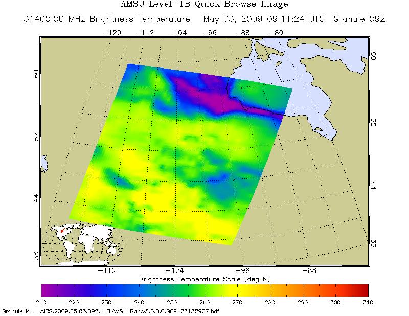
The AMSU-A Level 1B Near Real Time (NRT) product (AIRABRAD_NRT_005) differs from the routine product (AIRABRAD_005) in 2 ways to meet the three hour latency requirements of the... -
Millennium Ecosystem Assessment: MA Ecosystems
The Millennium Ecosystem Assessment: MA Ecosystems provides data and information on the extent and classification of ecosystems circa 2000, including coastal, cultivated, forest... -
Earth Radiation area average time series through Wide-field-of-view nonscanner abroad Earth Radiation Budget Satellite Edition 4.1
ERBE_S10N_WFOV_SF_ERBS_AreaAverageTimeSeries is the Earth Radiation Budget Experiment (ERBE) through Earth Radiation Budget Satellite (ERBS) area average time series through... -
SnowEx20 Boise State University Terrestrial Laser Scanner (TLS) Point Cloud V001
This data set contains terrestrial laser scanner (TLS) point cloud data collected as part of the 2020 SnowEx campaign in Grand Mesa, Colorado. Data were collected under both... -
Sentinel-3A OLCI Level-3B Global Binned Earth-observation Reduced-Resolution (ERR) Inherent Optical Properties (IOP), Near Real-time (NRT) Data, version R2022.0
The Ocean Biology DAAC produces near real-time (quicklook) products using the best-available combination of ancillary data from meteorological and ozone data. As such, the... -
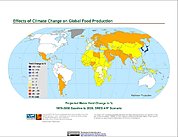
Effects of Climate Change on Global Food Production from SRES Emissions and Socioeconomic Scenarios
The Effects of Climate Change on Global Food Production from SRES Emissions and Socioeconomic Scenarios is an update to a major crop modeling study by the NASA Goddard Institute... -
MEaSUREs Arctic Sea Ice Characterization Daily 25km EASE-Grid 2.0 V001
This data set, part of the NASA Making Earth System Data Records for Use in Research Environments (MEaSUREs) program, provides a daily record of Arctic sea ice characteristics... -
GPM Ground Validation Daily Precipitation OLYMPEX V1
The GPM Ground Validation Daily Precipitation Olympic Mountain Experiment (OLYMPEX) dataset consists of a single netCDF-4 data file containing estimates of daily precipitation,... -
Global Sentinel-1 Burst ID Map
Sentinel-1 performs systematic acquisition of bursts in both IW and EW modes. The bursts overlap almost perfectly between different passes and are always located at the same... -
Terra MODIS Level-3 Global Mapped 4µm Day/Night Sea Surface Temperature (SST4) - Near Real-time (NRT) Data, version R2019.0 NGDA
The Ocean Biology DAAC produces near real-time (quicklook) products using the best-available combination of ancillary data from meteorological and ozone data. As such, the...

Official websites use .gov
A
.gov website belongs to an official government
organization in the United States.
Secure .gov websites use HTTPS
A
lock (
) or https:// means you’ve safely connected to
the .gov website. Share sensitive information only on official,
secure websites.