

SHIFT: AVIRIS-NG L2A Unrectified Surface Reflectance Version 1
Access & Use Information
Public: This dataset is intended for public access and use.
License:
See this page for license information.
Downloads & Resources
-
Web ResourceBIN
-
Web PageHTML
-
JPEG Image FileJPEG
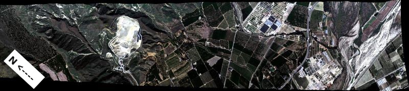
SHIFT_AVIRISNG_L2A_refl_Fig1.jpg
-
PDF FilePDF
SHIFT_AVIRISNG_L2A_refl.pdf
-
Original MetadataISO
The metadata's original source.
Dates
| Metadata Created Date | April 11, 2025 |
|---|---|
| Metadata Updated Date | April 9, 2026 |
Metadata Source
- Data.json Data.json Metadata
Harvested from NASA Data.json
Additional Metadata
| Resource Type | Dataset |
|---|---|
| Metadata Created Date | April 11, 2025 |
| Metadata Updated Date | April 9, 2026 |
| Publisher | ORNL_DAAC |
| Maintainer | |
| Identifier | 10.3334/ORNLDAAC/2376 |
| Data Last Modified | 2026-04-06 |
| Category | Earth Science |
| Public Access Level | public |
| Bureau Code | 026:00 |
| Metadata Context | https://project-open-data.cio.gov/v1.1/schema/catalog.jsonld |
| Schema Version | https://project-open-data.cio.gov/v1.1/schema |
| Catalog Describedby | https://project-open-data.cio.gov/v1.1/schema/catalog.json |
| Harvest Object Id | f5cc3fee-6e0a-4b12-b0f1-a5a80a00093e |
| Harvest Source Id | 58f92550-7a01-4f00-b1b2-8dc953bd598f |
| Harvest Source Title | NASA Data.json |
| License | https://www.usa.gov/government-works |
| Old Spatial | {"WestBoundingCoordinate":-120.643,"NorthBoundingCoordinate":34.8994,"EastBoundingCoordinate":-117.847,"SouthBoundingCoordinate":33.8561},"CARTESIAN" |
| Program Code | 026:000 |
| Source Datajson Identifier | True |
| Source Hash | 65a8ef1b44e7c713e1e40adc09490b749e808bc03e16e5cff9b371ed41a9059d |
| Source Schema Version | 1.1 |
| Spatial | |
| Temporal | 2022-02-24/2022-05-29 |
Didn't find what you're looking for? Suggest a dataset here.