U.S. flag

An official website of the United States government

Official websites use .gov
A .gov website belongs to an official government organization in the United States.

Secure .gov websites use HTTPS
A lock ( ) or https:// means you’ve safely connected to the .gov website. Share sensitive information only on official, secure websites.

Skip to content

Try the next-generation Data Catalog at catalog-beta.data.gov and help shape it with your feedback.

RapidScat Level 2B Ocean Wind Vectors in 12.5km Slice Composites Version 1.1

Metadata Updated: April 9, 2026

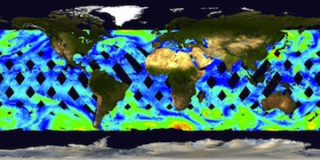
This dataset contains the RapidScat Level 2B 12.5km Version 1.1 science-quality ocean surface wind vectors. The Level 2B wind vectors are binned on a 12.5 km Wind Vector Cell (WVC) grid and processed using the Level 2A Sigma-0 dataset. RapidScat is a Ku-band dual beam circular rotating scatterometer retaining much of the same hardware and functionality of QuikSCAT, with exception of the antenna sub-system and digital interface to the International Space Station (ISS) Columbus module, which is where RapidScat is mounted. The NASA mission is officially referred to as ISS-RapidScat. Unlike QuikSCAT, ISS-RapidScat is not in sun-synchronous orbit, and flies at roughly half the altitude with a low inclination angle that restricts data coverage to the tropics and mid-latitude regions; the extent of latitudinal coverage stretches from approximately 61 degrees North to 61 degrees South. Furthermore, there is no consistent local time of day retrieval. This dataset is provided in a netCDF-3 file format that follows the netCDF-4 classic model (i.e., generated by the netCDF-4 API) and made available via FTP and OPeNDAP. For data access, please click on the "Data Access" tab above. This Version 1.1 dataset differs from the previous Version 1 dataset as follows: 1) A new neural network approach for high wind speeds provided rain corrections for the "retrieve_wind_speed" variable for wind speeds in excess of 15 m/s. 2) The data variables containing the number of measurements of each type for each wind vector cell have been corrected; these variables include "number_in_aft", "number_in_fore", "number_out_aft", and "number_out_fore". 3) The "wind_obj" data variable has been corrected to include the proper data for the conditional probability for the objective DIRTH function values. It is advised for users to avoid using the "wind_obj" variable in this dataset since it is minimally applicable and meant primarily for quality assurance; for users who wish to access the objective function values for each ambiguity, it is suggested to use only the "ambiguity_obj" variable. The "wind_obj" variable contains DIRTH probabilities (which are derived form the "ambiguity_obj" objective function values) in the range of 0 to 1 indicating the conditional probability that the true direction is within + or - 2.5 degrees of the retrieved wind direction given the observed backscatter measurements in the cell. If you have any questions, please contact podaac@podaac.jpl.nasa.gov

Access & Use Information

Public: This dataset is intended for public access and use. License: See this page for license information.

Downloads & Resources

Dates

Metadata Created Date April 11, 2025
Metadata Updated Date April 9, 2026

Metadata Source

Harvested from NASA Data.json

Additional Metadata

Resource Type Dataset
Metadata Created Date April 11, 2025
Metadata Updated Date April 9, 2026
Publisher ISS-RapidScat;NASA/JPL/PODAAC
Maintainer
Identifier 10.5067/RSX12-L2B11
Data Last Modified 2026-04-06
Category Earth Science
Public Access Level public
Bureau Code 026:00
Metadata Context https://project-open-data.cio.gov/v1.1/schema/catalog.jsonld
Schema Version https://project-open-data.cio.gov/v1.1/schema
Catalog Describedby https://project-open-data.cio.gov/v1.1/schema/catalog.json
Harvest Object Id 00ebc9fb-9ce0-45db-9fa9-b5a1236e92bb
Harvest Source Id 58f92550-7a01-4f00-b1b2-8dc953bd598f
Harvest Source Title NASA Data.json
License https://www.usa.gov/government-works
Old Spatial "CARTESIAN",{"WestBoundingCoordinate":-180,"SouthBoundingCoordinate":-61,"EastBoundingCoordinate":180,"NorthBoundingCoordinate":61}
Program Code 026:000
Source Datajson Identifier True
Source Hash e749f00ad9acbeaa49209036a0bb0dd7608eef25b929ce0fb9be907442e3bf40
Source Schema Version 1.1
Spatial
Temporal 2014-10-03/2016-03-10

Didn't find what you're looking for? Suggest a dataset here.