


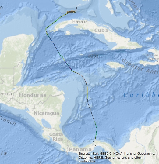
Okeanos Explorer (EX1710): Canal Transit and Gulf of Mexico Mapping (Mapping)
Access & Use Information
License: No license information was provided. If this work was prepared by an officer or employee of the United States government as part of that person's official duties it is considered a U.S. Government Work.
Downloads & Resources
-
OER Digital AtlasHTML
mapsOE.htm
Dates
| Metadata Date | November 7, 2023 |
|---|---|
| Metadata Created Date | October 19, 2024 |
| Metadata Updated Date | October 19, 2024 |
| Reference Date(s) | (publication) |
| Frequency Of Update |
Metadata Source
- ISO-19139 ISO-19139 Metadata
Harvested from NCDDC OER
Graphic Preview
Additional Metadata
| Resource Type | Collectionsession |
|---|---|
| Metadata Date | November 7, 2023 |
| Metadata Created Date | October 19, 2024 |
| Metadata Updated Date | October 19, 2024 |
| Reference Date(s) | (publication) |
| Responsible Party | UNH CCOM/JHC (Point of Contact, Principal Investigator) |
| Contact Email | |
| Guid | gov.noaa.ncei.oer:EX1710 |
| Access Constraints | Data use shall be credited to NOAA Office of Ocean Exploration and Research. No data access constraints, unless data are protected under the National Historic Preservation Act of 1966. |
| Bbox East Long | -80 |
| Bbox North Lat | 25 |
| Bbox South Lat | 8 |
| Bbox West Long | -85 |
| Coupled Resource | |
| Frequency Of Update | |
| Graphic Preview File | https://www.ncei.noaa.gov/waf/OER-Media/ex1710/ex1710-BrowseGraphic.jpg |
| Harvest Object Id | f005cf0b-0ee4-4cfd-aded-3eedbd3c9b00 |
| Harvest Source Id | 0eb61eac-016f-4f95-a6c3-2974339749bb |
| Harvest Source Title | NCDDC OER |
| Licence | |
| Lineage | |
| Metadata Language | eng; USA |
| Metadata Type | geospatial |
| Old Spatial | {"type": "Polygon", "coordinates": [[[-85.0, 8.0], [-80.0, 8.0], [-80.0, 25.0], [-85.0, 25.0], [-85.0, 8.0]]]} |
| Progress | completed |
| Spatial Data Service Type | |
| Spatial Reference System | |
| Spatial Harvester | True |
| Temporal Extent Begin | 2017-11-15T00:00:00 |
| Temporal Extent End | 2017-11-22T00:00:00 |
Didn't find what you're looking for? Suggest a dataset here.