

Northern and Mid-Latitude Soil Database, Version 1, R1
Access & Use Information
Public: This dataset is intended for public access and use.
License:
See this page for license information.
Downloads & Resources
-
Web ResourceBIN
-
Web PageHTML
-
Zip FileZIP
Mid-latitude_soils_705.zip
-
PNG Image FilePNG
soil_logo_square.png
-
JPEG Image FileJPEG
northmid.jpg
-
Text FileTEXT
Mid-latitude_soils_readme.txt
-
PDF FilePDF
Mid-latitude_soils.pdf
-
JPEG Image FileJPEG
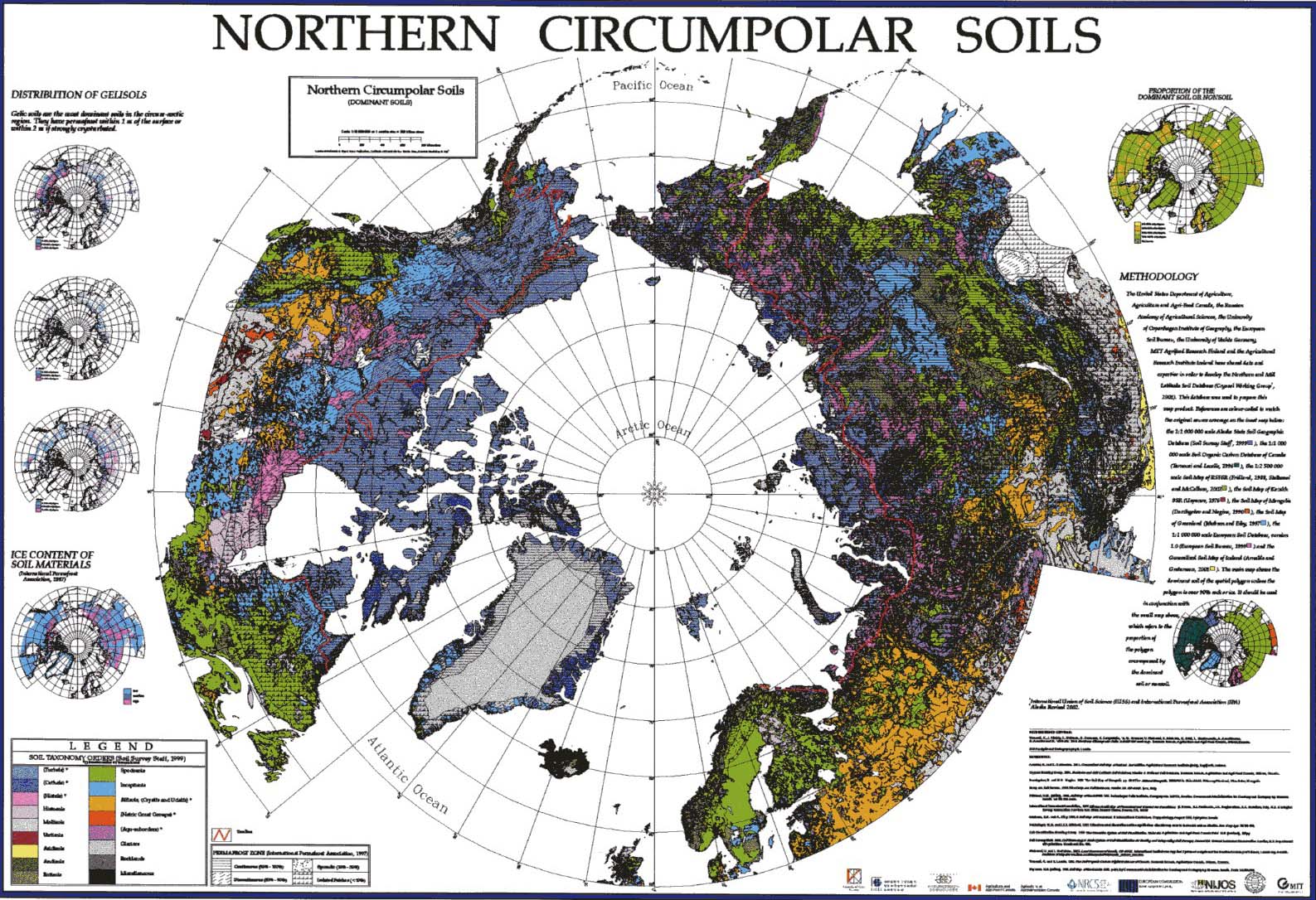
polar.jpg
-
Original MetadataISO
The metadata's original source.
Dates
| Metadata Created Date | April 11, 2025 |
|---|---|
| Metadata Updated Date | April 9, 2026 |
Metadata Source
- Data.json Data.json Metadata
Harvested from NASA Data.json
Additional Metadata
| Resource Type | Dataset |
|---|---|
| Metadata Created Date | April 11, 2025 |
| Metadata Updated Date | April 9, 2026 |
| Publisher | ORNL_DAAC |
| Maintainer | |
| Identifier | 10.3334/ORNLDAAC/705 |
| Data Last Modified | 2026-04-06 |
| Category | Earth Science |
| Category Tag 16E15F51 D96E 4051 9124 75665Abdc6Ff | "Energy Infrastructure" |
| Public Access Level | public |
| Bureau Code | 026:00 |
| Metadata Context | https://project-open-data.cio.gov/v1.1/schema/catalog.jsonld |
| Schema Version | https://project-open-data.cio.gov/v1.1/schema |
| Catalog Describedby | https://project-open-data.cio.gov/v1.1/schema/catalog.json |
| Harvest Object Id | b50ffa46-bbd5-4d76-8d24-bce8aa7bf91d |
| Harvest Source Id | 58f92550-7a01-4f00-b1b2-8dc953bd598f |
| Harvest Source Title | NASA Data.json |
| License | https://www.usa.gov/government-works |
| Old Spatial | {"WestBoundingCoordinate":-180.0,"NorthBoundingCoordinate":71.4,"EastBoundingCoordinate":-129.3,"SouthBoundingCoordinate":50.9},"CARTESIAN" |
| Program Code | 026:000 |
| Source Datajson Identifier | True |
| Source Hash | aeaa1f0e30fddd03d3aec196458ada3879352e2de99021784850394089dfb907 |
| Source Schema Version | 1.1 |
| Spatial | |
| Temporal | 2001-01-01/2001-12-31 |
Didn't find what you're looking for? Suggest a dataset here.