

Jason-3 GPS based orbit and SSHA OGDR
Access & Use Information
Public: This dataset is intended for public access and use.
License:
See this page for license information.
Downloads & Resources
-
Web ResourceBIN
-
PDF FilePDF
j3_prod_handbook_2020-09-21.pdf
-
Text FileTEXT
README_JASON3_GPSOGDR.txt
-
Web ResourceBIN
-
Web ResourceBIN
-
Web ResourceBIN
-
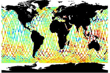
JPEG Image FileJPEG
JASON_3_L2_OST_OGDR_GPS.jpg
-
Original MetadataISO
The metadata's original source.
Dates
| Metadata Created Date | April 11, 2025 |
|---|---|
| Metadata Updated Date | April 10, 2026 |
Metadata Source
- Data.json Data.json Metadata
Harvested from NASA Data.json
Additional Metadata
| Resource Type | Dataset |
|---|---|
| Metadata Created Date | April 11, 2025 |
| Metadata Updated Date | April 10, 2026 |
| Publisher | NASA/JPL;NASA/JPL/PODAAC |
| Maintainer | |
| Identifier | 10.5067/J3L2G-OGDRF |
| Data Last Modified | 2026-04-06 |
| Category | Earth Science |
| Public Access Level | public |
| Bureau Code | 026:00 |
| Metadata Context | https://project-open-data.cio.gov/v1.1/schema/catalog.jsonld |
| Schema Version | https://project-open-data.cio.gov/v1.1/schema |
| Catalog Describedby | https://project-open-data.cio.gov/v1.1/schema/catalog.json |
| Harvest Object Id | 46c05bf8-f703-4744-a676-6d8f13ff2a46 |
| Harvest Source Id | 58f92550-7a01-4f00-b1b2-8dc953bd598f |
| Harvest Source Title | NASA Data.json |
| License | https://www.usa.gov/government-works |
| Old Spatial | "CARTESIAN",{"NorthBoundingCoordinate":66,"WestBoundingCoordinate":-180,"EastBoundingCoordinate":180,"SouthBoundingCoordinate":-66} |
| Program Code | 026:000 |
| Source Datajson Identifier | True |
| Source Hash | 2fbe3df3789290babf906410cec894c40aabdcdbc4c118976720bac6b71e33d9 |
| Source Schema Version | 1.1 |
| Spatial |
Didn't find what you're looking for? Suggest a dataset here.