

CYGNSS Level 2 Science Data Record Version 2.1
Access & Use Information
Downloads & Resources
-
Web ResourceBIN
-
Web ResourceBIN
-
Web ResourceBIN
148-0348-9_L2_v2.1_netCDF_Data_Dictionary.xlsx
-
Web ResourceBIN
-
PDF FilePDF
CYGNSS_Handbook_April2016.pdf
-
Web ResourceBIN
-
PDF FilePDF
148-0138_ATBD_L2_Wind_Speed_Retrieval_Rev5_Aug2018_release.pdf
-
PDF FilePDF
148-0139-L2-MSS-ATBD-R3.pdf
-
Web ResourceBIN
-
Web ResourceBIN
-
Web ResourceBIN
-
Web ResourceBIN
-
Web ResourceBIN
-
Web ResourceBIN
-
Web ResourceBIN
-
Web ResourceBIN
-
Text FileTEXT
Attitude_Table_FM_1.txt
-
Text FileTEXT
Attitude_Table_FM_2.txt
-
Text FileTEXT
Attitude_Table_FM_3.txt
-
Text FileTEXT
Attitude_Table_FM_4.txt
-
Text FileTEXT
Attitude_Table_FM_5.txt
-
Text FileTEXT
Attitude_Table_FM_6.txt
-
Text FileTEXT
Attitude_Table_FM_7.txt
-
Text FileTEXT
Attitude_Table_FM_8.txt
-
Web ResourceBIN
-
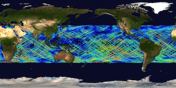
JPEG Image FileJPEG
CYGNSS_L2_V2.1.jpg
-
Original MetadataISO
The metadata's original source.
Dates
| Metadata Created Date | April 11, 2025 |
|---|---|
| Metadata Updated Date | April 10, 2026 |
Metadata Source
- Data.json Data.json Metadata
Harvested from NASA Data.json
Additional Metadata
| Resource Type | Dataset |
|---|---|
| Metadata Created Date | April 11, 2025 |
| Metadata Updated Date | April 10, 2026 |
| Publisher | NASA/JPL/PODAAC;NASA/ESSP/UMICH/CYGNSS |
| Maintainer | |
| Identifier | 10.5067/CYGNS-L2X21 |
| Data Last Modified | 2026-04-06 |
| Category | Earth Science |
| Public Access Level | public |
| Bureau Code | 026:00 |
| Metadata Context | https://project-open-data.cio.gov/v1.1/schema/catalog.jsonld |
| Schema Version | https://project-open-data.cio.gov/v1.1/schema |
| Catalog Describedby | https://project-open-data.cio.gov/v1.1/schema/catalog.json |
| Harvest Object Id | ade85ae4-4352-4761-a965-edf998861591 |
| Harvest Source Id | 58f92550-7a01-4f00-b1b2-8dc953bd598f |
| Harvest Source Title | NASA Data.json |
| License | https://www.usa.gov/government-works |
| Old Spatial | "CARTESIAN",{"NorthBoundingCoordinate":40.0,"WestBoundingCoordinate":-180.0,"EastBoundingCoordinate":180.0,"SouthBoundingCoordinate":-40.0} |
| Program Code | 026:000 |
| Source Datajson Identifier | True |
| Source Hash | 12da52740d349663615297a5c6b83a6dd4055347792b8fb8be2d54cc3f0cd261 |
| Source Schema Version | 1.1 |
| Spatial | |
| Temporal | 2017-03-18/2026-03-30 |
Didn't find what you're looking for? Suggest a dataset here.