
-
Federal
UARS Wind Imaging Interferometer (WINDII) Level 3AT V011 (UARWI3AT) at GES DISC
National Aeronautics and Space Administration —
The Wind Imaging Interferometer (WINDII) Level 3AT data product consists of daily, 65.536 second interval time-ordered vertical profiles of meridional and zonal wind... -
Federal
Carbon Monitoring System Carbon Flux Ocean L4 V3 (CMSFluxOcean)
National Aeronautics and Space Administration —
This dataset provides the Posterior Carbon Flux for the Ocean. The NASA Carbon Monitoring System (CMS) is designed to make significant contributions in... -
Federal
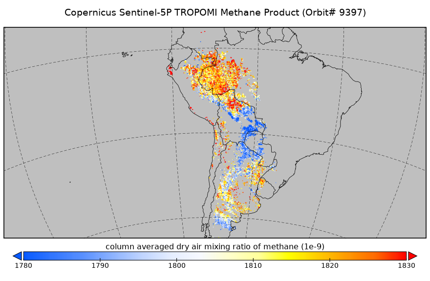
Sentinel-5P TROPOMI Methane CH4 1-Orbit L2 5.5km x 7km V2 (S5P_L2__CH4____HiR) at GES DISC
National Aeronautics and Space Administration —
Starting from August 6th in 2019, Sentinel-5P TROPOMI along-track high spatial resolution (~5.5km at nadir) has been implemented. For data before August 6th of 2019,... -
Federal
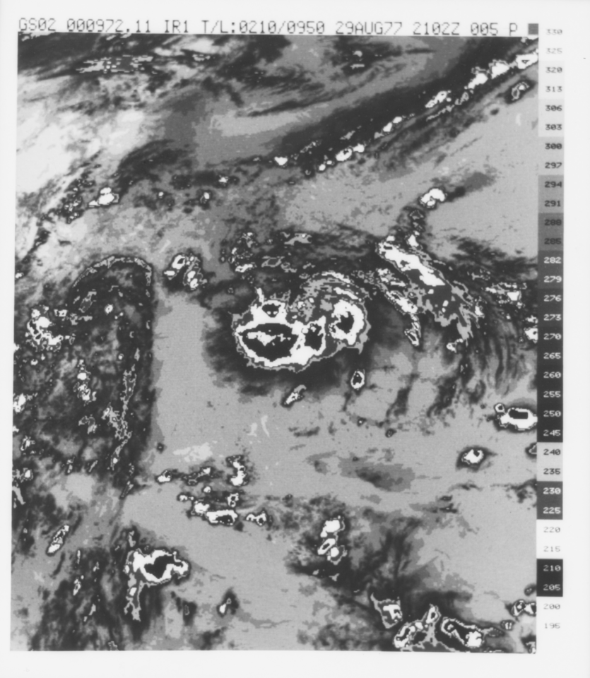
VISSR/GOES-2 Infrared Imagery on 70mm Film V001 (VISSRGOES2IMIR) at GES DISC
National Aeronautics and Space Administration —
VISSRGOES2IMIR is the Visible Infrared Spin-Scan Radiometer (VISSR) Infrared Imagery on 70mm Film data product from the second Geostationary Operational Environmental... -
Federal
Aqua/AIRS L2 Near Real Time (NRT) Support Retrieval (AIRS-only) V7.0 at GES DISC
National Aeronautics and Space Administration —
The Atmospheric Infrared Sounder (AIRS) Level 2 Near Real Time (NRT) Support Retrieval (AIRS-only) product (AIRS2SUP_NRT_7.0) differs from the routine product... -
Federal
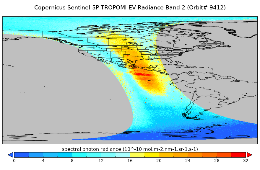
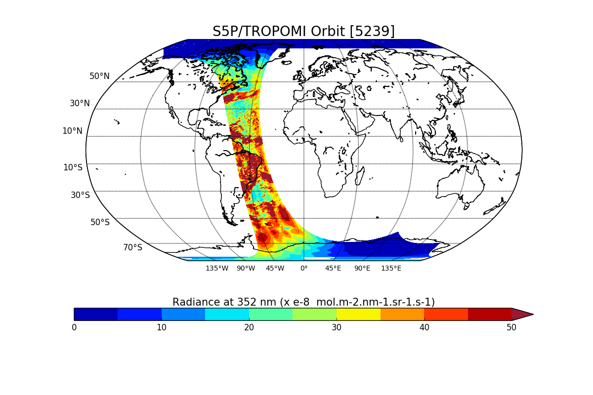
Sentinel-5P TROPOMI Radiance product band 2 (UV detector) L1B 5.5km x 3.5km V2 (S5P_L1B_RA_BD2_HiR) at GES DISC
National Aeronautics and Space Administration —
Starting from August 6th in 2019, Sentinel-5P TROPOMI along-track high spatial resolution (~5.5km at nadir) has been implemented. For data before August 6th of 2019,... -
Federal
Sentinel-5P TROPOMI Methane CH4 1-Orbit L2 5.5km x 7km V1 (S5P_L2__CH4____HiR) at GES DISC
National Aeronautics and Space Administration —
Starting from August 6th in 2019, Sentinel-5P TROPOMI along-track high spatial resolution (~5.5km at nadir) has been implemented. For data before August 6th of 2019,... -
Federal
MLS/Aura Level 2 Nitric Acid (HNO3) Mixing Ratio V005 (ML2HNO3) at GES DISC
National Aeronautics and Space Administration —
ML2HNO3 is the EOS Aura Microwave Limb Sounder (MLS) standard product for nitric acid derived from radiances measured by the 240 GHz radiometer at and below 10 hPa,... -
Federal
MLS/Aura Level 3 Monthly Binned Hydroxyl (OH) Mixing Ratio on Assorted Grids V005 (ML3MBOH) at GES DISC
National Aeronautics and Space Administration —
ML3MBOH is the EOS Aura Microwave Limb Sounder (MLS) monthly binned on various vertical grids product for hydroxyl (OH) derived from radiances measured by the THz... -
Federal
MLS/Aura Level 2 Geopotential Height V005 (ML2GPH) at GES DISC
National Aeronautics and Space Administration —
ML2GPH is the EOS Aura Microwave Limb Sounder (MLS) standard product for geopotential height derived from radiances measured by the 118 and 240 GHz radiometers. The... -
Federal
Sentinel-5P TROPOMI Radiance product band 2 (UV detector) L1B V1 (S5P_L1B_RA_BD2) at GES DISC
National Aeronautics and Space Administration —
Starting from August 6th in 2019, Sentinel-5P TROPOMI along-track high spatial resolution (~5.5km at nadir) has been implemented. For data after August 6th of 2019,... -
Federal
TROPESS Chemical Reanalysis Specific Humidity 6-Hourly 3-dimensional Product V1 (TRPSCRQ6H3D) at GES DISC
National Aeronautics and Space Administration —
The TROPESS Chemical Reanalysis Specific Humidity 6-Hourly 3-dimensional Product contains vertical specific humidity values, a meteorological field. The data are part... -
Federal
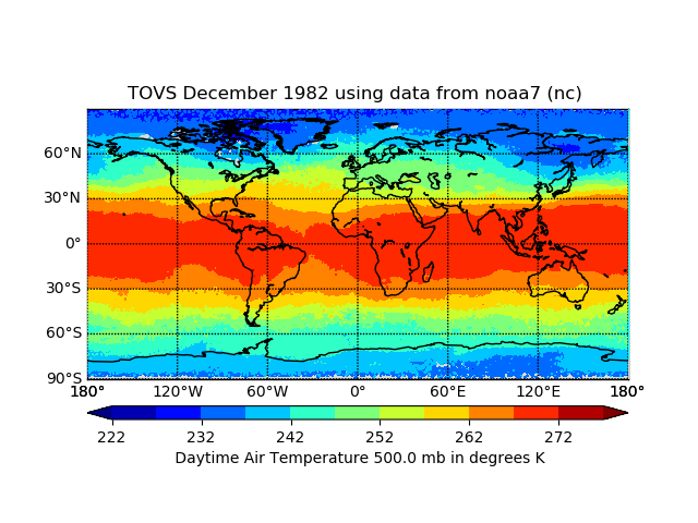
TOVS GLA MONTHLY GRIDS from NOAA-7 02 (TOVSAMNC) at GES DISC
National Aeronautics and Space Administration —
This dataset (TOVSAMNC) contains the TIROS Operational Vertical Sounder (TOVS) level 3 geophysical parameters derived using data from NOAA-7 and the physical... -
Federal
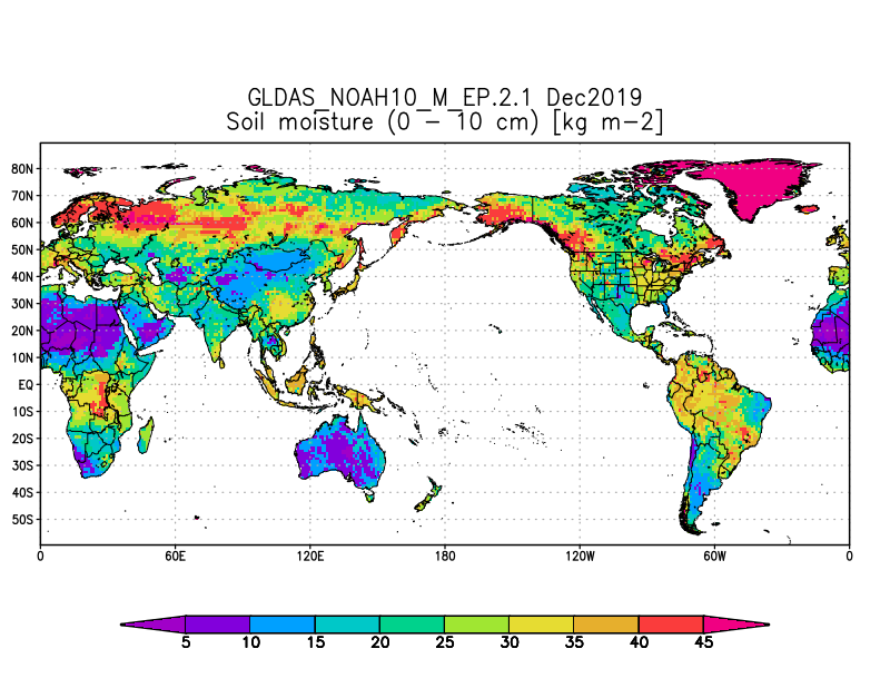
GLDAS Noah Land Surface Model L4 monthly 1.0 x 1.0 degree Early Product V2.1 (GLDAS_NOAH10_M_EP) at GES DISC
National Aeronautics and Space Administration —
NASA Global Land Data Assimilation System Version 2 (GLDAS-2) has three components: GLDAS-2.0, GLDAS-2.1, and GLDAS-2.2. GLDAS-2.0 is forced entirely with the... -
Federal
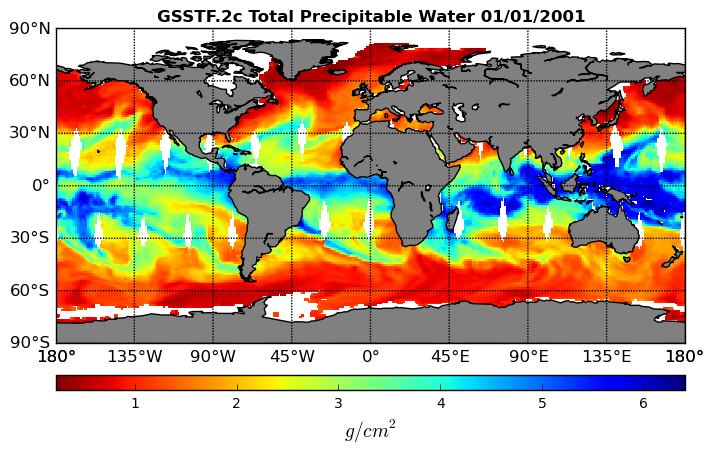
Goddard Satellite-Based Surface Turbulent Fluxes, 0.25 x 0.25 deg, Daily Grid V3 (GSSTF) at GES DISC
National Aeronautics and Space Administration —
These data are the Goddard Satellite-based Surface Turbulent Fluxes Version-3 (GSSTF3) Dataset recently produced through a MEaSUREs funded project led by Dr. Chung-... -
Federal
MODIS/Aqua Geolocation Fields 1km 5-Min 1A Narrow Swath Subset along CloudSat V002 (MAC03S0) at GES DISC
National Aeronautics and Space Administration —
This is the narrow-swath MODIS/Aqua subset along CloudSat field of view track. The goal of the narrow-swath subset is to select and return MODIS data that are within... -
Federal
MLS/Aura Level 3 Daily Binned Water Vapor (H2O) Mixing Ratio on Assorted Grids V005 (ML3DBH2O) at GES DISC
National Aeronautics and Space Administration —
ML3DBH2O is the EOS Aura Microwave Limb Sounder (MLS) daily binned on various vertical grids product for water vapor (H2O) derived from radiances measured primarily... -
Federal
Sentinel-5P TROPOMI Radiance product band 3 (UVIS detector) L1B V1 (S5P_L1B_RA_BD3) at GES DISC
National Aeronautics and Space Administration —
Starting from August 6th in 2019, Sentinel-5P TROPOMI along-track high spatial resolution (~5.5km at nadir) has been implemented. For data after August 6th of 2019,... -
Federal
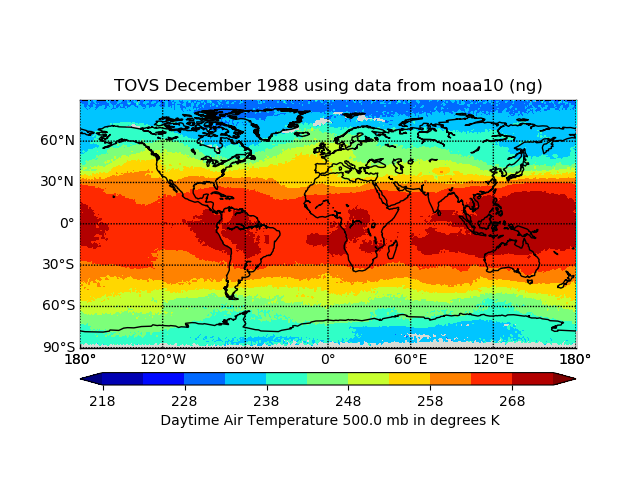
TOVS GLA MONTHLY GRIDS from NOAA-10 02 (TOVSAMNG) at GES DISC
National Aeronautics and Space Administration —
This dataset (TOVSAMNG) contains the TIROS Operational Vertical Sounder (TOVS) level 3 geophysical parameters derived using data from NOAA-10 and the physical... -
Federal
TROPESS Chemical Reanalysis O3 Increment Monthly 3-dimensional Product V1 (TRPSCRO3IM3D) at GES DISC
National Aeronautics and Space Administration —
The TROPESS Chemical Reanalysis O3 Increment Monthly 3-dimensional Product contains the ozone increment by data assimilation. The data are part of the Tropospheric...

Official websites use .gov
A
.gov website belongs to an official government
organization in the United States.
Secure .gov websites use HTTPS
A
lock (
) or https:// means you’ve safely connected to
the .gov website. Share sensitive information only on official,
secure websites.