
-
Federal
TIGER/Line Shapefile, 2021, County, Lafayette County, FL, All Roads
U.S. Census Bureau, Department of Commerce —
The TIGER/Line shapefiles and related database files (.dbf) are an extract of selected geographic and cartographic information from the U.S. Census Bureau's Master... -
Federal
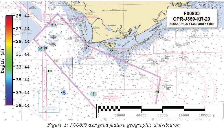
F00803: NOS Hydrographic Survey , 2020-06-28
National Oceanic and Atmospheric Administration, Department of Commerce —
The National Oceanic and Atmospheric Administration (NOAA) has the statutory mandate to collect hydrographic data in support of nautical chart compilation for safe... -
Federal
EnviroAtlas 15m Riparian Buffer Vegetated Cover Web Service
U.S. Environmental Protection Agency —
This EnviroAtlas web service supports research and online mapping activities related to EnviroAtlas (https://www.epa.gov/enviroatlas). This EnviroAtlas dataset... -
Federal
TIGER/Line Shapefile, 2020, State, Florida, State Legislative District (SLD) Upper Chamber
U.S. Census Bureau, Department of Commerce —
The TIGER/Line shapefiles and related database files (.dbf) are an extract of selected geographic and cartographic information from the U.S. Census Bureau's Master... -
Federal
2023 Cartographic Boundary File (SHP), County Subdivision for Florida, 1:500,000
U.S. Census Bureau, Department of Commerce —
The 2023 cartographic boundary shapefiles are simplified representations of selected geographic areas from the U.S. Census Bureau's Master Address File /... -
Federal
F00629: NOS Hydrographic Survey , St. Augustine, FL, 2013-04-09
National Oceanic and Atmospheric Administration, Department of Commerce —
The National Oceanic and Atmospheric Administration (NOAA) has the statutory mandate to collect hydrographic data in support of nautical chart compilation for safe... -
Federal
Single-Beam derived bathymetric contours of Florida Bay, Florida (1995-1999) in ESRI shapefile format
Department of the Interior —
Land development and alterations of the ecosystem in South Florida have decreased freshwater and increased nutrient flows into Florida Bay. As a result, there has... -
Federal
2022 Cartographic Boundary File (KML), Current Place for Florida, 1:500,000
U.S. Census Bureau, Department of Commerce —
The 2022 cartographic boundary KMLs are simplified representations of selected geographic areas from the U.S. Census Bureau's Master Address File / Topologically... -
Federal
NCCOS Assessment: Investigating the effects of chronic turbidity exposure to priority Florida coral species, Acropora cervicornis 2023-08-15 to 2023-11-07 (NCEI Accession 0309260)
National Oceanic and Atmospheric Administration, Department of Commerce —
This dataset is comprised of many biochemical analyses performed throughout the course of a 90-day laboratory exposure experiments to determine the chronic effects of... -
Federal
Metabolism estimates for 356 U.S. rivers (2007-2017): 7. Model diagnostics
Department of the Interior —
This dataset provides key diagnostics and overall assessments of metabolism model performance. The format is a table with 1 row per model (1 tab-delimited file,... -
Federal
Offshore baseline for the northeastern Florida (FLne) coastal region generated to calculate shoreline change rates
Department of the Interior —
Sandy ocean beaches are a popular recreational destination, often surrounded by communities containing valuable real estate. Development is on the rise despite the... -
Federal
Metabolism estimates for 356 U.S. rivers (2007-2017): 5. Model configurations
Department of the Interior —
This dataset provides model specifications used to estimate metabolism. The format is a table with 1 row per model (1 tab-delimited file, compressed into zip file).... -
Federal
Single-Beam Bathymetry Sounding Data of Tampa Bay, Florida (2001-2004) in X,Y,Z format
Department of the Interior —
Tampa Bay and its environs have experienced phenomenal urban growth and significant changes in land-use practices over the past 50 years. This trend is expected to... -
Federal
Assessing the Current and Potential Role of Shellfish for Improving Water Quality - NERRS/NSC(NERRS Science Collaborative)
National Oceanic and Atmospheric Administration, Department of Commerce —
By leveraging reserve capacity and deepening relationships, this project fostered connectedness between people and data to strengthen water quality restoration... -
Federal
Swath derived bathymetric grids of Lostmans and Lower Shark Rivers, Florida (2015) in Esri ASCII grid format
Department of the Interior —
High resolution bathymetry mapping of the coastal rivers and inland lakes along the Southwest coast of Everglades National Park (ENP) is greatly needed from the... -
Federal
Metabolism estimates for 356 U.S. rivers (2007-2017): 2a. Site coordinates
Department of the Interior —
This dataset provides site locations as shapefile points. The format is a shapefile for all sites combined (.shp, .shx, .dbf, and .prj files). This dataset is part of... -
Federal
Metabolism estimates for 356 U.S. rivers (2007-2017): 2b. Site catchment boundaries
Department of the Interior —
This dataset provides shapefile outlines of the catchments contributing to sites where metabolism was or could have been estimated. The format is a shapefile for all... -
Federal
EnviroAtlas - Tampa, FL - Tree Cover Configuration and Connectivity, Water Background
U.S. Environmental Protection Agency —
This EnviroAtlas dataset categorizes forest land cover into structural elements (e.g. core, edge, connector, etc.). In this community, forest is trees & forest... -
Federal
TIGER/Line Shapefile, 2021, State, Florida, Unified School Districts
U.S. Census Bureau, Department of Commerce —
The TIGER/Line shapefiles and related database files (.dbf) are an extract of selected geographic and cartographic information from the U.S. Census Bureau's Master... -
Federal
Digital Shoreline Analysis System version 4.3 Transects with Long-Term Linear Regression Rate Calculations for northeastern Florida (FLne)
Department of the Interior —
Sandy ocean beaches are a popular recreational destination, often surrounded by communities containing valuable real estate. Development is on the rise despite the...

Official websites use .gov
A
.gov website belongs to an official government
organization in the United States.
Secure .gov websites use HTTPS
A
lock (
) or https:// means you’ve safely connected to
the .gov website. Share sensitive information only on official,
secure websites.