
-
Federal
NCEP-GTS Marine Observations in BUFR format
National Oceanic and Atmospheric Administration, Department of Commerce —
The Global Telecommunications System (GTS) is a major component of transmitting global meteorological data, consisting of both in situ and satellite observations.... -
Federal
Tropical CPR identification data for Organization Metric
National Aeronautics and Space Administration —
There are three kinds of files are in one zip file. 1) Cloud-Precipitation (hybrid) regime information projected onto hourly IMERG precipitation data (Version Pr6x7... -
Federal
Level 1.5 Almucantar Inversion Products Phase Functions
National Aeronautics and Space Administration —
AERONET inversion code provides aerosoloptical properties in the total atmospheric column derived from the direct and diffuse radiation measured byAERONETCimel... -
Federal
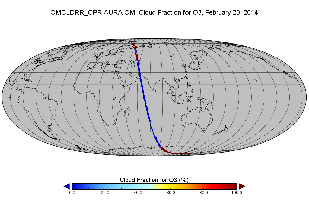
OMI/Aura Cloud Pressure and Fraction (Raman Scattering) 200-km swath subset along CloudSat track V003 (OMCLDRR_CPR) at GES DISC
National Aeronautics and Space Administration —
This is the OMI/Aura Cloud Pressure and Fraction (Raman Scattering) subset along CloudSat tracks, for the purposes of the A-Train mission. The original data product... -
Federal
Level 1.5 Almucantar Inversion Products (except phase functions)
National Aeronautics and Space Administration —
AERONET inversion code provides aerosoloptical properties in the total atmospheric column derived from the direct and diffuse radiation measured byAERONETCimel... -
Federal
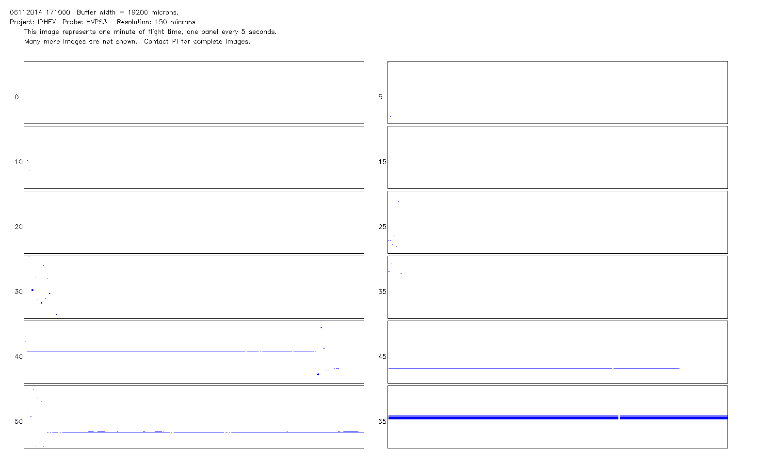
GPM Ground Validation NCAR Particle Probes IPHEx V1
National Aeronautics and Space Administration —
The GPM Ground Validation NCAR Particle Probes IPHEx dataset consists of Ice Water Content (IWC), particle number concentration normalized by bin width, and total... -
Federal
AMSR-E/AMSR2 Unified L2B Global Swath Ocean Products V001
National Aeronautics and Space Administration —
This AMSR Unified global ocean data set reports integrated water vapor and cloud liquid water content in the atmospheric column, plus 10-meter sea surface wind... -
Federal
AMSR-E/Aqua Weekly L3 Global Ascending/Descending .25x.25 deg Ocean Grids V002
National Aeronautics and Space Administration —
The Level-3 daily product (AE_DyOcn), weekly product (AE_WkOcn), and monthly product (AE_MoOcn) include SST, near-surface wind speed, columnar water vapor, and... -
Federal
Fast Longwave And SHortwave Fluxes (FLASHflux) Clouds and Radiative Swath (SSF) TERRA-FM1 data in HDF Version 4A
National Aeronautics and Space Administration —
FLASH_SSF_Terra-FM1-MODIS_Version4A is the Fast Longwave And Shortwave Radiative Fluxes (FLASHFlux) Clouds and Radiative Swath (SSF) TERRA-FM1 data in HDF Version 4A... -
Federal
Level 2.0 Almucantar Inversion Products Phase Functions
National Aeronautics and Space Administration —
AERONET inversion code provides aerosoloptical properties in the total atmospheric column derived from the direct and diffuse radiation measured byAERONETCimel... -
Federal
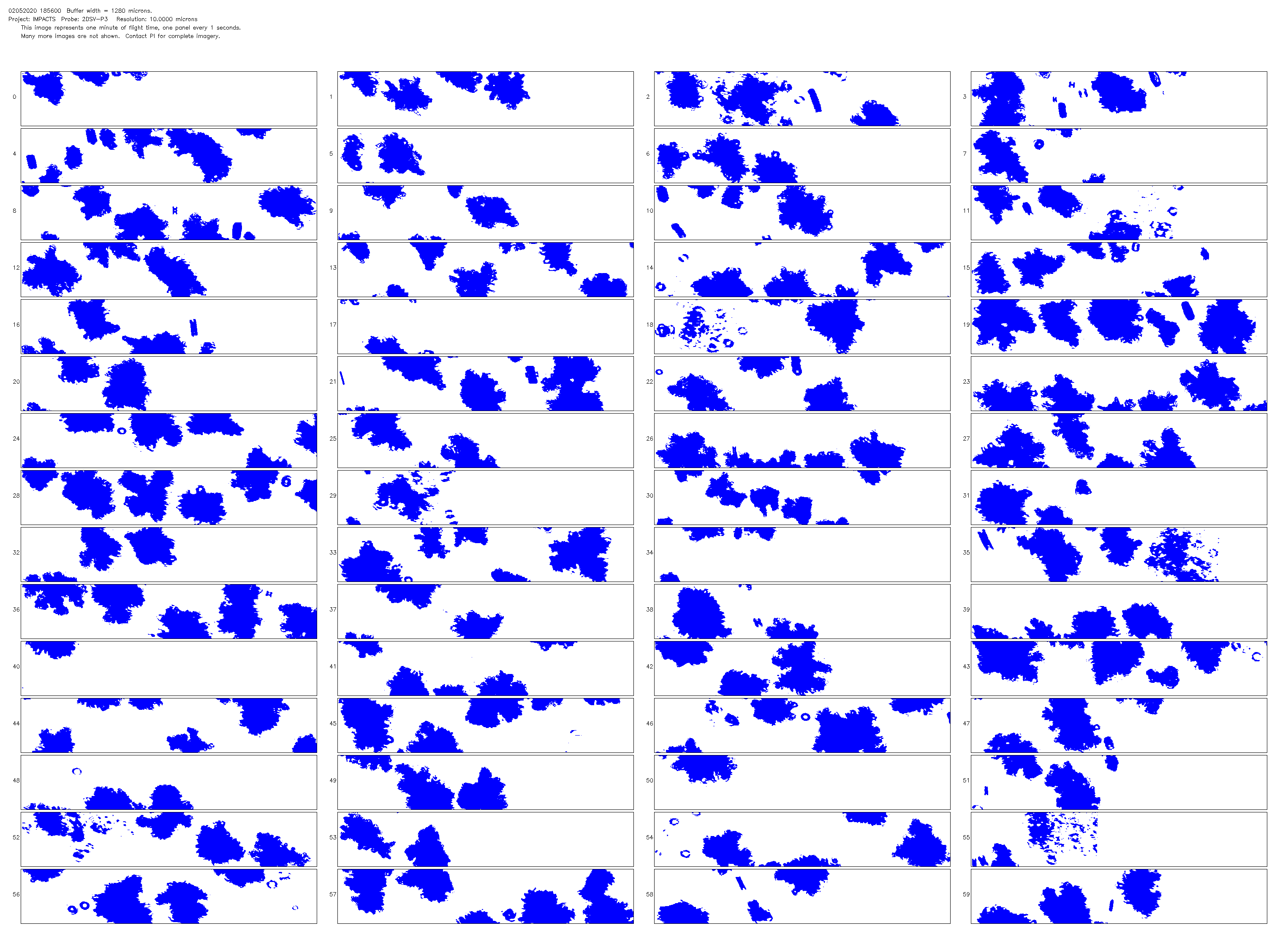
NCAR Particle Probes IMPACTS V1
National Aeronautics and Space Administration —
The NCAR Particle Probes IMPACTS dataset consists of data collected from six instruments on the NASA P-3 aircraft, the SPEC Hawkeye Cloud Particle Imager (CPI), the... -
Federal
TOVS GLA DAILY GRIDS from NOAA-11 V01 (TOVSADNH) at GES DISC
National Aeronautics and Space Administration —
This dataset (TOVSADNH) contains the TIROS Operational Vertical Sounder (TOVS) level 3 geophysical parameters derived using data from NOAA-11 and the physical... -
Federal
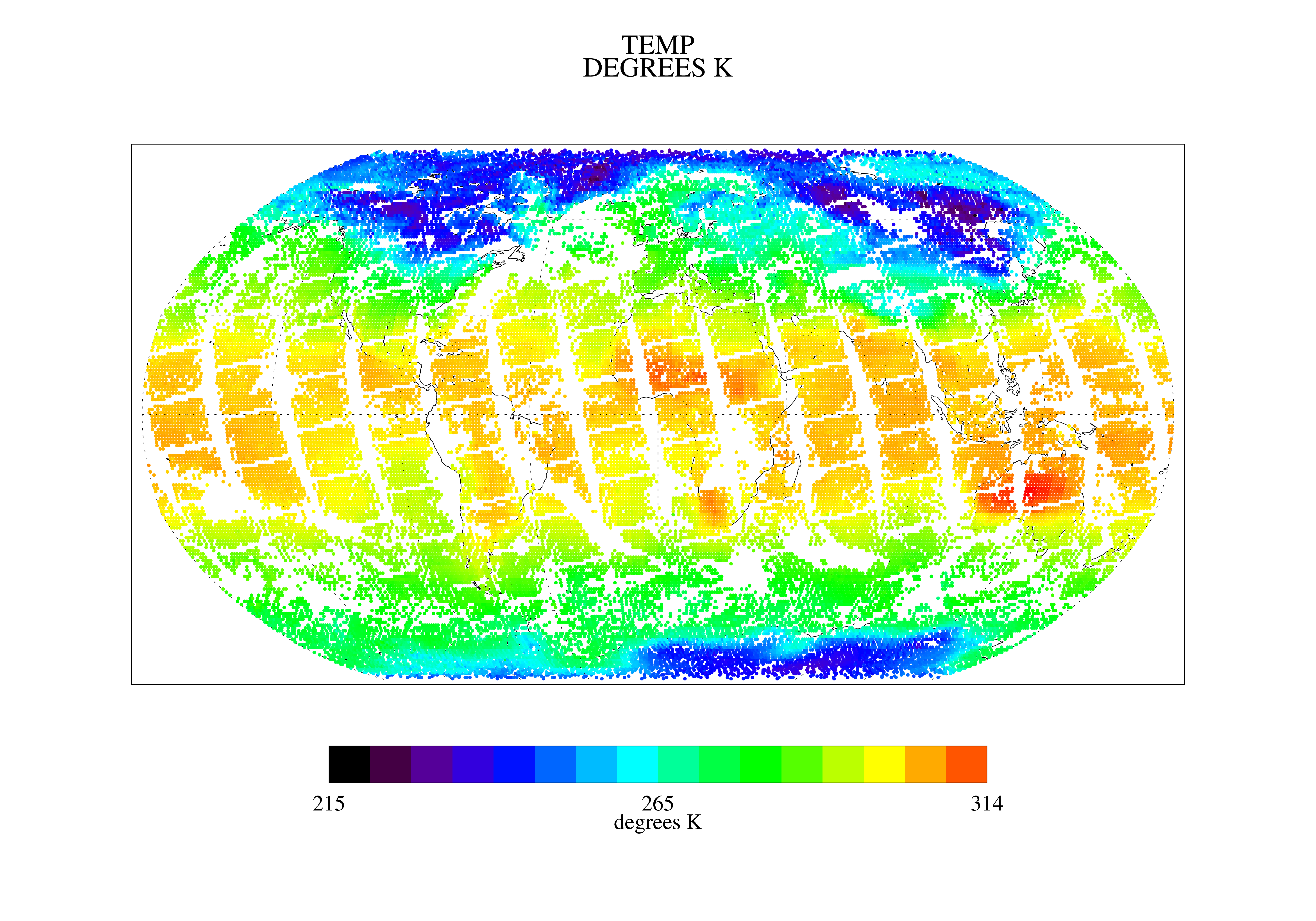
ATLAS/ICESat-2 L3B Monthly Gridded Atmosphere V005
National Aeronautics and Space Administration —
This data set contains a gridded summary of monthly global cloud fraction, total column optical depth over the oceans, polar cloud fraction, blowing snow frequency,... -
Federal
Surface Airways Observations (SAO) Hourly Data 1928-1948 (CDMP)
National Oceanic and Atmospheric Administration, Department of Commerce —
The dataset consists of hourly U.S. surface airways observations (SAO). These observations extend as far back as 1928, from the time when commercial aviation began in... -
Federal
SatCORPS CERES GEO Edition 4 Meteosat-10 Southern Hemisphere Version 1.0
National Aeronautics and Space Administration —
CER_GEO_Ed4_MET10_SH_V01 is the Satellite Cloud and Radiation Property retrieval System (SatCORPS) Clouds and the Earth's Radiant Energy System (CERES) Geostationary... -
Federal
Cloudmask, CLAVR-1, POES AVHRR, Alaska, Daytime, 2005-2008 (Hourly), Lon+/-180
National Oceanic and Atmospheric Administration, Department of Commerce —
The CLAVR-1 cloudmask (Stowe, 1999) is used to cloudmask AVHRR high resolution sea surface temperature products. The cloudmask runs a series of tests on each surface... -
Federal
TOVS GLA DAILY GRIDS from NOAA-12 V01 (TOVSADND) at GES DISC
National Aeronautics and Space Administration —
This dataset (TOVSADND) contains the TIROS Operational Vertical Sounder (TOVS) level 3 geophysical parameters derived using data from NOAA-12 and the physical... -
Federal
Summary of the Day (CDMP)
National Oceanic and Atmospheric Administration, Department of Commerce —
This Summary of the Day data file contains daily selected elements of observations recorded by certified observers. The stations were located in the U.S. and were... -
Federal
ER-2 X-Band Doppler Radar (EXRAD) IMPACTS V1
National Aeronautics and Space Administration —
The ER-2 X-band Radar (EXRAD) IMPACTS dataset consists of radar reflectivity and Doppler velocity estimates collected by the EXRAD onboard the NASA ER-2 high-altitude... -
Federal
AERONET Level 2.0 SDA
National Aeronautics and Space Administration —
The aerosol optical depth processing includes the spectral de-convolution algorithm (SDA) described in O'Neill et al. (2003). This algorithm yields fine (sub-micron)...

Official websites use .gov
A
.gov website belongs to an official government
organization in the United States.
Secure .gov websites use HTTPS
A
lock (
) or https:// means you’ve safely connected to
the .gov website. Share sensitive information only on official,
secure websites.