
-
Federal
Cook Inlet and Kenai Peninsula, Alaska ESI: M_MAMMAL (Marine Mammal Polygons)
National Oceanic and Atmospheric Administration, Department of Commerce —
This data set contains biological resource data for marine mammals in Cook Inlet and Kenai Peninsula, Alaska. Vector polygons in this data set represent locations of... -
Federal
Cook Inlet and Kenai Peninsula, Alaska ESI: MGT (Management Area Polygons)
National Oceanic and Atmospheric Administration, Department of Commerce —
This data set contains management area data for communities, wildlife refuges, and National, State, and regional parks in Cook Inlet and Kenai Peninsula, Alaska.... -
Federal
Back-Island Shorelines for the Undeveloped Areas of New Jersey's Barrier Islands, Extracted from Orthoimagery, March 9, 1991, to July 30, 2013
Department of the Interior —
Assessing the physical change to shorelines and wetlands is critical in determining the resiliency of wetland systems that protect adjacent habitat and communities.... -
Federal
Open-Ocean Shorelines for the Undeveloped Areas of New Jersey's Barrier Islands, Extracted from Orthoimagery, March 9, 1991 to July 30, 2013
Department of the Interior —
Assessing the physical change to shorelines and wetlands is critical in determining the resiliency of wetland systems that protect adjacent habitat and communities.... -
Federal
Shorelines Extracted from 1984-2015 Landsat Imagery: Cat Island, Mississippi (Polygon: Combined Dates)
Department of the Interior —
Shorelines Extracted from 1984-2015 Landsat Imagery: Cat Island, Mississippi (Polygon: Combined Dates) is a polygon shapefile representing shorelines generated from... -
Federal
Shorelines Extracted from 1984-2015 Landsat Imagery: Dauphin Island, Alabama (Polygon: Individual Dates)
Department of the Interior —
Shorelines Extracted from 1984-2015 Landsat Imagery: Dauphin Island, Alabama (Polygon: Individual Dates) is a dataset consisting of 223 polygon shapefiles... -
Federal
2002 Sediment Grab Data for Catlett and Goodwin Islands on the York River, Chesapeake Bay, Virginia (Ches_2002sedgrabs)
National Oceanic and Atmospheric Administration, Department of Commerce —
This data set represents the sediment grain size gathered from grab sampling in 2002 (56 stations).In Fall/Winter 2002, researchers from the Virginia Institute of... -
Federal
Shorelines Extracted from 1984-2015 Landsat Imagery: Petit Bois Island, Mississippi (Polyline: Combined Dates)
Department of the Interior —
Shorelines Extracted from 1984-2015 Landsat Imagery: Petit Bois Island, Mississippi (Polyline: Combined Dates) is a line shapefile representing shorelines generated... -
State
MD iMAP: Maryland Archived Land Use Land Cover 2002
State of Maryland —
This is a MD iMAP hosted service. Find more information on http://imap.maryland.gov. This layer contains land use land cover information for the year 2002. The Land... -
Federal
Sensitivity of Coastal Environments and Wildlife to Spilled Oil: Northwest Arctic, Alaska: HYDRO (Hydrography Lines and Polygons)
National Oceanic and Atmospheric Administration, Department of Commerce —
This data set contains vector arcs and polygons representing coastal hydrography used in the creation of the Environmental Sensitivity Index (ESI) for Northwest... -
State
MD iMAP: 2002 US Congressional Districts
State of Maryland —
This is a MD iMAP hosted service. Find more information at http://imap.maryland.gov. This is a map service of archived political districts in the state of Maryland.... -
Federal
Average Processing Time Until Hearing Held - FY 1989-2009
Social Security Administration —
This dataset provides historical data for average wait time (in days) from the hearing request date until a hearing was held. This dataset includes data from fiscal... -
Federal
OASDI Beneficiaries by State and County - 2002
Social Security Administration —
This annual publication focuses on the Social Security beneficiary population receiving Old-Age, Survivors, and Disability Insurance (OASDI) benefits at the local... -
County
2002 Lake County Aerial - SE Quarter
Lake County, Illinois —
This six inch pixel resolution black and white aerial photography was flown between April 13, 2002 and April 26, 2002 at a negative scale of 1" = 660' (a scale ratio... -
Federal
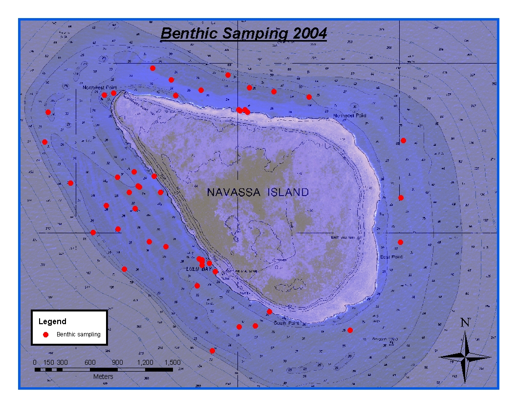
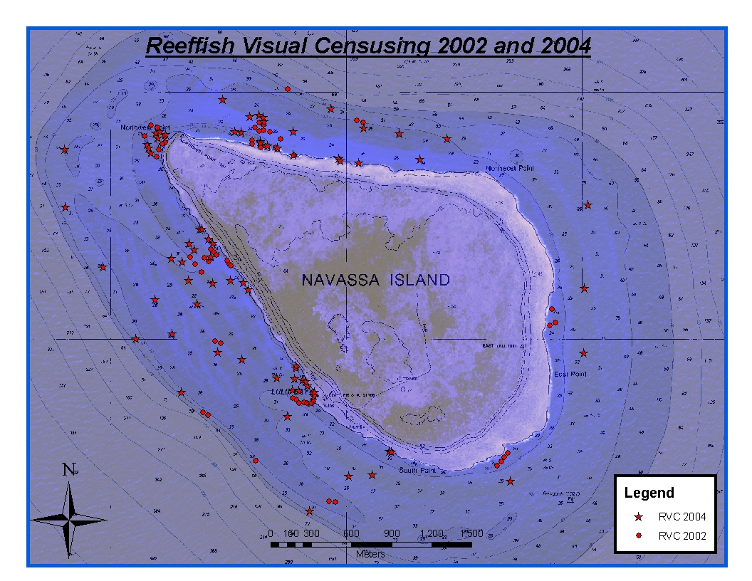
CRCP-Navassa reef assessment
National Oceanic and Atmospheric Administration, Department of Commerce —
Episodic cruises ( every 2 years) were conducted to perform assessments of Navassa Island coral reef resources including reeffish visual census, benthic reef... -
Federal
Appeals Council Requests - Average Processing Time - FY 1989-2016
Social Security Administration —
This dataset provides annual data from 1989 through 2016 for the average processing time (elapsed time in days) for dispositions by the Appeals Council (AC) (both... -
Federal
Cook Inlet and Kenai Peninsula, Alaska ESI: ICE (Ice Extent Lines)
National Oceanic and Atmospheric Administration, Department of Commerce —
This data set contains locations of ice extent in Cook Inlet, Alaska. Vector lines in the data set represent 50 percent ice coverage. Location-specific type and... -
Federal
Cook Inlet and Kenai Peninsula, Alaska ESI: INDEX (Index Polygons)
National Oceanic and Atmospheric Administration, Department of Commerce —
This data set contains vector polygons representing the boundaries used in the creation of the Environmental Sensitivity Index (ESI) for Cook Inlet and Kenai... -
Federal
Tree Canopy Cover (TCC) Science Standard Error (SE) Conterminous United States NGDA
Department of Agriculture —
The USDA Forest Service (USFS) builds two versions of percent tree canopy cover data, in order to serve needs of multiple user communities. These datasets encompass... -
Federal
Shorelines Extracted from 1984-2015 Landsat Imagery: Horn Island, Mississippi (Polyline: Combined Dates)
Department of the Interior —
Shorelines Extracted from 1984-2015 Landsat Imagery: Horn Island, Mississippi (Polyline: Combined Dates) is a line shapefile representing shorelines generated from...

Official websites use .gov
A
.gov website belongs to an official government
organization in the United States.
Secure .gov websites use HTTPS
A
lock (
) or https:// means you’ve safely connected to
the .gov website. Share sensitive information only on official,
secure websites.