-
Federal
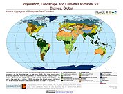
National Aggregates of Geospatial Data Collection: Population, Landscape, And Climate Estimates, Version 3 (PLACE III)
National Aeronautics and Space Administration —
The National Aggregates of Geospatial Data Collection: Population, Landscape, And Climate Estimates, Version 3 (PLACE III) data set contains estimates of national-... -
Federal
Airborne Precipitation Radar 3rd Generation (APR-3) CPEX-CV
National Aeronautics and Space Administration —
The Airborne Precipitation Radar 3rd Generation (APR-3) CPEX-CV dataset consists of radar reflectivity, Doppler velocity for all bands, linear depolarization ratio... -
Federal
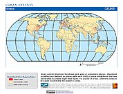
Global Rural-Urban Mapping Project, Version 1 (GRUMPv1): Urban Extents Grid
National Aeronautics and Space Administration —
The Global Rural-Urban Mapping Project, Version 1 (GRUMPv1): Urban Extents Grid distinguishes urban and rural areas based on a combination of population counts... -
Federal
Research Data Framework (RDaF) Database
National Institute of Standards and Technology —
The NIST RDaF is a map of the research data space that uses a lifecycle approach with six high-level lifecycle stages to organize key information concerning research... -
County
LEGO Diorama Images
Allegheny County / City of Pittsburgh / Western PA Regional Data Center —
We often create dioramas from LEGO bricks for use with our presentations, blogs, and social media posts. We find it's much more fun and effective to reenact meetings... -
Federal
Boundary of the North Cascades National Park Service Complex, Washington, nbndry_g2.shp
Department of the Interior —
ArcGIS shapefile polygons showing the location of the Park boundary as well as administrative unit boundaries (Ross Lake and Lake Chelan National Recreation Areas)... -
Federal
Aquarius Official Release Level 3 Wind Speed Standard Mapped Image 7-Day Data V5.0
National Aeronautics and Space Administration —
Aquarius Level 3 ocean surface wind speed standard mapped image data contains gridded 1 degree spatial resolution wind speed data averaged over daily, 7 day, monthly,... -
Federal
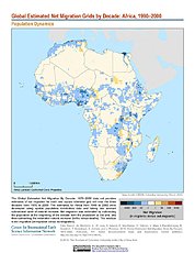
Global Estimated Net Migration Grids by Decade: 1970-2000
National Aeronautics and Space Administration —
The Global Estimated Net Migration by Decade: 1970-2000 data set provides estimates of net migration over the three decades from 1970 to 2000. Because of the lack of... -
Federal
SWOT Level 2 River Single-Pass Vector Reach Data Product, Version 2.0
National Aeronautics and Space Administration —
The SWOT Level 2 River Single-Pass Vector Reach Data Product from the Surface Water Ocean Topography (SWOT) mission provides water surface elevation, slope, width,... -
Federal
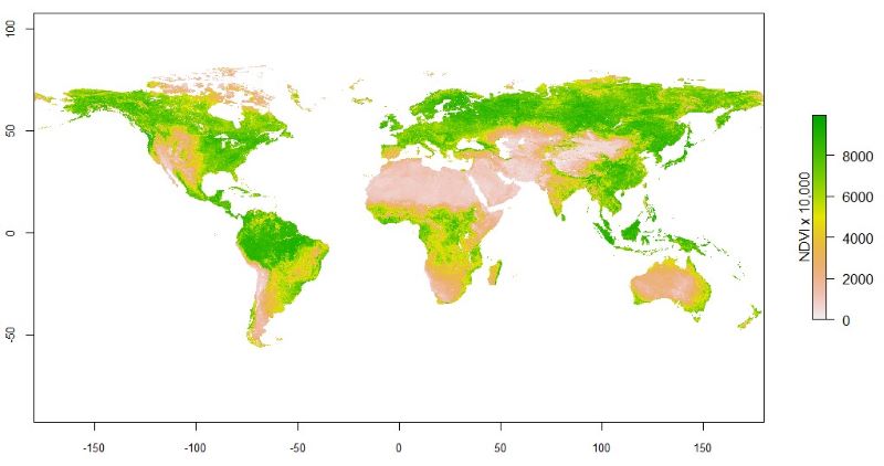
Global Vegetation Greenness (NDVI) from AVHRR GIMMS-3G+, 1981-2022
National Aeronautics and Space Administration —
This dataset holds the Global Inventory Modeling and Mapping Studies-3rd Generation V1.2 (GIMMS-3G+) data for the Normalized Difference Vegetation Index (NDVI). NDVI... -
Federal
Data from: Genotypic characterization of the U.S. peanut core collection
Department of Agriculture —
This collection contains supplementary data for the manuscript "Genotypic characterization of the U.S. Peanut Core Collection", which describes genotyping results for... -
Federal
SWOT Level 2 River Single-Pass Vector Node Data Product, Version D
National Aeronautics and Space Administration —
The SWOT Level 2 River Single-Pass Vector Data Product (SWOT_L2_HR_RiverSP_D) provides hydrologic measurements for predefined river reaches and nodes, derived from... -
Federal
ASTER L2 Surface Reflectance SWIR and ASTER L2 Surface Reflectance VNIR V003
National Aeronautics and Space Administration —
The Terra Advanced Spaceborne Thermal Emission and Reflection Radiometer (ASTER) Surface Reflectance VNIR and SWIR (AST_07) data product contains measures of the... -
Federal
China Dimensions Data Collection: China County-Level Data from Provincial Economic Yearbooks, Keyed to 1:1M GIS Map
National Aeronautics and Space Administration —
The China County-Level Data on Provincial Economic Yearbooks, Keyed To 1:1M GIS Map consists of socioeconomic and boundary data for the administrative regions of... -
Federal
SWOT Sword of Science River Discharge Products Version 1
National Aeronautics and Space Administration —
The SWOT Sword of Science River Discharge Products dataset from the Surface Water and Ocean Topography (SWOT) mission and produced by the Discharge Algorithm Working... -
Federal
Vegetation Index and Phenology (VIP) Phenology NDVI Yearly Global 0.05Deg CMG V004
National Aeronautics and Space Administration —
The NASA Making Earth System Data Records for Use in Research Environments (MEaSUREs)... -
Federal
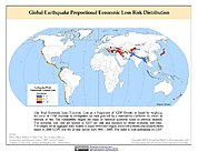
Global Earthquake Proportional Economic Loss Risk Deciles
National Aeronautics and Space Administration —
The Global Earthquake Proportional Economic Loss Risk Deciles is a 2.5 minute grid of earthquake hazard economic loss as proportions of Gross Domestic Product (GDP)... -
Federal
Yale Center for Earth Observation (YCEO) Surface Urban Heat Islands, Version 4, 2003-2018
National Aeronautics and Space Administration —
The Yale Center for Earth Observation (YCEO) Surface Urban Heat Islands, Version 4, 2003-2018 includes annual, summertime, and wintertime Surface Urban Heat Island... -
Federal
Global Forest Cover Change Forest Cover Change Multi-Year Global 30m V001
National Aeronautics and Space Administration —
The Land Processes Distributed Active Archive Center (LP DAAC) archives and distributes Global Forest Cover Change (GFCC) data products through the NASA Making Earth... -
Federal
Tellus Level-4 Greenland Mass Anomaly Time Series from JPL GRACE/GRACE-FO Mascon CRI Filtered Release 06.3 version 04
National Aeronautics and Space Administration —
This dataset is a time series of mass variability averaged over all of the global ocean. It provides the non-steric or mass only sea level changes over time. The mass...

Official websites use .gov
A
.gov website belongs to an official government
organization in the United States.
Secure .gov websites use HTTPS
A
lock (
) or https:// means you’ve safely connected to
the .gov website. Share sensitive information only on official,
secure websites.