
-
Federal
GPCP Precipitation Level 3 Monthly 0.5-Degree V3.2 (GPCPMON) at GES DISC
National Aeronautics and Space Administration —
Version 3.2 has been superseded by Version 3.3 (10.5067/MEASURES/GPCP/DATA306). The Global Precipitation Climatology Project (GPCP) is the precipitation component of... -
Federal
Aqua/AIRS L2 Standard Physical Retrieval (AIRS+AMSU) V7.0 at GES DISC
National Aeronautics and Space Administration —
The Atmospheric Infrared Sounder (AIRS) is a grating spectrometer (R = 1200) aboard the second Earth Observing System (EOS) polar-orbiting platform, EOS Aqua. The... -
Federal
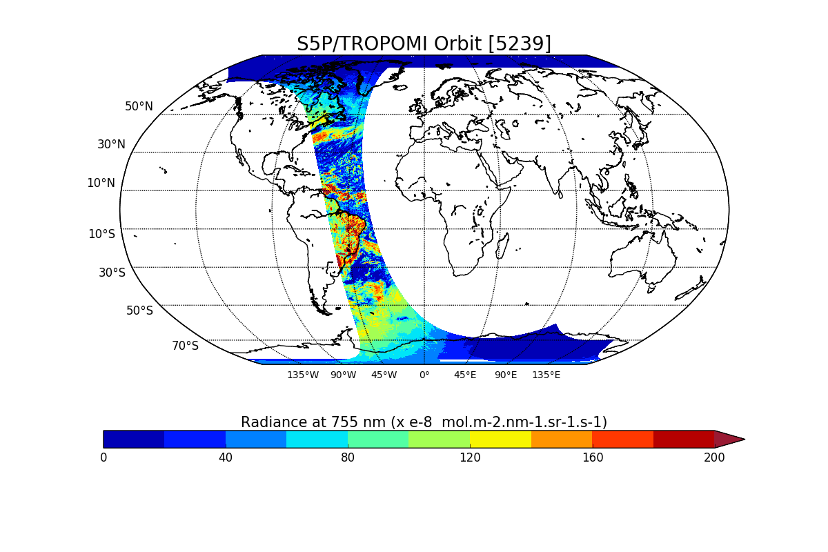
Sentinel-5P TROPOMI Near-Real-Time (NRT) Total Ozone Column 1-Orbit L2 5.5km x 3.5km V2 (S5P_L2__O3_TOT_HiR_NRT) at GES DISC
National Aeronautics and Space Administration —
The Sentinel-5P TROPOMI Near Real Time (NRT) Total Ozone Column 1-Orbit L2 5.5km x 3.5km V2 (S5P_L2__O3_TOT_HiR_NRT) at GES DISC is the near real time version of the... -
Federal
FLDAS Noah Land Surface Model L4 Global Monthly 0.1 x 0.1 degree (MERRA-2 and CHIRPS) V001 (FLDAS_NOAH01_C_GL_M) at GES DISC
National Aeronautics and Space Administration —
This dataset contains a series of land surface parameters simulated from the Noah 3.6.1 model in the Famine Early Warning Systems Network (FEWS NET) Land Data... -
Federal
GPM IMERG Late Precipitation L3 Half Hourly 0.1 degree x 0.1 degree V07 (GPM_3IMERGHHL) at GES DISC
National Aeronautics and Space Administration —
Version 07B is the current version of the IMERG data sets. Older versions will no longer be available and have been superseded by Version 07. The Integrated Multi-... -
Federal
OCO-2 Level 2 spatially ordered geolocated retrievals screened using the A-band Preprocessor, Retrospective Processing V10r (OCO2_L2_ABand) at GES DISC
National Aeronautics and Space Administration —
Version 10r is the current version of the data set. Older versions will no longer be available and are superseded by Version 10r. In early 2021, the OCO Team... -
Federal
Carbon Monitoring System Carbon Flux Total Prior L4 V3 (CMSFluxTotalPrior)
National Aeronautics and Space Administration —
This dataset provides the Prior for Total Carbon Flux. The NASA Carbon Monitoring System (CMS) is designed to make significant contributions in characterizing,... -
Federal
NLDAS Mosaic Land Surface Model L4 Monthly Climatology 0.125 x 0.125 degree V2.0 (NLDAS_MOS0125_MC) at GES DISC
National Aeronautics and Space Administration —
This monthly climatology data set contains a series of land surface parameters simulated from the Mosaic land-surface model (LSM) for Phase 2 of the North American... -
Federal
UARS Improved Stratospheric and Mesospheric Sounder (ISAMS) Level 3AT V010 (UARIS3AT) at GES DISC
National Aeronautics and Space Administration —
The Improved Stratospheric and Mesospheric Sounder (ISAMS) Level 3AT data product consists of daily, 65.536 second interval time-ordered vertical profiles of... -
Federal
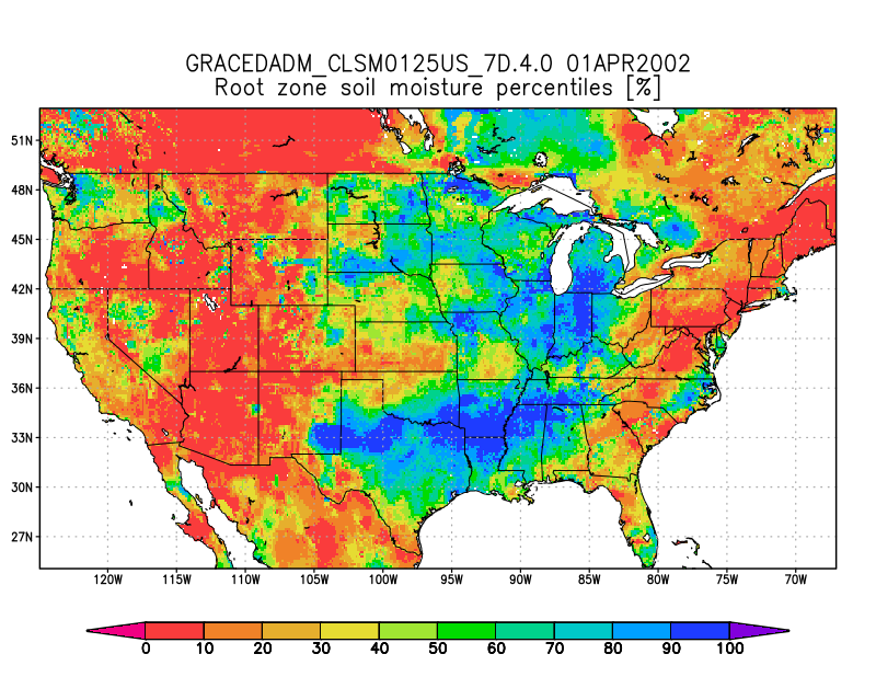
Groundwater and Soil Moisture Conditions from GRACE and GRACE-FO Data Assimilation L4 7-days 0.125 x 0.125 degree U.S. V4.0 (GRACEDADM_CLSM0125US_7D) at GES DISC
National Aeronautics and Space Administration —
Scientists at NASA Goddard Space Flight Center generate groundwater and soil moisture drought indicators each week. They are based on terrestrial water storage... -
Federal
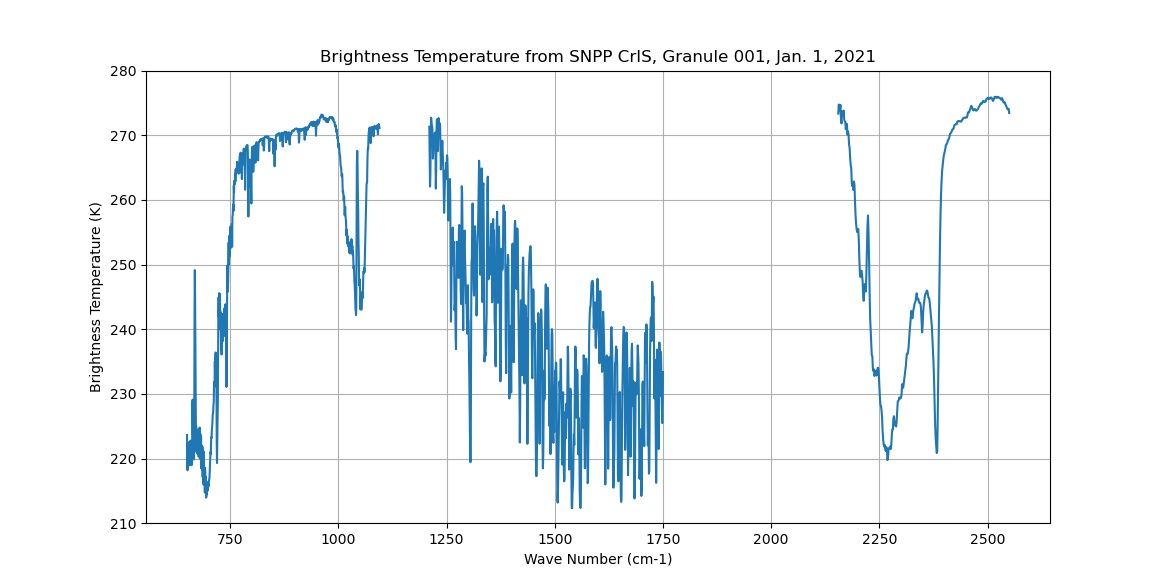
Sounder SIPS: Sun Synchronous 13:30 orbit Climate Hyperspectral InfraRed Product (CHIRP): Calibrated Radiances from S-NPP, V2 (SNDR13CHRP1SNCal) at GES DISC
National Aeronautics and Space Administration —
The Climate Hyperspectral Infrared Radiance Product (CHIRP) is a Level 1 radiance product derived from Atmospheric Infrared Sounder (AIRS) on EOS-AQUA and the Cross-... -
Federal
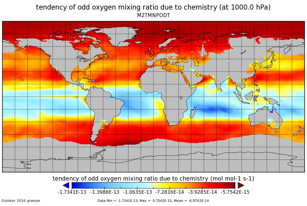
MERRA-2 tavgM_3d_odt_Np: 3d,Monthly mean,Time-Averaged,Pressure-Level,Assimilation,Ozone Tendencies 0.625 x 0.5 degree V5.12.4 (M2TMNPODT) at GES DISC
National Aeronautics and Space Administration —
M2TMNPODT (or tavgM_3d_odt_Np) is a 3-dimensional monthly mean data collection in Modern-Era Retrospective analysis for Research and Applications version 2 (MERRA-2).... -
Federal
GLDAS Noah Land Surface Model L4 monthly 0.25 x 0.25 degree V2.0 (GLDAS_NOAH025_M) at GES DISC
National Aeronautics and Space Administration —
NASA Global Land Data Assimilation System Version 2 (GLDAS-2) has three components: GLDAS-2.0, GLDAS-2.1, and GLDAS-2.2. GLDAS-2.0 is forced entirely with the... -
Federal
GLDAS Noah Land Surface Model L4 monthly 1.0 x 1.0 degree V2.0 (GLDAS_NOAH10_M) at GES DISC
National Aeronautics and Space Administration —
NASA Global Land Data Assimilation System Version 2 (GLDAS-2) has three components: GLDAS-2.0, GLDAS-2.1, and GLDAS-2.2. GLDAS-2.0 is forced entirely with the... -
Federal
OCO-3 Level 1A collated, parsed, calibration data V11 (OCO2_L1aIn_Pixel) at GES DISC
National Aeronautics and Space Administration —
Version 11 is the current version of the data set. Older versions will no longer be available and are superseded by Version 11. The Orbiting Carbon Observatory is the... -
Federal
Sentinel-5P TROPOMI Radiance product band 6 (NIR detector) L1B V1 (S5P_L1B_RA_BD6) at GES DISC
National Aeronautics and Space Administration —
Starting from August 6th in 2019, Sentinel-5P TROPOMI along-track high spatial resolution (~5.5km at nadir) has been implemented. For data after August 6th of 2019,... -
Federal
Carbon Monitoring System Lake Superior Primary Production Yearly V1 (CMSLakeSuperiorPPY) at GES DISC
National Aeronautics and Space Administration —
Yearly Average primary production/carbon fixation data for Lake Superior. The primary production data is derived using MODIS imagery with model data. The NASA Carbon... -
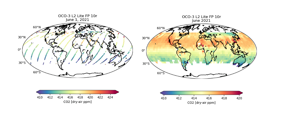
Federal
OCO-3 Level 2 bias-corrected XCO2 and other select fields from the full-physics retrieval aggregated as daily files, Retrospective processing V11r (OCO3_L2_Lite_FP) at GES DISC
National Aeronautics and Space Administration —
Version 11r is the current version of the data set. Older versions will no longer be available and are superseded by Version 11r. The Orbiting Carbon Observatory -3... -
Federal
AIRS/Aqua L1B Near Real Time (NRT) AMSU (A1/A2) geolocated and calibrated brightness temperatures V005 (AIRABRAD_NRT) at GES DISC
National Aeronautics and Space Administration —
The AMSU-A Level 1B Near Real Time (NRT) product (AIRABRAD_NRT_005) differs from the routine product (AIRABRAD_005) in 2 ways to meet the three hour latency... -
Federal
Aqua AIRS-MLS Matchup Indexes V1.0 (AIRS_MLS_IND) at GES_DISC
National Aeronautics and Space Administration —
This dataset is part of MEaSUREs 2012 Program, and represent Aqua/AIRS-Aura/MLS collocation indexes, in netCDF-4 format. These data map AIRS profile indexes to those...

Official websites use .gov
A
.gov website belongs to an official government
organization in the United States.
Secure .gov websites use HTTPS
A
lock (
) or https:// means you’ve safely connected to
the .gov website. Share sensitive information only on official,
secure websites.