
-
Federal
Satellite Laser Ranging (SLR) Predictions from NASA CDDIS
National Aeronautics and Space Administration —
Predicted satellite orbits for Satellite Laser Ranging (SLR) tracking of satellites equipped with corner cube retroreflectors. SLR stations download these prediction... -
Federal
MLS/Aura Level 3 Daily Binned Ozone (O3) Mixing Ratio on Assorted Grids V005 (ML3DBO3) at GES DISC
National Aeronautics and Space Administration —
ML3DBO3 is the EOS Aura Microwave Limb Sounder (MLS) daily binned on various vertical grids product for ozone (O3) derived from radiances measured by the 240 GHz... -
Federal
MLS/Aura Level 3 Daily Binned Chlorine Monoxide (ClO) Mixing Ratio on Assorted Grids V005 (ML3DBCLO) at GES DISC
National Aeronautics and Space Administration —
ML3DBCLO is the EOS Aura Microwave Limb Sounder (MLS) daily binned on various vertical grids product for chlorine monoxide (ClO) derived from radiances measured... -
Federal
MISR Level 3 FIRSTLOOK Component Global Radiance Product covering a month V002
National Aeronautics and Space Administration —
This file contains the MISR Level 3 FIRSTLOOK Component Global Radiance Product covering a month. MI3MRDF_002 is the Multi-angle Imaging SpectroRadiometer (MISR)... -
Federal
Measurements onboard the Russian R/V Akademik Sergey Vavilov
National Aeronautics and Space Administration —
Measurements from the Barents Sea north of Russia made during 1998 by the Russian research vessel, the Akademik Sergey Vavilov. -
Federal
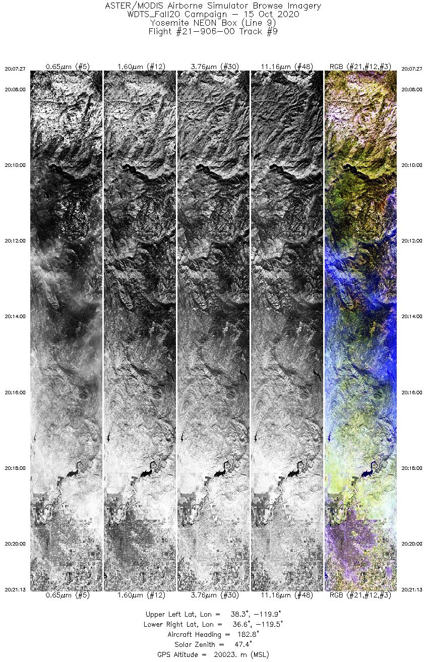
MASTER: Western Diversity Time Series Campaign, WDTS, California, USA, Fall 2020
National Aeronautics and Space Administration —
This dataset includes Level 1B (L1B) and Level 2 (L2) data products from the MODIS/ASTER Airborne Simulator (MASTER) instrument. The spectral data were collected as... -
Federal
MLS/Aura Level 2 Carbon Monoxide (CO) Mixing Ratio V004 (ML2CO) at GES DISC
National Aeronautics and Space Administration —
ML2CO is the EOS Aura Microwave Limb Sounder (MLS) standard product for carbon monoxide derived from radiances measured by the 640 GHz radiometer. The data version is... -
Federal
ECOSTRESS Cloud Mask Daily L2 Global 70m V001
National Aeronautics and Space Administration —
The ECO2CLD Version 1 data product was decommissioned on May 21, 2025. Users are encouraged to use theFederalECCO Ocean and Sea-Ice Surface Stress - Daily Mean 0.5 Degree (Version 4 Release 4)
National Aeronautics and Space Administration —
This dataset contains daily-averaged ocean and sea-ice surface stress interpolated to a regular 0.5-degree grid from the ECCO Version 4 revision 4 (V4r4) ocean and...FederalECCO Ocean Bottom Pressure - Daily Mean 0.5 Degree (Version 4 Release 4)
National Aeronautics and Space Administration —
This dataset contains daily-averaged ocean bottom pressure interpolated to a regular 0.5-degree grid from the ECCO Version 4 revision 4 (V4r4) ocean and sea-ice state...FederalDoppler Orbitography and Radiopositioning Integrated by Satellite (DORIS) RINEX data from NASA CDDIS
National Aeronautics and Space Administration —
The Doppler Orbitography by Radiopositioning Integrated on Satellite (DORIS) was developed by the Centre National d'Etudes Spatiales (CNES) with cooperation from...FederalCPEX-CV DC-8 Aircraft In-situ Cloud Data
National Aeronautics and Space Administration —
CPEXCV_Cloud_AircraftInSitu_DC8_Data is the in-situ cloud data collected during the Convective Processes Experiment - Cabo Verde (CPEX-CV) onboard the DC-8 aircraft....FederalDISCOVER-AQ California Deployment B-200 Aircraft In Situ Meteorological and Navigational Data
National Aeronautics and Space Administration —
DISCOVERAQ_California_MetNav_AircraftInSitu_B200_Data contains in situ meteorological and navigational data collected onboard NASA's B-200 aircraft during the...FederalNOAA-20 VIIRS Level-3 Global Mapped Normalized Difference Vegetation Index - Near Real-time (NRT) Data, version R2022.0
National Aeronautics and Space Administration —
The Ocean Biology DAAC produces near real-time (quicklook) products using the best-available combination of ancillary data from meteorological and ozone data. As...FederalNOAA-21 VIIRS Level-3 Global Binned Normalized Difference Vegetation Index - Near Real-time (NRT) Data, version R2022.0
National Aeronautics and Space Administration —
The Ocean Biology DAAC produces near real-time (quicklook) products using the best-available combination of ancillary data from meteorological and ozone data. As...FederalMODIS/Terra+Aqua BRDF/Albedo Parameter3 Band3 Daily L3 Global 30ArcSec CMG V006
National Aeronautics and Space Administration —
The MCD43D09 Version 6 data product was decommissioned on July 31, 2023. Users are encouraged to use the MCD43D09...FederalMODIS/Terra+Aqua BRDF/Albedo Parameter3 Band7 Daily L3 Global 30ArcSec CMG V061
National Aeronautics and Space Administration —
The MCD43D21 Version 6.1 Bidirectional Reflectance Distribution Function and Albedo (BRDF/Albedo) Model Parameter dataset is produced daily using 16 days of Terra and...FederalNOAA-20 VIIRS Level-3 Global Binned Triple-window Sea Surface Temperature (SST3) Data, version R2024.0
National Aeronautics and Space Administration —
The Visible and Infrared Imager/Radiometer Suite (VIIRS) is a multi-disciplinary instrument that is being flown on the Joint Polar Satellite System (JPSS) series of...9,607 datasets found

Official websites use .gov
A
.gov website belongs to an official government
organization in the United States.
Secure .gov websites use HTTPS
A
lock (
) or https:// means you’ve safely connected to
the .gov website. Share sensitive information only on official,
secure websites.