-
Federal
MOPITT CO gridded daily means (Thermal Infrared Radiances) V009
National Aeronautics and Space Administration —
MOP03T_9 is the Measurements Of Pollution In The Troposphere (MOPITT) Carbon Monoxide (CO) gridded daily means (Thermal Infrared Radiances) version 9 data product. It... -
Federal
ABoVE: High Resolution Cloud-Free Snow Cover Extent and Snow Depth, Alaska, 2001-2017
National Aeronautics and Space Administration —
This dataset provides estimates of maximum snow cover extent (SCE) and snow depth for each 8-day composite period from 2001 to 2017 at 1 km resolution across Alaska.... -
Federal
BOREAS TF-04 CO2 and CH4 Soil Profile Data from the SSA
National Aeronautics and Space Administration —
The BOREAS TF-04 team measured distributions of carbon dioxide (CO2) and methane (CH4) concentrations for the upper 5 meters of soil and unsaturated zone at the... -
Federal
LBA-ECO LC-07 Water Quality, CO2, Chlorophyll, Lago Curuai, Para, Brazil: 2003-2004
National Aeronautics and Space Administration —
This data set reports (1) concentrations of total, organic, and inorganic suspended solids; dissolved inorganic, and organic carbon; chlorophyll-a and (2)... -
Federal
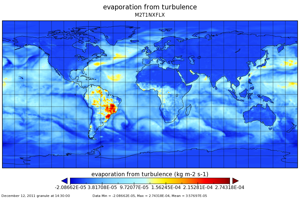
MERRA-2 tavg1_2d_flx_Nx: 2d,1-Hourly,Time-Averaged,Single-Level,Assimilation,Surface Flux Diagnostics 0.625 x 0.5 degree V5.12.4 (M2T1NXFLX) at GES DISC
National Aeronautics and Space Administration —
M2T1NXFLX (or tavg1_2d_flx_Nx) is an hourly time-averaged 2-dimensional data collection in Modern-Era Retrospective analysis for Research and Applications version 2... -
Federal
Pre-LBA CABARE Mapped Land Surface and Vegetation Characteristics, Rondonia, Brazil
National Aeronautics and Space Administration —
Surface parameter digital maps of vegetation, soil, and topography were obtained for Rondonia, Brazil, covering the 5x5 degree region bounded by 13-8 degrees S and... -
Federal
LBA-ECO LC-07 Methane and Carbon Dioxide Emissions from Balbina Reservoir, Brazil
National Aeronautics and Space Administration —
This data set provides flux measurements of methane (CH4) and carbon dioxide (CO2) from surface waters to the atmosphere. It also provides CH4, CO2, and oxygen (O2)... -
Federal
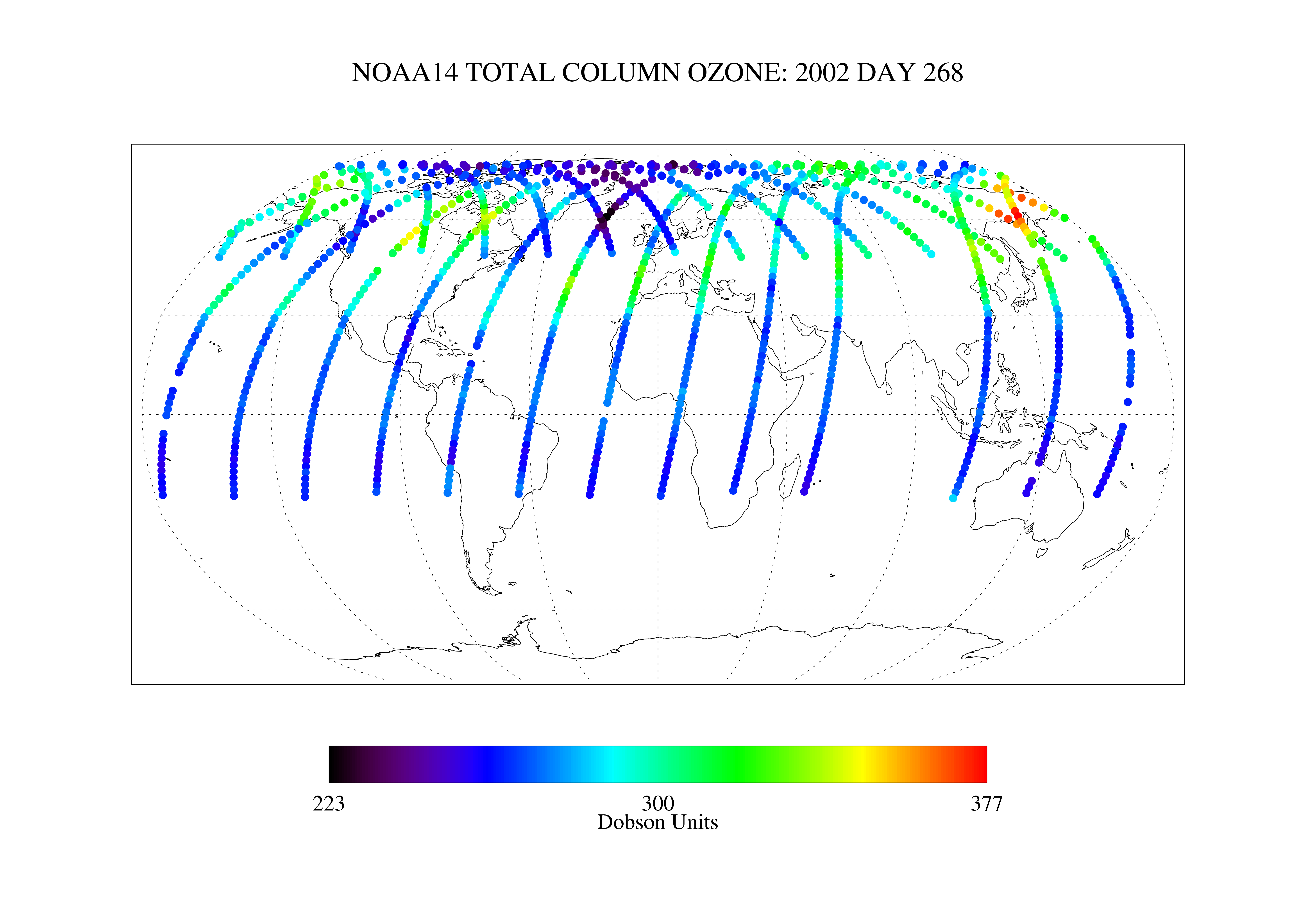
SBUV2/NOAA-14 Ozone (O3) Nadir Profile and Total Column 1 Day L2 V1 (SBUV2N14L2) at GES DISC
National Aeronautics and Space Administration —
The Solar Backscattered Ultraviolet (SBUV) from NOAA-14 Level-2 daily product (SBUV2N14L2) contains ozone nadir profile and total column data from retrievals... -
Federal
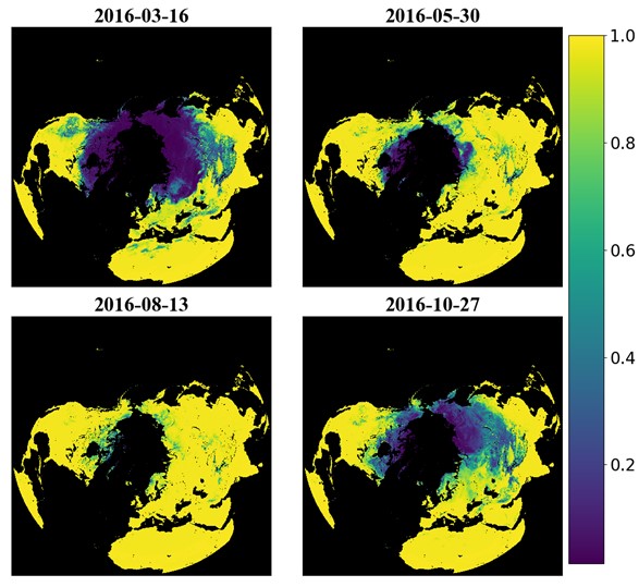
Probabilistic Freeze-Thaw Record for the Northern Hemisphere, 2016-2020
National Aeronautics and Space Administration —
This dataset provides a probabilistic freeze/thaw (FT) data record from 2016 to 2020 for the Northern Hemisphere derived using a deep learning model (U-Net). The... -
Federal
JPL SMAP Level 3 CAP Sea Surface Salinity Standard Mapped Image 8-Day Running Mean V5.0 Validated Dataset
National Aeronautics and Space Administration —
This is the PI-produced JPL SMAP-SSS V5.0 CAP, 8-day running mean, level 3 mapped, sea surface salinity (SSS) product from the NASA Soil Moisture Active Passive... -
Federal
GPM SAPHIR on MT1 (PRPS) Climate-based Radiometer Precipitation Profiling L3 1 day 0.25 x 0.25 degree V06 (GPM_3PRPSMT1SAPHIR_DAY_CLIM) at GES DISC
National Aeronautics and Space Administration —
The "CLIM" products differ from their "regular" counterparts (without the "CLIM" in the name) by the ancillary data they use. They are Climate-Reference products,... -
Federal
Polar Stereographic Valid Ice Masks Derived from National Ice Center Monthly Sea Ice Climatologies, Version 1
National Aeronautics and Space Administration —
These valid ice masks provide a way to remove spurious ice caused by residual weather effects and land spillover in passive microwave data. They are derived from the... -
Federal
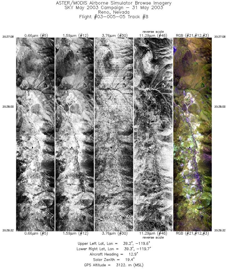
MASTER: Functional check flight, California-Nevada, May, 2003
National Aeronautics and Space Administration —
This dataset includes Level 1B (L1B) data products from the MODIS/ASTER Airborne Simulator (MASTER) instrument. The spectral data were collected during a single... -
Federal
GPM GROUND VALIDATION AUTONOMOUS PARSIVEL UNIT (APU) MC3E V1
National Aeronautics and Space Administration —
The GPM Ground Validation Autonomous Parsivel Unit (APU) MC3E dataset was collected by the Autonomous Parsivel Unit (APU), which is an optical disdrometer that... -
Federal
ABoVE: River Ice Breakup and Freeze-up Stages, Yukon River Basin, Alaska, 1972-2016
National Aeronautics and Space Administration —
This dataset provides estimates of river ice breakup and freeze-up stages along selected reaches of the Yukon and Tanana Rivers in the Yukon River Basin in interior... -
Federal
Tara Oceans Polar Circle 2013 Expedition
National Aeronautics and Space Administration —
Tara Oceans Polar Circle 2013 -
Federal
FIREX-AQ Analysis and Supplementary Data
National Aeronautics and Space Administration —
FIREXAQ_Analysis_Data are supplementary analysis and ancillary data collected during FIREX-AQ. This product includes plume ratios, and supplementary datasets... -
Federal
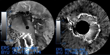
ERS-1 Gridded Level 3 Enhanced Resolution Sigma-0 from BYU
National Aeronautics and Space Administration —
This European Remote Sensing (ERS) Sigma-0 dataset is generated by the Scatterometer Climate Record Pathfinder (SCP) project at Brigham Young University (BYU) and is... -
Federal
Rock glaciers from Norway and Svalbard, Version 1
National Aeronautics and Space Administration —
A complete inventory of rock glaciers on mainland Norway and Svalbard has only been carried out in connection with coarse geomorphological mapping. The data presented... -
Federal
Sounder SIPS: JPSS-1 CrIMSS Level 2: Atmospheric state at Standard Pressure Levels derived from CLIMCAPS V2.1 (SNDRJ1IML2PLEVCPS) at GES DISC
National Aeronautics and Space Administration —
The CLIMCAPS (Community Long-term Infrared Microwave Coupled Product System) algorithm is used to analyze data from the Cross-track Infrared Sounder/Advanced...

Official websites use .gov
A
.gov website belongs to an official government
organization in the United States.
Secure .gov websites use HTTPS
A
lock (
) or https:// means you’ve safely connected to
the .gov website. Share sensitive information only on official,
secure websites.