
-
Federal
TIGER/Line Shapefile, 2021, County, Fresno County, CA, All Roads
U.S. Census Bureau, Department of Commerce —
The TIGER/Line shapefiles and related database files (.dbf) are an extract of selected geographic and cartographic information from the U.S. Census Bureau's Master... -
State
MediCal Dental FFS Provider Listing
State of California —
The dataset provides enrollment and geographic data for Fee-for-Service (FFS) providers enrolled in the Medi-Cal Dental program and Safety Net Clinics (SNCs) who... -
Federal
TIGER/Line Shapefile, 2021, County, Orange County, CA, All Roads
U.S. Census Bureau, Department of Commerce —
The TIGER/Line shapefiles and related database files (.dbf) are an extract of selected geographic and cartographic information from the U.S. Census Bureau's Master... -
Federal
2024 Cartographic Boundary File (KML), 119th Congressional Districts for California, 1:500,000
U.S. Census Bureau, Department of Commerce —
The 2024 cartographic boundary KMLs are simplified representations of selected geographic areas from the U.S. Census Bureau's Master Address File / Topologically... -
Federal
EnviroAtlas - Los Angeles, CA - Greenspace Proximity Gradient
U.S. Environmental Protection Agency —
In any given 1-square meter point in this EnviroAtlas dataset, the value shown gives the percentage of square meters of greenspace within 1/4 square kilometer... -
Federal
Channel Islands National Park Small-Scale Base GIS Data
Department of the Interior —
This data set contains small-scale base GIS data layers compiled by the National Park Service Servicewide Inventory and Monitoring Program and Water Resources... -
Federal
EnviroAtlas Green Space Proximity Gradient Web Service
U.S. Environmental Protection Agency —
This EnviroAtlas web service supports research and online mapping activities related to EnviroAtlas (https://www.epa.gov/enviroatlas). In any given 1-square meter... -
Federal
2022 Cartographic Boundary File (SHP), Current Secondary School District for California, 1:500,000
U.S. Census Bureau, Department of Commerce —
The 2022 cartographic boundary shapefiles are simplified representations of selected geographic areas from the U.S. Census Bureau's Master Address File /... -
Federal
2024 Cartographic Boundary File (SHP), Census Tract for California, 1:500,000
U.S. Census Bureau, Department of Commerce —
The 2024 cartographic boundary shapefiles are simplified representations of selected geographic areas from the U.S. Census Bureau's Master Address File /... -
Federal
EnviroAtlas - Fresno, CA - Domestic Water Demand per Day by U.S. Census Block Group
U.S. Environmental Protection Agency —
As included in this EnviroAtlas dataset, community level domestic water demand is calculated using locally available water use data per capita in gallons of water per... -
Federal
Near-real-time surface ocean velocities derived from HF-radar stations located along coastal waters of North Slope Alaska, Gulf of Alaska, Puerto Rico/Virgin Islands, eastern U.S./Gulf of America, Hawaii, Great Lakes, and western U.S.
National Oceanic and Atmospheric Administration, Department of Commerce —
This dataset contains near-real-time ocean surface velocities, also known as total vector velocities, derived from high-frequency (HF) radar stations. The velocities... -
Federal
TIGER/Line Shapefile, 2021, County, Tulare County, CA, All Roads
U.S. Census Bureau, Department of Commerce —
The TIGER/Line shapefiles and related database files (.dbf) are an extract of selected geographic and cartographic information from the U.S. Census Bureau's Master... -
Federal
TIGER/Line Shapefile, 2024, State, California, CA, Unified School Districts
U.S. Census Bureau, Department of Commerce —
The TIGER/Line shapefiles and related database files (.dbf) are an extract of selected geographic and cartographic information from the U.S. Census Bureau's Master... -
Federal
TIGER/Line Shapefile, 2021, County, San Diego County, CA, All Roads
U.S. Census Bureau, Department of Commerce —
The TIGER/Line shapefiles and related database files (.dbf) are an extract of selected geographic and cartographic information from the U.S. Census Bureau's Master... -
Federal
TIGER/Line Shapefile, 2023, State, California, CA, Block Group
U.S. Census Bureau, Department of Commerce —
The TIGER/Line shapefiles and related database files (.dbf) are an extract of selected geographic and cartographic information from the U.S. Census Bureau's Master... -
Federal
EnviroAtlas - Los Angeles, CA - Land Cover by Block Group
U.S. Environmental Protection Agency —
This EnviroAtlas dataset describes the breakdown of the land cover classes with each Census Block Group. In this community, forest is defined as Trees & Forest,... -
Federal
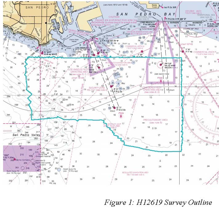
H12619: NOS Hydrographic Survey , Approaches to LA Long Beach, CA, 2013-11-03
National Oceanic and Atmospheric Administration, Department of Commerce —
The National Oceanic and Atmospheric Administration (NOAA) has the statutory mandate to collect hydrographic data in support of nautical chart compilation for safe... -
Federal
TIGER/Line Shapefile, 2021, County, San Benito County, CA, All Roads
U.S. Census Bureau, Department of Commerce —
The TIGER/Line shapefiles and related database files (.dbf) are an extract of selected geographic and cartographic information from the U.S. Census Bureau's Master... -
Federal
Rangeland Condition Monitoring Assessment and Projection (RCMAP) Annual Herbaceous Fractional Component Time-Series Across the Western U.S. 1985-2021
Department of the Interior —
The RCMAP (Rangeland Condition Monitoring Assessment and Projection) dataset quantifies the percent cover of rangeland components across the western U.S. using... -
Federal
2022 Cartographic Boundary File (KML), Current County Subdivision for California, 1:500,000
U.S. Census Bureau, Department of Commerce —
The 2022 cartographic boundary KMLs are simplified representations of selected geographic areas from the U.S. Census Bureau's Master Address File / Topologically...

Official websites use .gov
A
.gov website belongs to an official government
organization in the United States.
Secure .gov websites use HTTPS
A
lock (
) or https:// means you’ve safely connected to
the .gov website. Share sensitive information only on official,
secure websites.