
-
Federal
MERRA-2 tavg3_3d_cld_Nv: 3d,3-Hourly,Time-Averaged,Model-Level,Assimilation,Cloud Diagnostics 0.625 x 0.5 degree V5.12.4 (M2T3NVCLD) at GES DISC
National Aeronautics and Space Administration —
M2T3NVCLD (or tavg3_3d_cld_Nv) is a 3-dimensional 3-hourly time averaged data collection in Modern-Era Retrospective analysis for Research and Applications version 2... -
Federal
Cross-track Infrared Sounder (CrIS) Level 2 Earth System Science Profiling Algorithm Ammonia Retrieval Algorithm (ESSPA-NH3) V1 (SNDRSNIL2ESPNH3)
National Aeronautics and Space Administration —
The objective of this limited edition data collection is to examine the ammonia products generated by the ESSPA (Earth System Science Profiling Algorithm) algorithm... -
Federal
NLDAS Primary Forcing Data L4 Hourly 0.125 x 0.125 degree V2.0 (NLDAS_FORA0125_H) at GES DISC
National Aeronautics and Space Administration —
This data set contains the primary forcing hourly data "File A" for Phase 2 of the North American Land Data Assimilation System (NLDAS-2). The data are in 1/8th... -
Federal
OCO-2 Level 2 geolocated XCO2 retrievals results, physical model, Retrospective Processing V10r (OCO2_L2_Standard) at GES DISC
National Aeronautics and Space Administration —
Version 10r is the current version of the data set. Older versions will no longer be available and are superseded by Version 10r. In early 2021, the OCO Team... -
Federal
TRMM Radar Rain Distributions L3 1 month 5 degree x 5 degree V7 (TRMM_3A26) at GES DISC
National Aeronautics and Space Administration —
The new version of these data is in GPM-like format (consistent with the GPM Dual-frequency Radar data format), and can be found under the name GPM_3PR. This dataset... -
Federal
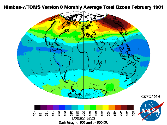
TOMS Nimbus-7 Total Column Ozone Monthly L3 Global 1 deg x 1.25 deg Lat/Lon Grid V008 (TOMSN7L3mtoz) at GES DISC
National Aeronautics and Space Administration —
This Nimbus-7 Total Ozone Mapping Spectrometer (TOMS) version 8 monthly averaged global gridded data product contains total column ozone values. The data are mapped... -
Federal
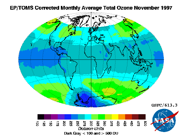
TOMS Earth Probe Total Column Ozone Monthly L3 Global 1 deg x 1.25 deg Lat/Lon Grid V008 (TOMSEPL3mtoz) at GES DISC
National Aeronautics and Space Administration —
This Earth Probe (EP) Total Ozone Mapping Spectrometer (TOMS) version 8 monthly averaged global gridded data product contains total column ozone values. The data are... -
Federal
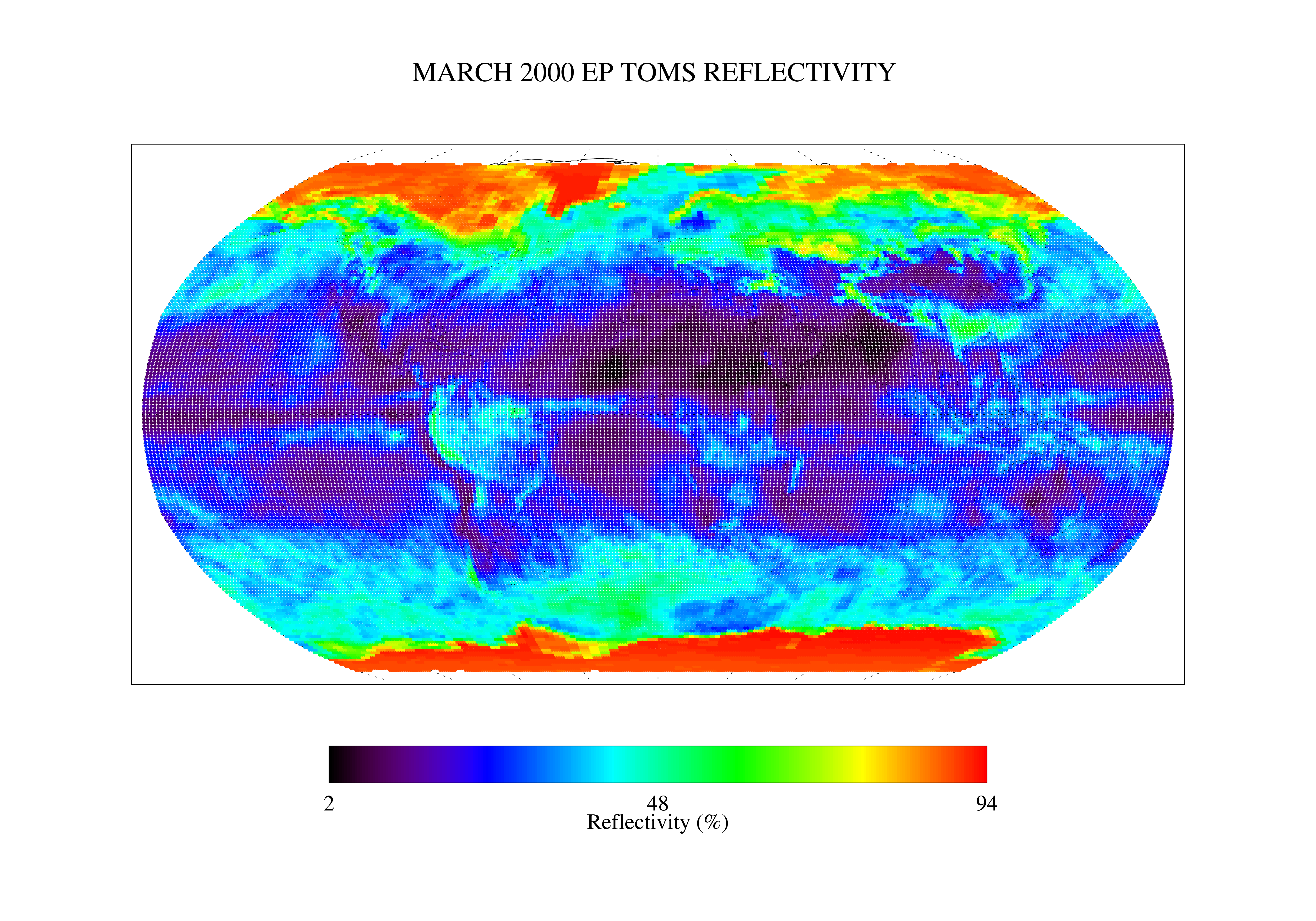
TOMS Earth Probe UV Reflectivity Monthly L3 Global 1 deg x 1.25 deg Lat/Lon Grid V008 (TOMSEPL3mref) at GES DISC
National Aeronautics and Space Administration —
This Earth Probe (EP) Total Ozone Mapping Spectrometer (TOMS) version 8 monthly averaged global gridded data product contains Lambertian effective surface... -
Federal
TRMM Ground Validation Calibrated QC Radar Reflectivity Full Volume Scan L1C 1 hour V7 (TRMM_1C51UW) at GES DISC
National Aeronautics and Space Administration —
This dataset is part of the University of Washington TRMM Ground Validation products. Files are in "Universal Format", described in BAMS, Vol 61, No 11, November... -
Federal
GPM SSMIS on F17 (GPROF) Radiometer Precipitation Profiling L3 1 day 0.25 degree x 0.25 degree V07 (GPM_3GPROFF17SSMIS_DAY) at GES DISC
National Aeronautics and Space Administration —
Version 07 is the current version of the data set. Older versions will no longer be available and have been superseded by Version 07. 3GPROF products provide global... -
Federal
GPM AMSUB on NOAA15 (GPROF) Climate-based Radiometer Precipitation Profiling L3 1 day 0.25 degree x 0.25 degree V07 (GPM_3GPROFNOAA15AMSUB_DAY_CLIM) at GES DISC
National Aeronautics and Space Administration —
The "CLIM" products differ from their "regular" counterparts (without the "CLIM" in the name) by the ancillary data they use. They are Climate-Reference products,... -
Federal
Carbon Monitoring System Carbon Flux Ocean Prior L4 V3 (CMSFluxOceanPrior)
National Aeronautics and Space Administration —
This dataset provides the Prior for the Carbon Flux for Ocean. The NASA Carbon Monitoring System (CMS) is designed to make significant contributions in... -
Federal
GPM GMI (GPROF) Climate-based Radiometer Precipitation Profiling L2A 1.5 hours 4 km x 4 km V07 (GPM_2AGPROFGPMGMI_CLIM) at GES DISC
National Aeronautics and Space Administration —
Version 07 is the current version of the data set. Older versions will no longer be available and have been superseded by Version 07. The 'CLIM' products differ from... -
Federal
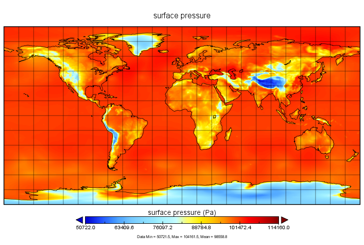
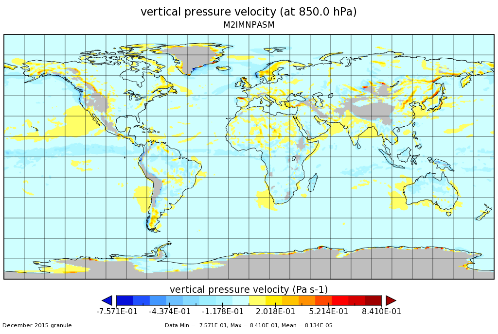
MERRA-2 instM_3d_asm_Np: 3d,Monthly mean,Instantaneous,Pressure-Level,Assimilation,Assimilated Meteorological Fields 0.625 x 0.5 degree V5.12.4 (M2IMNPASM) at GES DISC
National Aeronautics and Space Administration —
M2IMNPASM (or instM_3d_asm_Np) is an instantaneous 3-dimensional monthly mean data collection in Modern-Era Retrospective analysis for Research and Applications... -
Federal
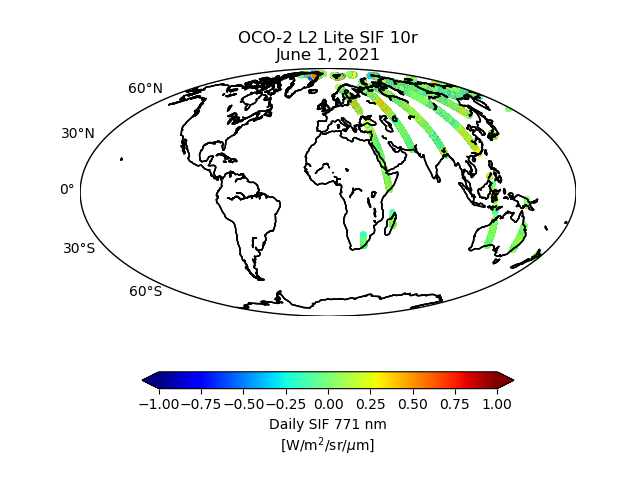
OCO-2 Level 2 bias-corrected solar-induced fluorescence and other select fields from the IMAP-DOAS algorithm aggregated as daily files, Retrospective processing V10r (OCO2_L2_Lite_SIF) at GES DISC
National Aeronautics and Space Administration —
Version 10r is the current version of the data set. Older versions will no longer be available and are superseded by Version 10r. The OCO-2 SIF Lite files contain... -
Federal
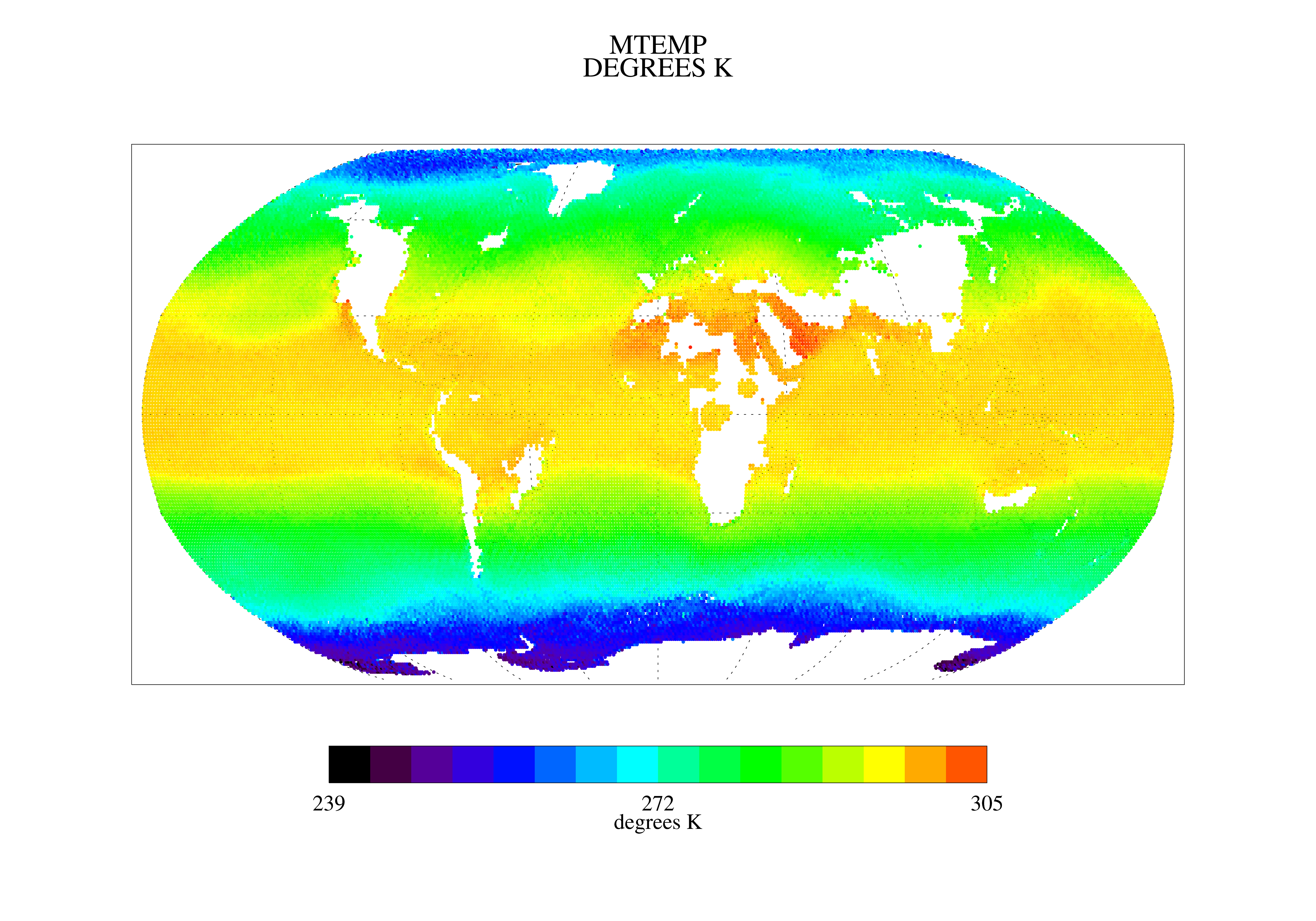
TOVS LMD MONTHLY GRIDS from NOAA-12 V01 (TOVSBMND) at GES DISC
National Aeronautics and Space Administration —
Level 3 parameters from HIRS/2 and MSU radiances using the Improved Initialization Inversion (3I) classification retrieval scheme by the Laboratoire de Meteorologie... -
Federal
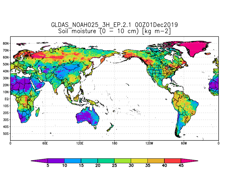
GLDAS Noah Land Surface Model L4 3 hourly 0.25 x 0.25 degree Early Product V2.1 (GLDAS_NOAH025_3H_EP) at GES DISC
National Aeronautics and Space Administration —
NASA Global Land Data Assimilation System Version 2 (GLDAS-2) has three components: GLDAS-2.0, GLDAS-2.1, and GLDAS-2.2. GLDAS-2.0 is forced entirely with the... -
Federal
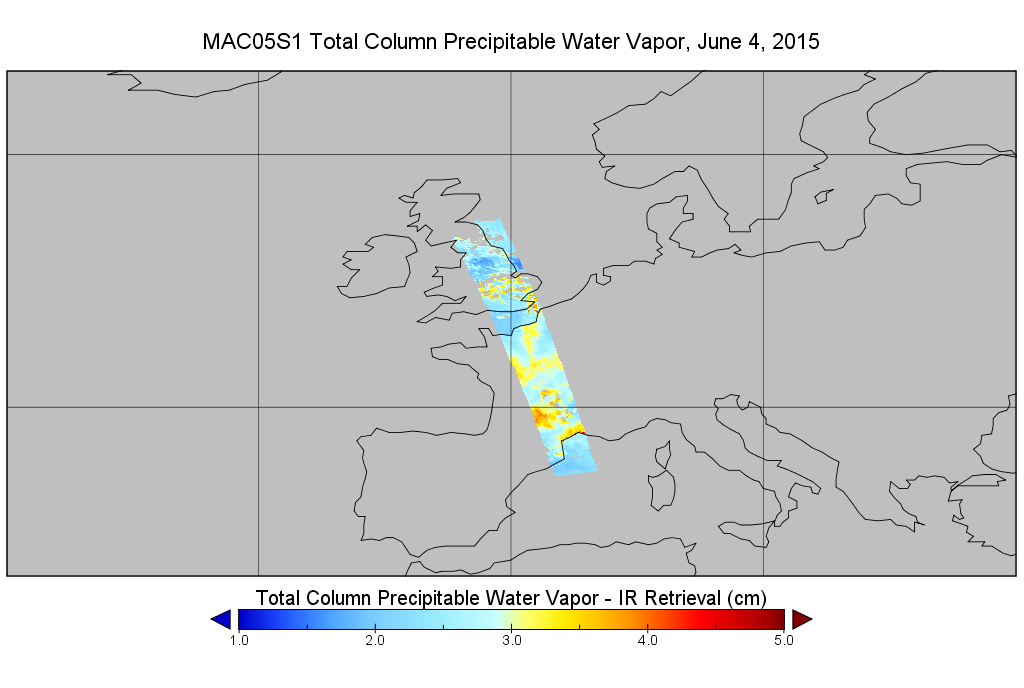
MODIS/Aqua Total Precip Water Vapor 1km and 5km 5-Min L2 Swath Subset along MLS V002 (MAM05S0) at GES DISC
National Aeronautics and Space Administration —
This is the MODIS/Aqua subset along MLS field of view track. The goal of the subset is to select and return MODIS data that are within +-100 km across the MLS track.... -
Federal
Sentinel-6 NASA/JPL GNSS-RO Near-Real-Time Level 1B V1 (S6A_RO_1B_NRT_NC__) at GES DISC
National Aeronautics and Space Administration —
This dataset provides the L1B Global Navigation Satellite System (GNSS) Radio-Occultation (RO) Near-Real-Time (NRT) retrieval generated by NASA's Jet Propulsion... -
Federal
Sounder SIPS: Suomi NPP CrIMSS Level 2 CHART Normal Spectral Resolution: Atmosphere, cloud and surface geophysical state V1
National Aeronautics and Space Administration —
The objective of this limited edition data collection is to examine products generated by the Climate Heritage AIRS Retrieval Technique (CHART) algorithm to analyze...

Official websites use .gov
A
.gov website belongs to an official government
organization in the United States.
Secure .gov websites use HTTPS
A
lock (
) or https:// means you’ve safely connected to
the .gov website. Share sensitive information only on official,
secure websites.