
-
Federal
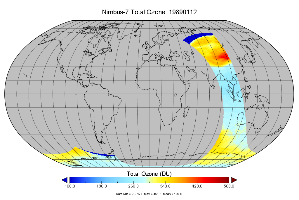
TOMS Nimbus-7 Ozone (O3) Total Column 1-Orbit L2 Swath 50 km x 50 km V008 (TOMSN7L2) at GES DISC
National Aeronautics and Space Administration —
The Nimbus-7 Total Ozone Mapping Spectrometer (TOMS) version 8 orbital swath data product contains total column ozone, UV aerosol index, and Lambertian effective... -
Federal
VIIRSN, Suomi-NPP, Level-3 SMI, NASA, Global, 4km, Reflectance at 671 nm, v2016, 2012-2017, Daily, DEPRECATED, Lon0360
National Oceanic and Atmospheric Administration, Department of Commerce —
THIS VERSION WAS DISCONTINUED on 2017-12-01. SEE THE NEW erdVH2018 DATASETS. Level-3 Standard Mapped Image (SMI), Global, 4km, Remote Sensing Reflectance at 671 nm,... -
Federal
Remote Sensing Reflectance at 667 nm, Aqua MODIS, NPP, Gulf of Mexico, 2002-2012 (Monthly Composite), Lon0360
National Oceanic and Atmospheric Administration, Department of Commerce —
MODIS measures the remote sensing reflectance (Rrs) at 667nm. This can be used to view very high concentrations of phytoplankton in the very surface of the water. -
Federal
Remote Sensing Reflectance at 667 nm, Terra MODIS, NPP, Global, 2000-2013, Science Quality (Monthly Composite)
National Oceanic and Atmospheric Administration, Department of Commerce —
MODIS measures the remote sensing reflectance (Rrs) at 667nm. This can be used to view very high concentrations of phytoplankton in the very surface of the water. -
Federal
Field spectra from an experiment conducted at the USGS Columbia Environmental Research Center, Columbia, MO, on April 2, 2019
Department of the Interior —
This child data release includes field spectra and in situ measurements of turbidity and Rhodamine WT dye concentration acquired during an experiment performed at the... -
Federal
VIIRSN, Suomi-NPP, Level-3 SMI, Global, 4km, Reflectance at 671 nm, 2012-2016, Daily, DEPRECATED
National Oceanic and Atmospheric Administration, Department of Commerce —
DEPRECATED 2016-04-01 - SEE THE NEW erdVH2018 VERSION. Level-3 Standard Mapped Image (SMI), Global, 4km, Remote Sensing Reflectance at 671 nm, Daily composite data... -
Federal
C-HARM v2 3-Day Forecast, Pseudo-nitzschia, cellular domoic acid, and particular domoic acid probability, California and Southern Oregon coast, 2022-present, Lon+/-180
National Oceanic and Atmospheric Administration, Department of Commerce —
The C-HARM model generates nowcast and forecasts of the probability of Pseudo-nitzschia concentrations of in excess of 10,000 cells/L, the probability of particulate... -
Federal
Remote Sensing Reflectance at 667 nm, Aqua MODIS, NPP, East US, 2002-2012 (1 Day Composite), Lon0360
National Oceanic and Atmospheric Administration, Department of Commerce —
MODIS measures the remote sensing reflectance (Rrs) at 667nm. This can be used to view very high concentrations of phytoplankton in the very surface of the water. -
Federal
Jornada Basin LTER: Wireless meteorological station at NPP T-EAST site: 30-minute summary data: 2013 - ongoing
Department of Agriculture —
30-minute summary data at NPP P-TOBO met station. Average air temperature, relative humidity, wind speed, wind direction, and solar radiation are measured and... -
Federal
ESA CCI Ocean Colour Product (CCI ALL-v5.0-5DAY), 0.04166666°, 1997-present
National Oceanic and Atmospheric Administration, Department of Commerce —
Data products generated by the Ocean Colour component of the European Space Agency Climate Change Initiative project. These files are 5 day composites of merged... -
Federal
Field Spectra from the upper Sacramento River in northern California, September 11-14, 2017
Department of the Interior —
Field spectra were collected from a reach of the upper Sacramento River in northern California, September 11-14, 2017, to support research on remote sensing of... -
Federal
NOAA Climate Data Record (CDR) of VIIRS Surface Reflectance, Version 1
National Oceanic and Atmospheric Administration, Department of Commerce —
This dataset contains gridded daily surface reflectance and brightness temperatures derived from the Visible Infrared Imaging Radiometer Suite (VIIRS) sensors onboard... -
Federal
C-HARM v2 2-Day Forecast, Pseudo-nitzschia, cellular domoic acid, and particular domoic acid probability, California and Southern Oregon coast, 2022-present
National Oceanic and Atmospheric Administration, Department of Commerce —
The C-HARM model generates nowcast and forecasts of the probability of Pseudo-nitzschia concentrations of in excess of 10,000 cells/L, the probability of particulate... -
Federal
C-HARM v1 Nowcast, Pseudo-nitzschia, cellular domoic acid, and particular domoic acid probability, California and Southern Oregon coast, 2018-2022, Lon+/-180
National Oceanic and Atmospheric Administration, Department of Commerce —
The C-HARM model generates nowcast and forecasts of the probability of Pseudo-nitzschia concentrations of in excess of 10,000 cells/L in California and Southern... -
Federal
NOAA Climate Data Record (CDR) of Gridded Satellite Data from ISCCP B1 (GridSat-B1) Infrared Channel Brightness Temperature, Version 1 (Version Superseded)
National Oceanic and Atmospheric Administration, Department of Commerce —
Note: This dataset version has been superseded by a newer version. It is highly recommended that users access the current version. Users should only use this... -
Federal
Remote Sensing Reflectance at 667 nm, Aqua MODIS, NPP, Gulf of Mexico, 2002-2012 (Monthly Composite)
National Oceanic and Atmospheric Administration, Department of Commerce —
MODIS measures the remote sensing reflectance (Rrs) at 667nm. This can be used to view very high concentrations of phytoplankton in the very surface of the water. -
Federal
2010 North American Land Cover 30-Meter
Department of Agriculture —
The 2010 North American Land Cover 30-meter dataset was produced as part of the North American Land Change Monitoring System (NALCMS), a trilateral effort between... -
Federal
ESA CCI Ocean Colour Product (CCI ALL-v5.0-DAILY), 0.04166666°, 1997-present, Lon0360
National Oceanic and Atmospheric Administration, Department of Commerce —
Data products generated by the Ocean Colour component of the European Space Agency Climate Change Initiative project. These files are daily composites of merged... -
Federal
ESA CCI Ocean Colour Product (CCI ALL-v3.1-MONTHLY), 0.04166666°, 1997-2018, Lon0360
National Oceanic and Atmospheric Administration, Department of Commerce —
Data products generated by the Ocean Colour component of the European Space Agency Climate Change Initiative project. These files are monthly composites of merged... -
Federal
Hyperspectral and RGB images acquired during an experiment conducted at the USGS Columbia Environmental Research Center, Columbia, MO, on April 2, 2019
Department of the Interior —
This child data release includes hyperspectral and RGB images acquired from an Unmanned Aircraft System (UAS) during an experiment performed at the USGS Columbia...

Official websites use .gov
A
.gov website belongs to an official government
organization in the United States.
Secure .gov websites use HTTPS
A
lock (
) or https:// means you’ve safely connected to
the .gov website. Share sensitive information only on official,
secure websites.