

167 datasets found
-
Federal
Fracture Sustainability Pressure, Temperature, Differential Pressure, and Aperture Closure Data
Department of Energy —
In these data sets, the experiment time, actual date and time, room temperature, sample temperature, upstream and downstream pressures (measured independently),... -
State
Bedrock-geologic map, Alaska Highway corridor, Little Gerstle River to Dot Lake, Alaska
State of Alaska —
Preliminary Interpretive Report 2019-1, Bedrock-geologic map, Alaska Highway corridor, Little Gerstle River to Dot Lake, Alaska, shows the distribution of bedrock... -
Federal
TIGER/Line Shapefile, Current, County, Granite County, MT, Topological Faces (Polygons With All Geocodes)
U.S. Census Bureau, Department of Commerce —
The TIGER/Line shapefiles and related database files (.dbf) are an extract of selected geographic and cartographic information from the U.S. Census Bureau's Master... -
Federal
TIGER/Line Shapefile, Current, County, Granite County, MT, Topological Faces-Area Hydrography Relationship File
U.S. Census Bureau, Department of Commerce —
The TIGER/Line shapefiles and related database files (.dbf) are an extract of selected geographic and cartographic information from the U.S. Census Bureau's Master... -
State
LA-ICP-MS uranium lead geochronologic data of zircon from igneous and meta-igneous rocks in the Mount Harper project area, Eagle, Tanacross, Mount Hayes, and Big Delta quadrangles, Alaska
State of Alaska —
LA-ICP-MS uranium lead geochronologic data of zircon from igneous and meta-igneous rocks in the Mount Harper project area, Eagle, Tanacross, Mount Hayes, and Big... -
Federal
USU Camas-1 Test Well: Documentation
Department of Energy —
This submission contains documents that describe the USU Camas-1 test well, drilled in Camas Prairie, Idaho, in Fall 2018 and Fall 2019. The purpose of this well is... -
Federal
Utah FORGE: Results of Direct Shear Tests on Saturated Joints in Sierra White Granite
Department of Energy —
This dataset includes an Excel file with the results of direct shear tests to investigate the mechanical and geophysical response of saturated joints. Tests were... -
State
Field station locations and magnetic susceptibility data collected in 2022 for the Mount Harper project, Eagle, Big Delta, and Mount Hayes quadrangles, Alaska
State of Alaska —
Field station locations and magnetic susceptibility data collected in 2022 for the Mount Harper project, Eagle, Big Delta, and Mount Hayes quadrangles, Alaska, Raw... -
Federal
Shear Induced Permeability Test: Stripa Granite Temperature Pressure and Displacement Data
Department of Energy —
Spreadsheet containing the raw measured data, calibrated data, and brief explanation of data for Test1 Stripa Granite Geomechanical/Geochemical Test. Stress on... -
State
Geologic map of the Kechumstuk fault zone in the Mount Veta area, Fortymile mining district, east-central Alaska
State of Alaska —
Scientific Investigations Map 3291, Geologic map of the Kechumstuk fault zone in the Mount Veta area, Fortymile mining district, east-central Alaska, provides... -
State
Geology and geochemistry of the Inmachuk River map area, Seward Peninsula, Alaska
State of Alaska —
Geology and geochemistry of the Inmachuk River map area, Seward Peninsula, Alaska, Geologic Report 23, presents a geological overview of the Inmachuk map area, a... -
Federal
TIGER/Line Shapefile, 2024, County, Granite County, MT, Feature Names Relationship File
U.S. Census Bureau, Department of Commerce —
The TIGER/Line shapefiles and related database files (.dbf) are an extract of selected geographic and cartographic information from the U.S. Census Bureau's Master... -
State
Bedrock-geologic map, Alaska Highway corridor, Dot Lake to Tetlin Junction, Alaska
State of Alaska —
Preliminary Interpretive Report 2019-2, Bedrock-geologic map, Alaska Highway corridor, Dot Lake to Tetlin Junction, Alaska, shows the distribution of bedrock units... -
Federal
Purdue University: Results of B-Value Tests for Rock Saturation
Department of Energy —
This dataset includes an Excel file with the results of B-value tests to determine the magnitude of the back pressure required for full saturation of Sierra White... -
Federal
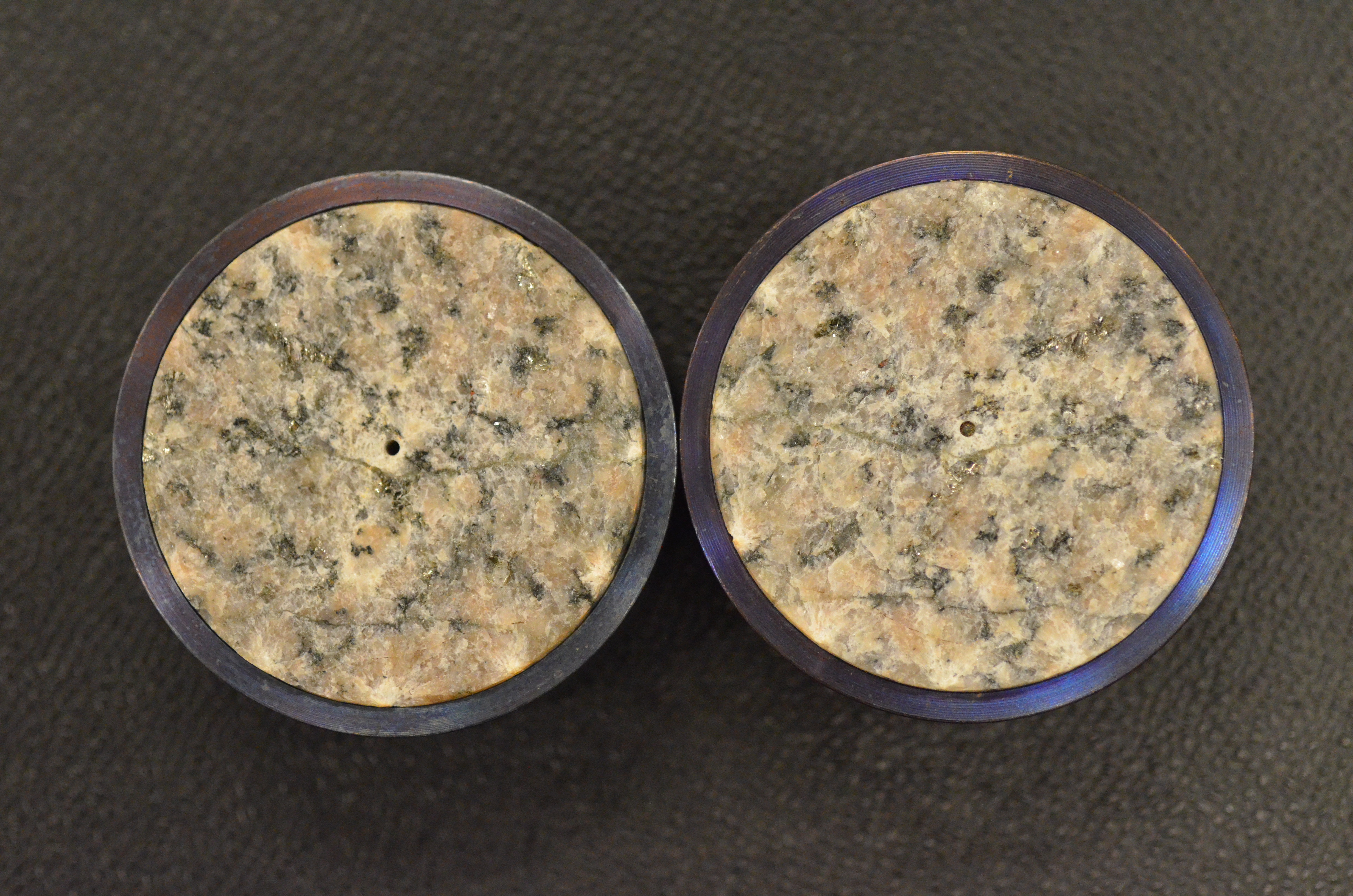
Images of Fracture Sustainability Test on Stripa Granite
Department of Energy —
Images of the Stripa Granite core before and after the fracture sustainability test. Photos of fracture faces of Stripa Granite core. -
Federal
Data of High-Temperature Dynamic LCM Testing Setup
Department of Energy —
Data from high temperature dynamic sealing tests for various fracture widths, at various temperatures (degrees F), with 5 wt.% bentonite-based mud containing various... -
Federal
Geologic Map of the Greenville 1 degree x 2 degree Quadrangle, South Carolina, Georgia, and North Carolina
Department of the Interior —
Regional geologic investigations show that all the metamorphosed crystalline rocks underlying the Greenville 1 degree x 2 degree quadrangle are allochthonous.... -
Federal
Laboratory Evaluation of EGS Shear Stimulation-Test 001
Department of Energy —
This is the results of an initial setup-shakedon test in order to develop the plumbing system for this test design. a cylinder of granite with offset holes was... -
State
Geochemical data from samples collected in 2020 and 2021 for the Western Tanacross project, Tanacross Quadrangle, Alaska
State of Alaska —
During the 2021 field season, geologists from the Alaska Division of Geological & Geophysical Surveys (DGGS) conducted 1:100,000-scale bedrock geologic mapping of... -
Federal
Geodatabase for the Preliminary Geologic Map of the Cherry Hill Quadrangle, Dinwiddie, Sussex, and Greensville Counties, Virginia
Department of the Interior —
The database for the Preliminary Geologic Map of the Cherry Hill Quadrangle, Dinwiddie, Sussex, and Greensville Counties, Virginia geographically straddles the...
167 datasets found