
-
Federal
GPM SSMI on F08 (GPROF) Climate-based Radiometer Precipitation Profiling L3 1 day 0.25 degree x 0.25 degree V07 (GPM_3GPROFF08SSMI_DAY_CLIM) at GES DISC
National Aeronautics and Space Administration —
Version 7 is the current version of the data set. Older versions will no longer be available and have been superseded by the current version. The "CLIM" products... -
Federal
GPM MHS on NOAA18 (GPROF) Radiometer Precipitation Profiling L3 1 month 0.25 degree x 0.25 degree V07 (GPM_3GPROFNOAA18MHS_CLIM) at GES DISC
National Aeronautics and Space Administration —
Version 07 is the current version of the data set. Older versions are no longer available and have been superseded by Version 07. The "CLIM" products differ from... -
Federal
TOVS GLA 5 DAY GRIDS from NOAA-9 V01 (TOVSA5NF) at GES DISC
National Aeronautics and Space Administration —
This dataset (TOVSA5NF) contains the TIROS Operational Vertical Sounder (TOVS) level 3 geophysical parameters derived using data from NOAA-9 and the physical... -
Federal
UARS PEM Level 2 VMAG AC V001 (UARPE2VMAGAC) at GES DISC
National Aeronautics and Space Administration —
The Particle Environment Monitor (PEM) level 2 Vector Magnetometer (VMAG) AC daily product contains the Vector Magnetic Field AC component. PEM was flown on the UARS... -
Federal
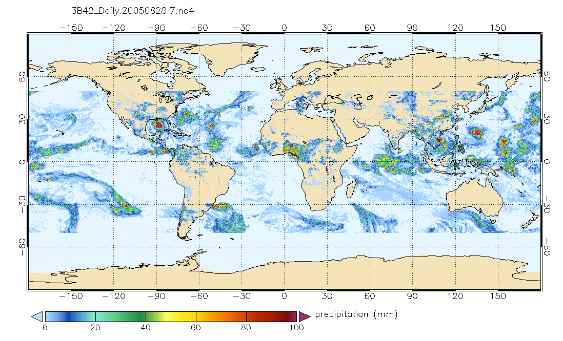
TRMM (TMPA) Precipitation L3 1 day 0.25 degree x 0.25 degree V7 (TRMM_3B42_Daily) at GES DISC
National Aeronautics and Space Administration —
TMPA (3B42_Daily) dataset have been discontinued as of Dec. 31, 2019, and users are strongly encouraged to shift to the successor IMERG dataset (doi:... -
Federal
TOVS GLA DAILY GRIDS from NOAA-9 V01 (TOVSADNF) at GES DISC
National Aeronautics and Space Administration —
This dataset (TOVSADNF) contains the TIROS Operational Vertical Sounder (TOVS) level 3 geophysical parameters derived using data from NOAA-9 and the physical... -
Federal
TROPESS CrIS-SNPP L2 Ammonia for West Coast Fires, Standard Product V1 (TRPSDL2NH3CRSWCF) at GES DISC
National Aeronautics and Space Administration —
The TROPESS CrIS-SNPP L2 Ammonia for West Coast Fires, Standard Product contains the vertical distribution of the retrieved atmospheric state of ammonia (NH3), formal... -
Federal
GEOS-Carb CASA-GFED 3-hourly Ecosystem Exchange Fluxes 0.5 degree x 0.625 degree V3 (GEOS_CASAGFED_3H_NEE) at GES DISC
National Aeronautics and Space Administration —
This product provides 3 hourly average net ecosystem exchange (NEE) and gross ecosystem exchange (GEE) of Carbon derived from the Carnegie-Ames-Stanford-Approach –... -
Federal
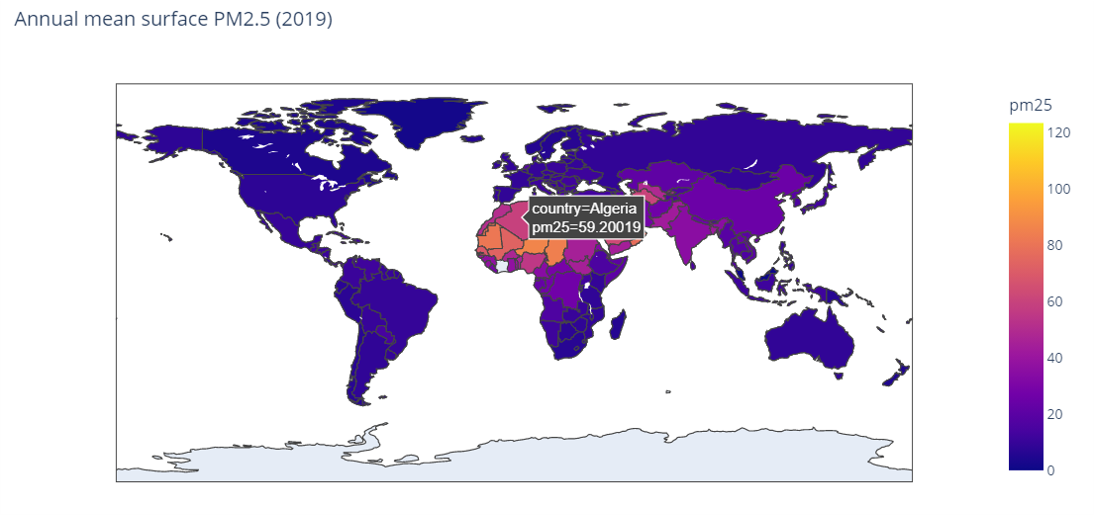
MERRA-2 avgM_2d_pm25_admin0, 2d, Single-Level, Country-Level Surface PM2.5 Monthly Mean Products V1 (M2_TMAX_PM25) at GES DISC
National Aeronautics and Space Administration —
M2_TMAX_PM25 is a value-added product derived from the MERRA-2 aerosol monthly product M2TMNXAER_5.12.4 (or tavgM_2d_aer_Nx). The surface concentration of fine... -
Federal
MERRA-2 statM_2d_edi_Nx: 2d, Single-Level, Monthly Extremes Detection Indices V1 (M2SMNXEDI) at GES DISC
National Aeronautics and Space Administration —
M2SMNXEDI (or statM_2d_edi_Nx) is a 2-dimensional monthly data collection for extreme detection indices derived from daily Modern-Era Retrospective analysis for... -
Federal
TSIS TIM Level 3 Total Solar Irradiance 24-Hour Means V04 (TSIS_TSI_L3_24HR) at GES DISC
National Aeronautics and Space Administration —
Version 04 is the current release of this data product, and supercedes all previous versions. The TSIS TIM Level 3 Total Solar Irradiance (TSI) 24-Hour Means data... -
Federal
LIMS/Nimbus-7 Level 2 Vertical Profiles of O3, NO2, H2O, HNO3, Geopotential Height, and Temperature V006 (LIMSN7L2) at GES DISC
National Aeronautics and Space Administration —
The Limb Infrared Monitor of the Stratosphere (LIMS) version 6 Level-2 data product consists of daily, geolocated, vertical profiles of temperature, geopotential... -
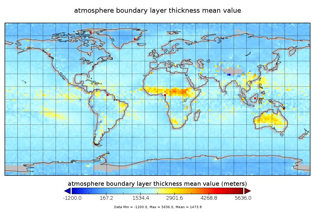
Federal
GPS Radio Occultation Boundary Layer Depth Seasonal L3 V2 (GPSROZPBLS) at GES DISC
National Aeronautics and Space Administration —
This dataset provides a seasonal average climatology of global planetary boundary layer (PBL) height derived from COSMIC/FORMOSAT-3, TerraSAR-X, KOMPSAT-5, and PAZ... -
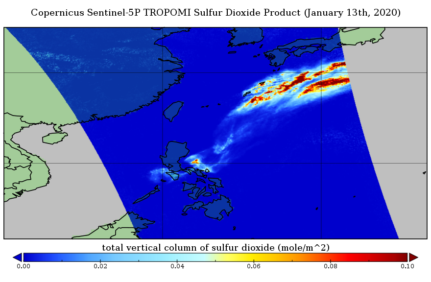
Federal
Sentinel-5P TROPOMI Sulphur Dioxide SO2 1-Orbit L2 5.5km x 3.5km V1 (S5P_L2__SO2____HiR) at GES DISC
National Aeronautics and Space Administration —
Starting from August 6th in 2019, Sentinel-5P TROPOMI along-track high spatial resolution (~5.5km at nadir) has been implemented. Starting from July 13th in 2020,... -
Federal
OCO-2 Level 2 spatially ordered geolocated retrievals screened using the A-band Preprocessor Retrospective Processing V11.2r (OCO2_L2_ABand) at GES DISC
National Aeronautics and Space Administration —
Version 11.2r is the current version of the data set. Older versions will no longer be available and are superseded by Version 11.2r. The Orbiting Carbon Observatory... -
Federal
Global Landslide Nowcast from LHASA L4 1 day 1 km x 1 km version 1.1 (Global_Landslide_Nowcast) at GES DISC
National Aeronautics and Space Administration —
The Landslide Hazard Assessment for Situational Awareness (LHASA) model identifies locations with high potential for landslide occurrence at a daily temporal... -
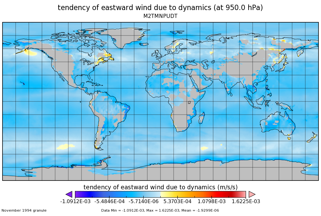
Federal
MERRA-2 tavgM_3d_udt_Np: 3d,Monthly mean,Time-Averaged,Pressure-Level,Assimilation,Wind Tendencies 0.625 x 0.5 degree V5.12.4 (M2TMNPUDT) at GES DISC
National Aeronautics and Space Administration —
M2TMNPUDT (or tavgM_3d_udt_Np) is a 3-dimensional monthly mean data collection in Modern-Era Retrospective analysis for Research and Applications version 2 (MERRA-2).... -
Federal
Multi-Satellite Air Quality Sulfur Dioxide (SO2) Database Long-Term L4 Global V2 (MSAQSO2L4) at GES DISC
National Aeronautics and Space Administration —
These data are a part of Multi-Decadal Sulfur Dioxide (SO2) Climatology from Satellite Instruments (MEaSUREs-12-0022 project). Version 2 of the global catalogue of... -
Federal
OMI/Aura and MODIS/Aqua Merged Cloud Product 1-Orbit L2 Swath 13x24 km V003 (OMMYDCLD) at GES DISC
National Aeronautics and Space Administration —
The OMI/Aura and MODIS/Aqua Merged Cloud Product 1-Orbit L2 Swath 13x24 km (OMMYDCLD) is a Level-2 orbital product that combines cloud parameters retrieved by the... -
Federal
OMI/Aura NO2 Tropospheric, Stratospheric & Total Columns MINDS Daily L2 Global Gridded 0.25 degree x 0.25 degree V1.1 (OMI_MINDS_NO2G) at GES DISC
National Aeronautics and Space Administration —
As part of the NASA's Making Earth System Data Records for Use in Research Environments (MEaSUREs) program, this project entitled “Multi-Decadal Nitrogen Dioxide and...

Official websites use .gov
A
.gov website belongs to an official government
organization in the United States.
Secure .gov websites use HTTPS
A
lock (
) or https:// means you’ve safely connected to
the .gov website. Share sensitive information only on official,
secure websites.