
-
Federal
2023 NOAA Topobathy Lidar: Whitefish Point Lake Superior, MI
National Oceanic and Atmospheric Administration, Department of Commerce —
These lidar are processed Classified LAS 1.4 files, formatted to 983 individual 500 m x 500 m tiles. The project AOI covers approximately 161.5 square kilometers, and... -
Federal
New Orleans, Louisiana 1/3 arc-second MHW Coastal Digital Elevation Model
National Oceanic and Atmospheric Administration, Department of Commerce —
NOAA's National Geophysical Data Center (NGDC) is building high-resolution digital elevation models (DEMs) for select U.S. coastal regions in the Gulf of Mexico.... -
Federal
USDA Rural Development Single Family Section 502 Direct Active Borrowers by County
Department of Agriculture —
Active borrower characteristics aggregated at the county level of geography, including number of borrowers, income levels, race, ethnicity, marital status, number of... -
State
Open NY Quarterly Report October 2025
State of New York —
Having trouble viewing the report in the Preview pane? Just click the Download button below to download a copy of the report. -
Federal
Shoreline Mapping Program of Galveston and Bolivar Peninsula, TX, TX1803G-TB-C NGDA
National Oceanic and Atmospheric Administration, Department of Commerce —
These data provide an accurate high-resolution shoreline compiled from imagery of Galveston and Bolivar Peninsula, TX . This vector shoreline data is based on an... -
Federal
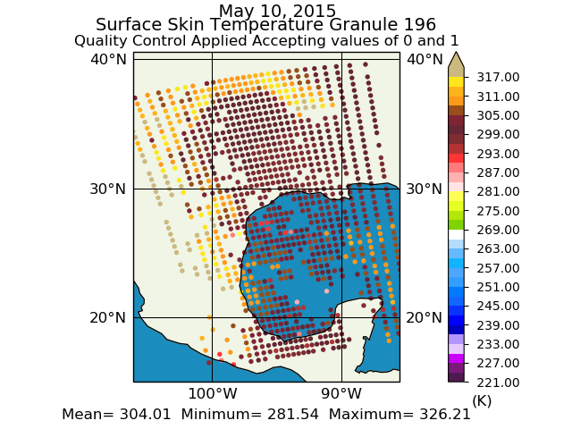
Aqua/AIRS L2 Support Retrieval (AIRS+AMSU) V7.0 at GES DISC
National Aeronautics and Space Administration —
The Atmospheric Infrared Sounder (AIRS) is a grating spectrometer (R = 1200) aboard the second Earth Observing System (EOS) polar-orbiting platform, EOS Aqua. In... -
Federal
Accelerated Aging Experiments for Capacitor Health Monitoring and Prognostics
National Aeronautics and Space Administration —
This paper discusses experimental setups for health monitoring and prognostics of electrolytic capacitors under nominal operation and accelerated aging conditions.... -
Federal
MODIS/Terra Vegetation Indices Monthly L3 Global 0.05Deg CMG V006
National Aeronautics and Space Administration —
The MOD13C2 Version 6 data product was decommissioned on July 31, 2023. Users are encouraged to use the MOD13C2... -
Federal
Sensitivity of Coastal Environments and Wildlife to Spilled Oil: Northwest Arctic, Alaska: NESTS (Nest Points)
National Oceanic and Atmospheric Administration, Department of Commerce —
This data set contains sensitive biological resource data for nesting birds in Northwest Arctic, Alaska. Vector points in this data set represent locations of nesting... -
Federal
2020 Cartographic Boundary File (KML), Current Place for Arizona, 1:500,000
U.S. Census Bureau, Department of Commerce —
The 2020 cartographic boundary KMLs are simplified representations of selected geographic areas from the U.S. Census Bureau's Master Address File / Topologically... -
Federal
Hawaii DAR Commercial Catch
National Oceanic and Atmospheric Administration, Department of Commerce —
Hawaii law requires that all fishers who take marine life for commercial purposes report their catch and effort to the Hawaii Division of Aquatic Resources (DAR).... -
Federal
Cooperative Atlantic States Shark Pupping and Nursery (COASTSPAN)
National Oceanic and Atmospheric Administration, Department of Commerce —
Survey of inshore areas used by sharks for pupping and nurseries. Various locations have been surveyed, from the U.S. Virgin Islands to Massachusetts, most in... -
Federal
MODIS/Terra Net Primary Production Gap-Filled Yearly L4 Global 500m SIN Grid V006
National Aeronautics and Space Administration —
The MOD17A3HGF Version 6 data product was decommissioned on July 31, 2023. Users are encouraged to use theFederalU.S. Active Duty Military Casualty Deaths - Calendar Year 2003
Department of Defense —
Detailed listing of all U.S. Military Active Duty deaths for 2003FederalH12040: NOS Hydrographic Survey , Southern Chesapeake Bay, Virginia, 2009-12-07
National Oceanic and Atmospheric Administration, Department of Commerce —
The National Oceanic and Atmospheric Administration (NOAA) has the statutory mandate to collect hydrographic data in support of nautical chart compilation for safe...FederalCoastal Change Analysis Program (C-CAP) High Resolution Land Cover and Change Data NGDA
National Oceanic and Atmospheric Administration, Department of Commerce —
The NOAA Coastal Change Analysis Program (C-CAP) produces national standardized high resolution land cover and change products for the coastal regions of the U.S. and...Federal2024 Cartographic Boundary File (KML), State Legislative District (SLD) Lower Chamber for Georgia, 1:500,000
U.S. Census Bureau, Department of Commerce —
The 2024 cartographic boundary KMLs are simplified representations of selected geographic areas from the U.S. Census Bureau's Master Address File / Topologically...FederalH08874: NOS Hydrographic Survey , Severn River Annapolis, Maryland, 1966-09-12
National Oceanic and Atmospheric Administration, Department of Commerce —
The National Oceanic and Atmospheric Administration (NOAA) has the statutory mandate to collect hydrographic data in support of nautical chart compilation for safe...FederalH13193: NOS Hydrographic Survey , 2019-09-11
National Oceanic and Atmospheric Administration, Department of Commerce —
The National Oceanic and Atmospheric Administration (NOAA) has the statutory mandate to collect hydrographic data in support of nautical chart compilation for safe...43,113 datasets found

Official websites use .gov
A
.gov website belongs to an official government
organization in the United States.
Secure .gov websites use HTTPS
A
lock (
) or https:// means you’ve safely connected to
the .gov website. Share sensitive information only on official,
secure websites.
.jpg)