-
Federal
NANP1M.TIF - North Anacapa Passage sidescan sonar backscatter image in nearshore Benthic Habitat mapping Project S. California map Series. (UTM 10N, NAD83)
Department of the Interior —
The sidescan sonar image of the nearshore seafloor (0 to 100 m water depths) of the North Anacapa Passage area was mosaicked from data collected in 2000. A Klein 2000... -
Federal
California spiny lobster habitat suitability model for Channel Islands National Marine Sanctuary Biogeographic Assessment
National Oceanic and Atmospheric Administration, Department of Commerce —
The National Marine Sanctuary Program (NMSP) updates and revises the management plans for each of its 13 sanctuaries. This process, which is open to the public,... -
Federal
EnviroAtlas - Sonoma County, CA - Park Access by Block Group
U.S. Environmental Protection Agency —
This EnviroAtlas dataset shows the block group population that is within and beyond an easy walking distance (500m) of a park entrance. Park entrances were included... -
Federal
2020 Cartographic Boundary File (KML), Current Elementary School District for California, 1:500,000
U.S. Census Bureau, Department of Commerce —
The 2020 cartographic boundary KMLs are simplified representations of selected geographic areas from the U.S. Census Bureau's Master Address File / Topologically... -
Federal
EnviroAtlas - Fresno, CA - Estimated Intersection Density of Walkable Roads
U.S. Environmental Protection Agency —
This EnviroAtlas dataset estimates the intersection density of walkable roads within a 750 meter radius of any given 10 meter pixel in the community. Intersections... -
Federal
W00445: NOS Hydrographic Survey , External Source Data 2018, 2017-09-04
National Oceanic and Atmospheric Administration, Department of Commerce —
The National Oceanic and Atmospheric Administration (NOAA) has the statutory mandate to collect hydrographic data in support of nautical chart compilation for safe... -
Federal
EnviroAtlas - Los Angeles, CA - Residents with Minimal Potential Window Views of Trees by Block Group
U.S. Environmental Protection Agency —
This EnviroAtlas dataset shows the total block group population and the percentage of the block group population that has little access to potential window views of... -
State
i12 CalSIMII OutputData
State of California —
The i12_CalSim_Output dataset is a point feature class containing 44 point locations representing a subset of CalSim II output locations. A related table of... -
Federal
2023 Cartographic Boundary File (KML), Place for California, 1:500,000
U.S. Census Bureau, Department of Commerce —
The 2023 cartographic boundary KMLs are simplified representations of selected geographic areas from the U.S. Census Bureau's Master Address File / Topologically... -
Federal
2023 Cartographic Boundary File (KML), Block Group for California, 1:500,000
U.S. Census Bureau, Department of Commerce —
The 2023 cartographic boundary KMLs are simplified representations of selected geographic areas from the U.S. Census Bureau's Master Address File / Topologically... -
Federal
EnviroAtlas - Los Angeles, CA - 51m Riparian Buffer Forest Cover
U.S. Environmental Protection Agency —
This EnviroAtlas dataset describes the percentage of a 51-m riparian buffer that is forested. In this community, tree cover is defined as Trees & Forest, and... -
Federal
EnviroAtlas - Fresno, CA - BenMAP Results by Block Group
U.S. Environmental Protection Agency —
This EnviroAtlas dataset demonstrates the effect of changes in pollution concentration on local populations in 405 block groups in Fresno, California. The US EPA's... -
Federal
TIGER/Line Shapefile, 2021, County, San Francisco County, CA, All Roads
U.S. Census Bureau, Department of Commerce —
The TIGER/Line shapefiles and related database files (.dbf) are an extract of selected geographic and cartographic information from the U.S. Census Bureau's Master... -
Federal
2024 Cartographic Boundary File (SHP), Elementary School District for California, 1:500,000
U.S. Census Bureau, Department of Commerce —
The 2024 cartographic boundary shapefiles are simplified representations of selected geographic areas from the U.S. Census Bureau's Master Address File /... -
Federal
TIGER/Line Shapefile, 2021, County, Humboldt County, CA, All Roads
U.S. Census Bureau, Department of Commerce —
The TIGER/Line shapefiles and related database files (.dbf) are an extract of selected geographic and cartographic information from the U.S. Census Bureau's Master... -
Federal
Airborne geophysical survey: San Jacinto, California
Department of the Interior —
Aeromagnetic data were collected along flight lines by instruments in an aircraft that recorded magnetic-field values and locations. This dataset presents latitude,... -
Federal
Airborne geophysical survey: Salton Sea South '81, California Survey Part 1 of 2
Department of the Interior —
Aeromagnetic data were collected along flight lines by instruments in an aircraft that recorded magnetic-field values and locations. This dataset presents latitude,... -
Federal
Airborne geophysical survey: Clear Lake '95, California
Department of the Interior —
Aeromagnetic data were collected along flight lines by instruments in an aircraft that recorded magnetic-field values and locations. This dataset presents latitude,... -
Federal
l585nc.m77t - MGD77 data file for Geophysical data from field activity L-5-85-NC in Northern California from 08/10/1985 to 08/31/1985
Department of the Interior —
Single-beam bathymetry and magnetics data along with DGPS navigation data was collected as part of field activity L-5-85-NC in Northern California from 08/10/1985 to... -
Federal
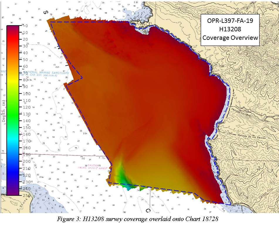
H13208: NOS Hydrographic Survey , 2019-10-14
National Oceanic and Atmospheric Administration, Department of Commerce —
The National Oceanic and Atmospheric Administration (NOAA) has the statutory mandate to collect hydrographic data in support of nautical chart compilation for safe...

Official websites use .gov
A
.gov website belongs to an official government
organization in the United States.
Secure .gov websites use HTTPS
A
lock (
) or https:// means you’ve safely connected to
the .gov website. Share sensitive information only on official,
secure websites.