
-
Federal
LIS 0.1 DEGREE VERY HIGH RESOLUTION GRIDDED LIGHTNING ANNUAL CLIMATOLOGY (VHRAC) V1
National Aeronautics and Space Administration —
The LIS 0.1 Degree Very High Resolution Gridded Lightning Annual Climatology (VHRAC) dataset consists of gridded annual climatologies of total lightning flash rates... -
Federal
Carbon transport in the Mississippi River
National Aeronautics and Space Administration —
Measurements made near the Mississippi River outflow region in the Gulf of Mexico between 2001 and 2003. -
Federal
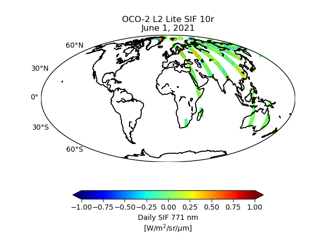
OCO-2 Level 2 bias-corrected solar-induced fluorescence and other select fields from the IMAP-DOAS algorithm aggregated as daily files, Retrospective processing V10r (OCO2_L2_Lite_SIF) at GES DISC
National Aeronautics and Space Administration —
Version 10r is the current version of the data set. Older versions will no longer be available and are superseded by Version 10r. The OCO-2 SIF Lite files contain... -
Federal
Voyager 2 Saturn Plasma Wave Spectrometer (PWS) Resampled Spectral Analyzer, Version 1.0, 48 s Data
National Aeronautics and Space Administration —
- Data Set Overview\n =================\n\n+-------------------------------------------------+\n| Data Characteristics | Value...
-
Federal
First ISCCP Regional Experiment (FIRE) Atlantic Stratocumulus Transition Experiment (ASTEX) United Kingdom Meteorological Office (UKMO) C-130 Aircraft Data
National Aeronautics and Space Administration —
The First ISCCP Regional Experiments have been designed to improve data products and cloud/radiation parameterizations used in general circulation models (GCMs).... -
Federal
MODIS/Aqua Near Real Time (NRT) Thermal Anomalies/Fire 5-Min L2 Swath 1km
National Aeronautics and Space Administration —
MODIS Near Real Time (NRT) Thermal Anomalies/Fire products are primarily derived from MODIS 4- and 11-micrometer radiances. The fire detection strategy is based on... -
Federal
Delta-X: UAVSAR L1 Single Look Complex (SLC) Stack Products, MRD, Louisiana, 2021
National Aeronautics and Space Administration —
This dataset contains UAVSAR Level 1 (L1) Single Look Complex (SLC) stack products for Delta-X flight lines acquired during 2021-03-27 to 2021-04-18 (spring) and... -
Federal
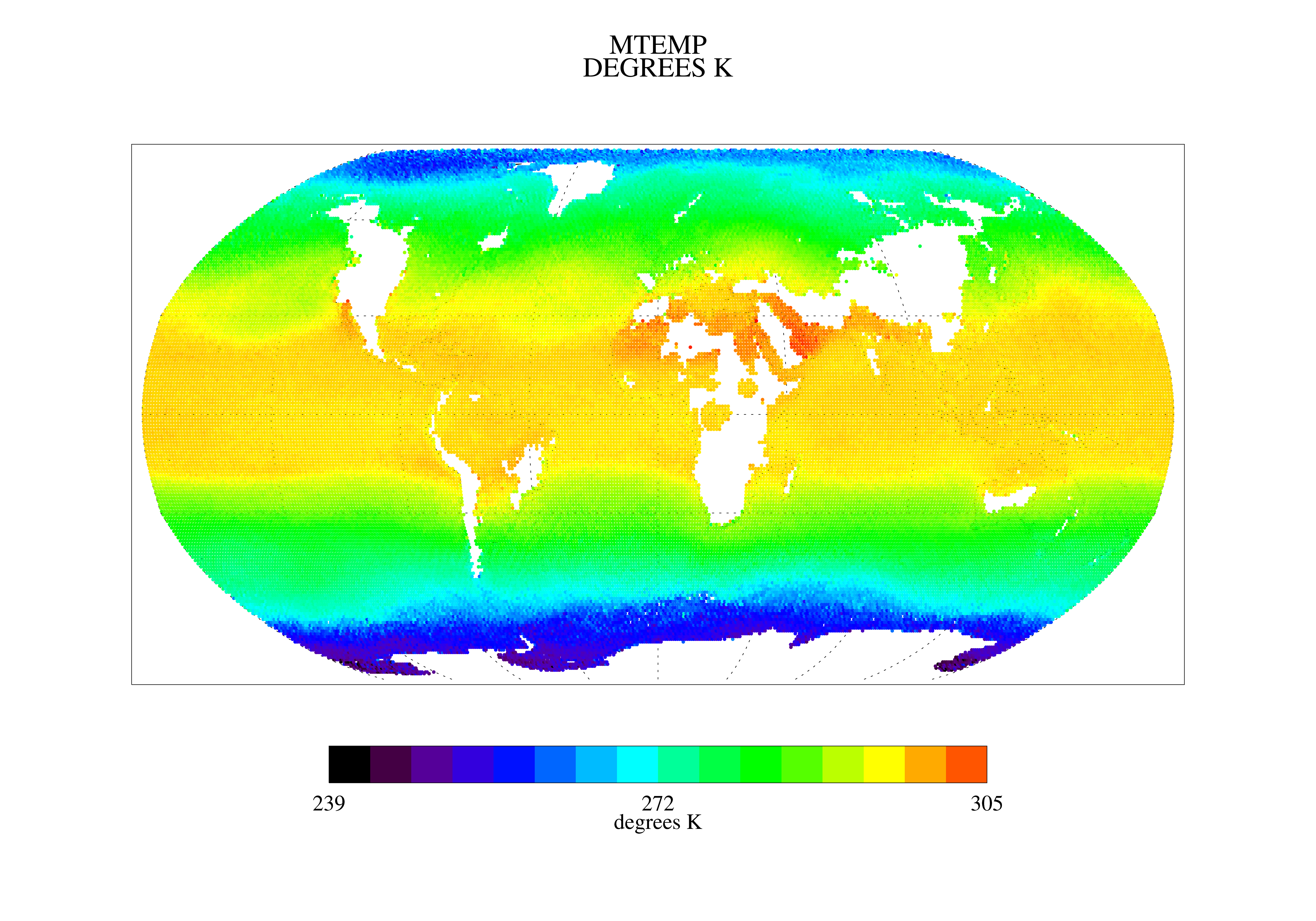
TOVS LMD MONTHLY GRIDS from NOAA-12 V01 (TOVSBMND) at GES DISC
National Aeronautics and Space Administration —
Level 3 parameters from HIRS/2 and MSU radiances using the Improved Initialization Inversion (3I) classification retrieval scheme by the Laboratoire de Meteorologie... -
Federal
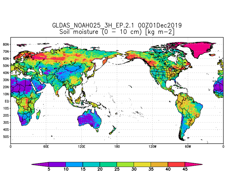
GLDAS Noah Land Surface Model L4 3 hourly 0.25 x 0.25 degree Early Product V2.1 (GLDAS_NOAH025_3H_EP) at GES DISC
National Aeronautics and Space Administration —
NASA Global Land Data Assimilation System Version 2 (GLDAS-2) has three components: GLDAS-2.0, GLDAS-2.1, and GLDAS-2.2. GLDAS-2.0 is forced entirely with the... -
Federal
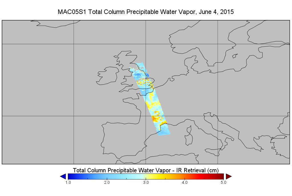
MODIS/Aqua Total Precip Water Vapor 1km and 5km 5-Min L2 Swath Subset along MLS V002 (MAM05S0) at GES DISC
National Aeronautics and Space Administration —
This is the MODIS/Aqua subset along MLS field of view track. The goal of the subset is to select and return MODIS data that are within +-100 km across the MLS track.... -
Federal
QuickBird Level 1B Panchromatic Satellite Imagery
National Aeronautics and Space Administration —
The QuickBird Panchromatic Imagery collection contains satellite imagery acquired from Maxar Technologies by the Commercial Smallsat Data Acquisition (CSDA) Program.... -
Federal
CALIPSO Lidar Level 3 Tropospheric Aerosol Profiles, Cloudy Sky Transparent Data, Standard V4-21
National Aeronautics and Space Administration —
CAL_LID_L3_Tropospheric_APro_CloudySkyTransparent-Standard-V4-21 is the Cloud-Aerosol Lidar and Infrared Pathfinder Satellite Observation (CALIPSO) Lidar Level 3... -
Federal
A Global Data Set of Leaf Photosynthetic Rates, Leaf N and P, and Specific Leaf Area
National Aeronautics and Space Administration —
This global data set of photosynthetic rates and leaf nutrient traits was compiled from a comprehensive literature review. It includes estimates of Vcmax (maximum... -
Federal
VIIRS/NPP Vegetation Indices 16-Day L3 Global 1km SIN Grid V002
National Aeronautics and Space Administration —
The NASA/NOAA Suomi National Polar-orbiting Partnership (Suomi NPP) Visible Infrared Imaging Radiometer Suite (VIIRS) Vegetation Indices (VNP13A2) Version 2 data... -
Federal
SWOT Level 2 River Cycle-Averaged Data Product, Version D
National Aeronautics and Space Administration —
Cycle average and aggregation of river reach pass data within predefined hydrological basins. Basin for each cycle. Available in Shapefile file format. -
Federal
ASTER L2 Surface Kinetic Temperature V004
National Aeronautics and Space Administration —
The Terra Advanced Spaceborne Thermal Emission and Reflection Radiometer (ASTER) Surface Kinetic Temperature (AST_08) V004 product delivers surface kinetic... -
Federal
Sentinel-6 NASA/JPL GNSS-RO Near-Real-Time Level 1B V1 (S6A_RO_1B_NRT_NC__) at GES DISC
National Aeronautics and Space Administration —
This dataset provides the L1B Global Navigation Satellite System (GNSS) Radio-Occultation (RO) Near-Real-Time (NRT) retrieval generated by NASA's Jet Propulsion... -
Federal
Western North American FLEXPART Back Trajectory 2005 Data
National Aeronautics and Space Administration —
WNA-FLEXPART-BackTraj-2005 is the 2005 Western North America Back Trajectory data using the FLEXible PARTicle (FLEXPART) dispersion model. Data collection for this... -
Federal
Sounder SIPS: Suomi NPP CrIMSS Level 2 CHART Normal Spectral Resolution: Atmosphere, cloud and surface geophysical state V1
National Aeronautics and Space Administration —
The objective of this limited edition data collection is to examine products generated by the Climate Heritage AIRS Retrieval Technique (CHART) algorithm to analyze... -
Federal
ECCO Ocean Mixed Layer Depth - Daily Mean 0.5 Degree (Version 4 Release 4)
National Aeronautics and Space Administration —
This dataset contains daily-averaged ocean mixed layer depth interpolated to a regular 0.5-degree grid from the ECCO Version 4 revision 4 (V4r4) ocean and sea-ice...

Official websites use .gov
A
.gov website belongs to an official government
organization in the United States.
Secure .gov websites use HTTPS
A
lock (
) or https:// means you’ve safely connected to
the .gov website. Share sensitive information only on official,
secure websites.