
-
Federal
SMAP_L1A_RADAR_QA_V001
National Aeronautics and Space Administration —
SMAP Level 1A Radar Data Quality Information -
Federal
SMAP_L1B_SIGMA_NAUGHT_LOW_RES_QA_V003
National Aeronautics and Space Administration —
SMAP Level 1B Sigma Naught Low Res Data Quality Info Version 3 -
Federal
SMAP_L1B_SIGMA_NAUGHT_LOW_RES_QA_V002
National Aeronautics and Space Administration —
SMAP Level 1B Sigma Naught Low Res Data Quality Info Version 2 -
Federal
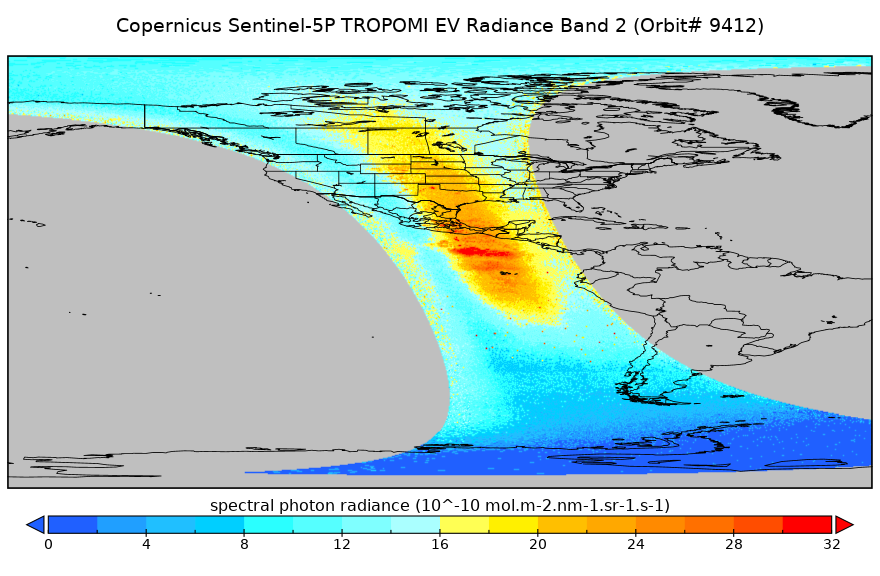
Sentinel-5P TROPOMI Radiance product band 2 (UV detector) L1B 5.5km x 3.5km V2 (S5P_L1B_RA_BD2_HiR) at GES DISC
National Aeronautics and Space Administration —
Starting from August 6th in 2019, Sentinel-5P TROPOMI along-track high spatial resolution (~5.5km at nadir) has been implemented. For data before August 6th of 2019,... -
Federal
Sentinel-5P TROPOMI Near-Real-Time (NRT) Radiance product band 4 (UVIS detector) L1B 5.5km x 3.5km V2 (S5P_L1B_RA_BD4_HiR_NRT) at GES DISC
National Aeronautics and Space Administration —
The Sentinel-5P TROPOMI Near Real Time (NRT) Radiance product band 4 (UVIS detector) L1B 5.5km x 21km V2 (S5P_L1B_RA_BD4_HiR_NRT) product at GES DISC is the near real... -
Federal
Sentinel-5P TROPOMI Near-Real-Time (NRT) Radiance product band 5 (NIR detector) L1B 5.5km x 3.5km V2 (S5P_L1B_RA_BD5_HiR_NRT) at GES DISC
National Aeronautics and Space Administration —
The Sentinel-5P TROPOMI Near Real Time (NRT) Radiance product band 5 (NIR detector) L1B 5.5km x 21km V2 (S5P_L1B_RA_BD5_HiR_NRT) product at GES DISC is the near real... -
Federal
OLCI/Sentinel-3A L1 Full Resolution Top of Atmosphere Reflectance
National Aeronautics and Space Administration —
The OLCI/Sentinel-3A L1 Full Resolution Top of Atmosphere Reflectance product, S3A_OL_1_EFR is generated from the data aquired by the Ocean and Land Colour Instrument... -
Federal
TRMM Attitude and TMI Packets and Header Record L1A V7 (TRMM_1A11) at GES DISC
National Aeronautics and Space Administration —
The Level-1A Product file, "1A11", is a concatenation of Header record, Spacecraft Attitude packets, TMI Housekeeping packets, TMI Science Data packets, QACs and an... -
Federal
ECOSTRESS Attitude Daily L1B Global 70m V001
National Aeronautics and Space Administration —
The ECOsystem Spaceborne Thermal Radiometer Experiment on Space Station (ECOSTRESS) mission measures the temperature of plants to better understand how much water... -
Federal
DC-8 Meteorological and Navigation Data CPEX-AW V1
National Aeronautics and Space Administration —
The DC-8 Meteorological and Navigation Data CPEX-AW dataset is a subset of airborne measurements that include GPS positioning and trajectory data, aircraft... -
Federal
TRACE-P In Situ P-3B Meteorology and Navigation Data
National Aeronautics and Space Administration —
TRACE-P_MetNav_Aircraft_InSitu_P3B_Data is the in situ meteorology and navigation data collected onboard the P-3B aircraft during the Transport and Chemical Evolution... -
Federal
SLSTR/Sentinel-3A L1 Full Resolution Top of Atmosphere Radiances and Brightness Temperature
National Aeronautics and Space Administration —
The SLSTR/Sentinel-3A L1 Full Resolution Top of Atmosphere Radiances and Brightness Temperature product with shortname S3A_SL_1_RBT, is generated from the data... -
Federal
Soil Moisture Active Passive (SMAP) L1-L3 Ancillary Satellite Data V001
National Aeronautics and Space Administration —
This ancillary SMAP product contains two dynamic data sets describing 1) the attitude and 2) the trajectory of the SMAP satellite. The data files are generated using... -
Federal
Sentinel-5P TROPOMI Radiance product band 5 (NIR detector) L1B 5.5km x 3.5km V2 (S5P_L1B_RA_BD5_HiR) at GES DISC
National Aeronautics and Space Administration —
Starting from August 6th in 2019, Sentinel-5P TROPOMI along-track high spatial resolution (~5.5km at nadir) has been implemented. For data before August 6th of 2019,... -
Federal
OCO-2 Level 0 spacecraft attitude data V11.2 (OCO2_Att) at GES DISC
National Aeronautics and Space Administration —
Version 11.2 is the current version of the data set. Older versions will no longer be available and are superseded by Version 11.2 The Orbiting Carbon Observatory is... -
Federal
OLCI/Sentinel-3B L1 Reduced Resolution Top of Atmosphere Reflectance
National Aeronautics and Space Administration —
The OLCI/Sentinel-3B L1 Reduced Resolution Top of Atmosphere Reflectance product, S3B_OL_1_ERR is generated from the data acquired by the Ocean and Land Colour... -
Federal
Global Hawk Navigation EPOCH V1
National Aeronautics and Space Administration —
The Global Hawk Navigation EPOCH dataset consists of the real-time navigation and housekeeping data that was acquired by various instruments aboard the Global Hawk... -
Federal
OCO-2 Level 0 spacecraft attitude data V10 (OCO2_Att) at GES DISC
National Aeronautics and Space Administration —
Version 10 is the current version of the data set. Older versions will no longer be available and are superseded by Version 10. The Orbiting Carbon Observatory is the...

Official websites use .gov
A
.gov website belongs to an official government
organization in the United States.
Secure .gov websites use HTTPS
A
lock (
) or https:// means you’ve safely connected to
the .gov website. Share sensitive information only on official,
secure websites.