
-
Federal
NY/NJ Metro Area, Hudson River, and South Long Island 2016 BIRDSPT Points
National Oceanic and Atmospheric Administration, Department of Commerce —
This data set contains sensitive biological resource data for raptors in the New York/New Jersey Metro Area, Hudson River, and South Long Island region. Vector points... -
Federal
National Status and Trends, Benthic Surveillance Project Sites, 1984-1992, National Centers for Coastal Ocean Science
National Oceanic and Atmospheric Administration, Department of Commerce —
This data set reports information regarding the nominal sampling locations for the National Status and Trends Benthic Surveillance Project sites. One record is... -
Federal
NY/NJ Metro Area, Hudson River, and South Long Island 2016 ESI RESOURCE MANAGEMENT Polygons, Points
National Oceanic and Atmospheric Administration, Department of Commerce —
This data set contains vector polygons depicting locations for aquaculture, essential habitats, and water intakes; and vector points depicting locations for... -
Federal
National Status and Trends, Benthic Surveillance Project Fluorescent Aromatic Compounds (FAC) Data, 1984-1991, National Centers for Coastal Ocean Science
National Oceanic and Atmospheric Administration, Department of Commerce —
The National Status and Trends (NSandT) Benthic Surveillance Fluorescent Aromatic Compounds (FAC) file reports the trace concentrations of Fluorescent Aromatic... -
Federal
2010 Hudson River Shallow Water Sediment Grabs
National Oceanic and Atmospheric Administration, Department of Commerce —
The Hudson River Shallow Water Mapping project characterizes the bottom of the Hudson River Estuary in shallow water (<3 m). The characterization includes acoustic... -
Federal
Side-Scan_Sonar backscatter tiles for Hudson River, NY (.xtf)
National Oceanic and Atmospheric Administration, Department of Commerce —
Raw XTF files. Sonar data were collected November 6 to December 15, 2009, in the estuary north from Saugerties to Troy. Data Collection and Processing: The... -
Federal
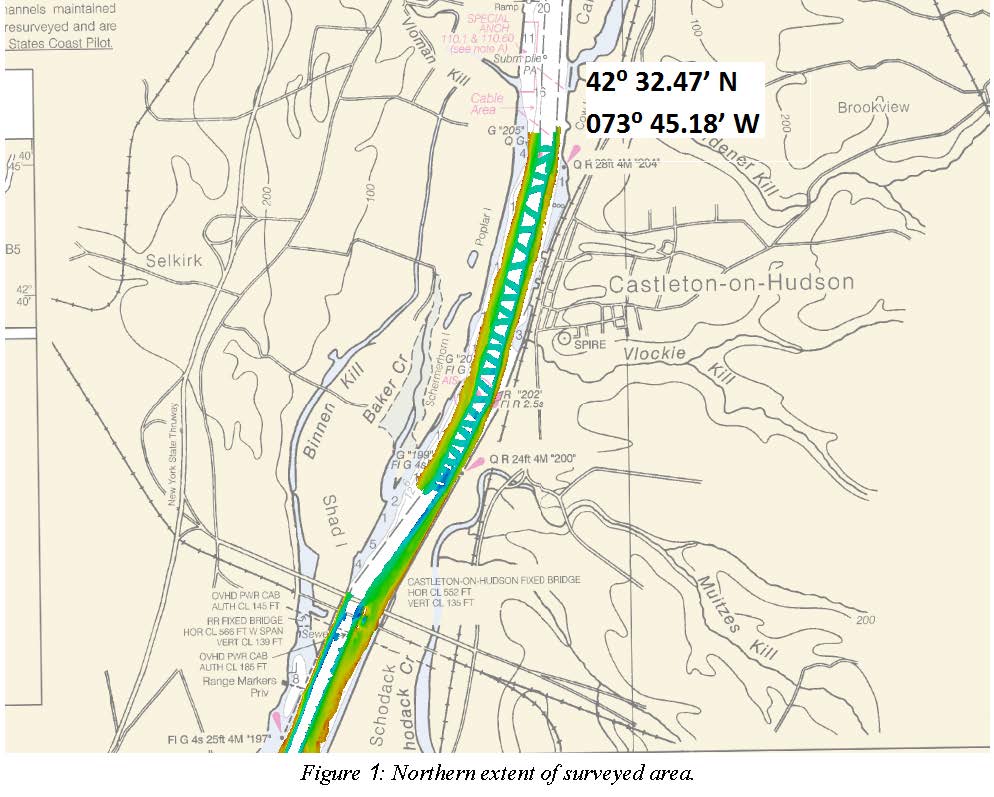
H12872: NOS Hydrographic Survey , 2016-08-31
National Oceanic and Atmospheric Administration, Department of Commerce —
The National Oceanic and Atmospheric Administration (NOAA) has the statutory mandate to collect hydrographic data in support of nautical chart compilation for safe... -
Federal
Sensitivity of Coastal Environments and Wildlife to Spilled Oil: Hudson River: MGT (Management Area Polygons)
National Oceanic and Atmospheric Administration, Department of Commerce —
This data set contains sensitive human-use data for regional and state parks, historic sites, marine sanctuaries, and other managed areas for the Hudson River. Vector... -
Federal
Sensitivity of Coastal Environments and Wildlife to Spilled Oil: Hudson River: BIRDS (Bird Polygons)
National Oceanic and Atmospheric Administration, Department of Commerce —
This data set contains sensitive biological resource data for wading birds, shorebirds, waterfowl, raptors, diving birds, passerine birds, and gulls and terns in the... -
Federal
F00658: NOS Hydrographic Survey , 2015-09-10
National Oceanic and Atmospheric Administration, Department of Commerce —
The National Oceanic and Atmospheric Administration (NOAA) has the statutory mandate to collect hydrographic data in support of nautical chart compilation for safe... -
Federal
H13138: NOS Hydrographic Survey , 2018-08-06
National Oceanic and Atmospheric Administration, Department of Commerce —
The National Oceanic and Atmospheric Administration (NOAA) has the statutory mandate to collect hydrographic data in support of nautical chart compilation for safe... -
Federal
Hudson River Sub-Bottom Profile Lines_r09272010
National Oceanic and Atmospheric Administration, Department of Commerce —
Subbottom Profiler Tracklines. Data was collected November 5 to December 15, 2009, in the estuary north from Saugerties to Troy. Fugro utilized the GeoAcoustics... -
Federal
NY/NJ Metro Area, Hudson River, and South Long Island 2016 HYDROL (Hydrography Lines)
National Oceanic and Atmospheric Administration, Department of Commerce —
This data set contains vector lines representing coastal hydrography features that are not captured in the HYDROP polygon data layer. The features found in the HYDROL... -
Federal
D00211: NOS Hydrographic Survey , 2016-06-08
National Oceanic and Atmospheric Administration, Department of Commerce —
The National Oceanic and Atmospheric Administration (NOAA) has the statutory mandate to collect hydrographic data in support of nautical chart compilation for safe... -
Federal
NY/NJ Metro Area, Hudson River, and South Long Island 2016 HERP Polygons
National Oceanic and Atmospheric Administration, Department of Commerce —
This data set contains sensitive biological resource data for sea turtles, northern diamondback terrapins, and other federally and/or state endangered, threatened, or... -
Federal
H10938: NOS Hydrographic Survey , Hudson River, New York and New Jersey, 1999-10-14
National Oceanic and Atmospheric Administration, Department of Commerce —
The National Oceanic and Atmospheric Administration (NOAA) has the statutory mandate to collect hydrographic data in support of nautical chart compilation for safe... -
Federal
H12874: NOS Hydrographic Survey , 2016-09-29
National Oceanic and Atmospheric Administration, Department of Commerce —
The National Oceanic and Atmospheric Administration (NOAA) has the statutory mandate to collect hydrographic data in support of nautical chart compilation for safe... -
Federal
NY/NJ Metro Area, Hudson River, and South Long Island 2016 ESIP (Environmental Sensitivity Index Polygons)
National Oceanic and Atmospheric Administration, Department of Commerce —
This data set contains vector polygons representing the coastal shoreline and hydrography used in the creation of the Environmental Sensitivity Index (ESI) for New... -
Federal
Sensitivity of Coastal Environments and Wildlife to Spilled Oil: Hudson River: WETLANDS (Environmental Sensitivity Index Wetland Types - Polygons)
National Oceanic and Atmospheric Administration, Department of Commerce —
This data set contains vector polygons representing coastal wetland habitats for the Hudson River classified according to the Environmental Sensitivity Index (ESI)... -
Federal
Sensitivity of Coastal Environments and Wildlife to Spilled Oil: Hudson River: INDEX (Index Polygons)
National Oceanic and Atmospheric Administration, Department of Commerce —
This data set contains vector polygons representing the boundaries of all hardcopy cartographic products produced as part of the Environmental Sensitivity Index (ESI)...

Official websites use .gov
A
.gov website belongs to an official government
organization in the United States.
Secure .gov websites use HTTPS
A
lock (
) or https:// means you’ve safely connected to
the .gov website. Share sensitive information only on official,
secure websites.
.jpg)