


37 datasets found
-
Federal
Natural Reservoir Analysis in Low-Temperature Geothermal Play Fairway Analysis for the Appalachian Basin
Department of Energy —
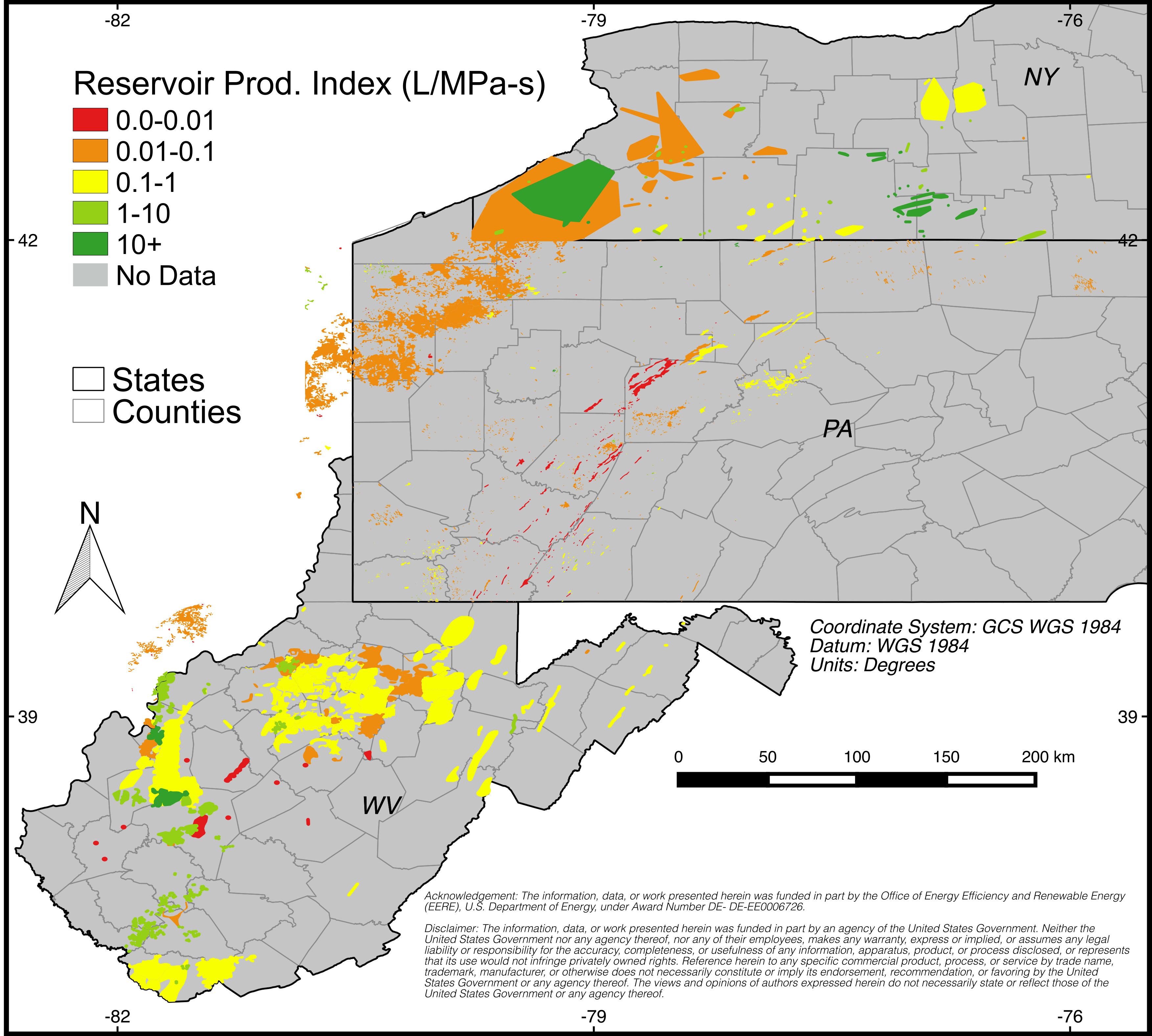
The files included in this submission contain all data pertinent to the methods and results of this task's output, which is a cohesive multi-state map of all known... -
Federal
Appalachian Basin Play Fairway Analysis Analyses and Results
Department of Energy —
This submission updates a 2015 submission for the utilization analysis (https://gdr.openei.org/submissions/623) The files document the analysis of... -
Federal
Improvements in 2016 to Natural Reservoir Analysis in Low-Temperature Geothermal Play Fairway Analysis for the Appalachian Basin
Department of Energy —
These files add to and replace same-named files found within Submission 559 (hover over file display names to see actual file names in bottom-left corner of... -
Federal
USGS National and Global Oil and Gas Assessment Project-Appalachian Basin Province, Upper Devonian Shales Assessment Unit Boundaries and Assessment Input Forms
Department of the Interior —
The Assessment Unit is the fundamental unit used in the National Assessment Project for the assessment of undiscovered oil and gas resources. The Assessment Unit is... -
Federal
Deep Direct-Use Feasibility Study Tuscarora Sandstone Geophysical Log Digitization
Department of Energy —
This dataset contains well log files collected from wells penetrating the Tuscarora Sandstone, structural geologic map of West Virginia and salinity information based... -
Federal
Deep Direct-Use Feasibility Study Reservoir Productivity Uncertainty Analysis for the Tuscarora Sandstone, Morgantown, WV
Department of Energy —
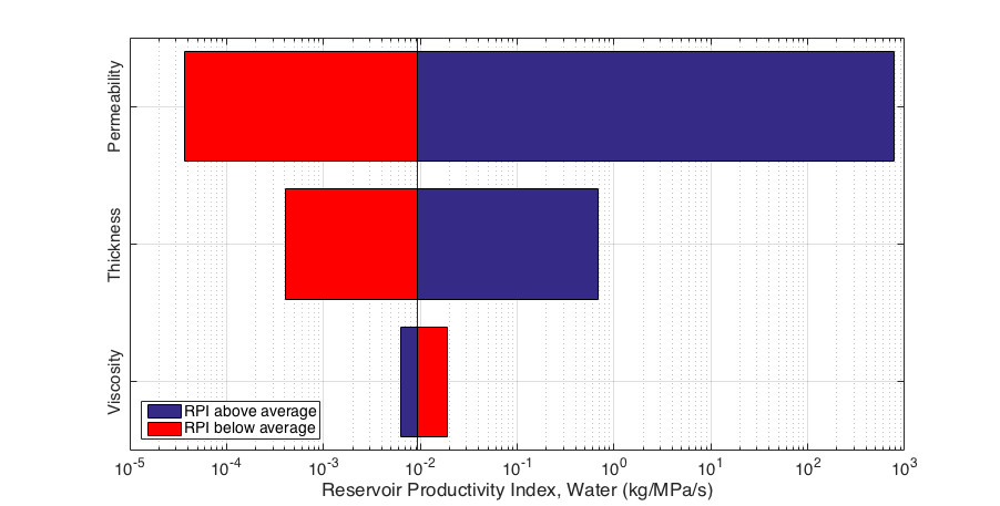
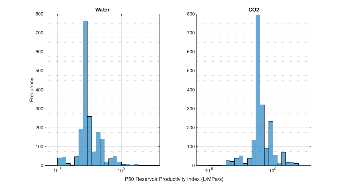
This dataset contains figures that summarize the Tuscarora Sandstone core permeability data collected from the Preston 119 well in Preston County, WV, and summary... -
Federal
Geologic Reservoir Content Model from Low-Temperature Geothermal Play Fairway Analysis for the Appalachian Basin
Department of Energy —
This dataset contains the known hydrocarbon reservoirs within the study area of the Geothermal Play Fairway Analysis for the Appalachian Basin (GPFA-AB) as part of... -
Federal
Appalachian Basin Play Fairway Analysis Thermal Risk Factor and Quality Analyses
Department of Energy —
This submission revises the analysis and products for Thermal Quality Analysis for the northern half of the Appalachian Basin... -
Federal
Appalachian Basin Play Fairway Analysis: Thermal Quality Analysis in Low-Temperature Geothermal Play Fairway Analysis (GPFA-AB)
Department of Energy —
This collection of files are part of a larger dataset uploaded in support of Low Temperature Geothermal Play Fairway Analysis for the Appalachian Basin (GPFA-AB).... -
Federal
Deep Direct-Use Feasibility Study Energy Demand Characterization and Surface Plant Modeling for West Virginia University
Department of Energy —
This dataset provides information gathered to determine end use load and assessment of existing district heating systems (DHS). It also provides Aspen simulation... -
Federal
Selected geochemistry and mineralogy of Paleozoic strata in northern and central Appalachian basin, U.S.A., 1994-2012
Department of the Interior —
A U.S. Geological Survey (USGS) provisional geochemical and mineralogical database for hydrocarbon-rich shale in the Appalachian region has been compiled by Catherine... -
Federal
National Assessment of Oil and Gas Project - Appalachian Basin Province (067) Boundary
Department of the Interior —
The USGS Central Region Energy Team assesses oil and gas resources of the United States. The onshore and State water areas of the United States comprise 71 provinces.... -
Federal
USGS National and Global Oil and Gas Assessment Project - Sunbury and Chattanooga Shales Assessment Unit Boundaries and Assessment Input Forms
Department of the Interior —
The Assessment Unit is the fundamental unit used in the National Assessment Project for the assessment of undiscovered oil and gas resources. The Assessment Unit is... -
Federal
Appalachian Basin Play Fairway Analysis: Natural Sedimentary Reservoirs Data 2016 Revision
Department of Energy —
Tier 3 data for Appalachian Basin sectors of New York, Pennsylvania and West Virginia used in a Geothermal Play Fairway Analysis of opportunities for low-temperature... -
Federal
Deep Direct-Use Feasibility Study Computed Tomography (CT)-scanned data Analysis for the Tuscarora Sandstone at the National Energy Technology Laboratory
Department of Energy —
The computed tomography (CT) facilities at the National Energy Technology Laboratory (NETL) Morgantown, West Virginia site were used to characterize core of the... -
Federal
Utilization Analysis in Low-Temperature Geothermal Play Fairway Analysis for the Appalachian Basin (GPFA-AB)
Department of Energy —
This submission of Utilization Analysis data to the Geothermal Data Repository (GDR) node of the National Geothermal Data System (NGDS) is in support of Phase 1 Low... -
Federal
National Assessment of Oil and Gas Project - Appalachian Basin (067) Quarter-Mile Cells
Department of the Interior —
Cell maps for each oil and gas assessment unit were created by the USGS as a method for illustrating the degree of exploration, type of production, and distribution...

37 datasets found